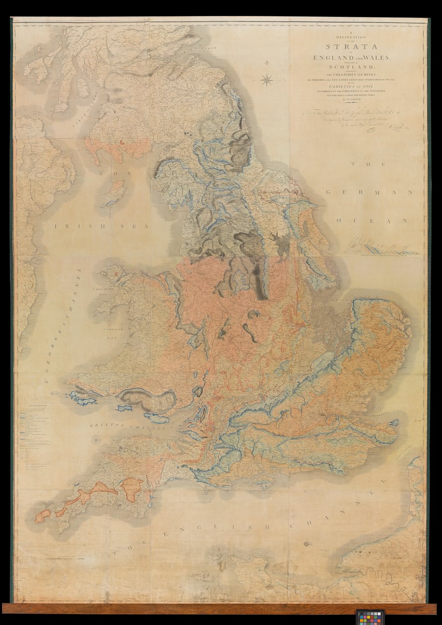
A Delineation of the Strata of England and Wales with Part of Scotland by William Smith

A Delineation of the Strata of England and Wales with Part of Scotland

(A Delineation of the Strata of England and Wales with part of Scotland exhibiting the Collieries and Mines, the Marshes and Fen Lands originally overflowed by the Sea and the varieties of soil according to the variations of the Substrata, illustrated by th)


William Smith

€ 124.91
Enthält 13.5% MwSt.
   Configure art print
1815  ·  Picture ID: 1552917

Nonclassified artists

A Delineation of the Strata of England and Wales with Part of Scotland by William Smith. Available as an art print on canvas, photo paper, watercolor board, uncoated paper or Japanese paper.
AR/3D   View in 3D / AR zu Favoriten hinzufügen   Add to favorites    Select wall color    View painting in a room
0 Reviews

Configure art print

Picture Frame

Medium & Stretcher

Glass & Passepartout

Miscellaneous & Extras

 Save / compare configuration
Preview Icon

Summary

Gemälde
Veredelung
Keilrahmen
Museumslizenz

€ 124.91
(inkl. 20% MwSt)
   Add to cart

Bildschärfe: PERFEKT

Should you desire adjustments to brightness and color, or a custom crop of the motif, we are happy to make these changes at no additional cost to you. Please do not hesitate to contact us.

Similar artworks selected for you

Delineation of the Strata of England and Wales with a Part of Scotland Praehagraphy of England, being a map of that Kingdom illustrative of the principle battles fought in it, 1807 Praehagraphy of England, being a map of that Kingdom illustrative of the principle battles fought in it, pub. 1807 Map of Roman Britain with Ireland and adjacent islands Map of England, Britannia Antiqua, from Map of England and Wales Physical Map of the British Isles Royal Atlas, c 1900: Density of Population Saxon England Map of Britain, illustrating the threatened invasion by Napoleon Bonaparte (1769-1821) 1803 Denmark with Northwest Portion of the German Empire The British Isles, Physical Europe - by A Geological Map of Scotland, c 1850s Railway Map of England and Wales General geological features of the British Isles Roman Britain A New Map of England Scotland and Wales Map of England and Wales The Graphic Parliamentary Map Railway Map of the British Isles, 1902 Map of the Highlands of Scotland with the Territories of the Clans British Isles, Economic, Agricultural Districts Finland and Russia, from Europe, describing all the changes of Territory, together with their deviations in the boundary lines of its several Empires and States agreed to and confirmed by the definitive treaty of Paris, 20th Nov. 1815, published 1816 Royal Atlas, c 1900: Land Surface Features Royal Atlas, c 1900: Ecclesiastical Divisions Enlarged plan of Erebus and Terror Bay – The winter quarters of Sir John Franklin Map of the British Isles, 1910 Geological Map of Ireland, c 1850s
Show more similar artworks

Other art prints by William Smith

Staffa and Its Caves View of London from the south, showing the River Thames, London Bridge and the Tower Map of Essex, 1602-03 Philip Bury Duncan, 1837 Rainy Mountains, 1910 A New Mapp of the County of Essex, published by Henry Overton Philip Bury Duncan Fleuron from Book: An Historical Account of the Expedition Against the Ohio Indians, in the Year MDCCLXIV Johannes Gay A Landscape with Distant Classical Ruins, a Bridge, Figures, and Cattle A Landscape with Distant Classical Ruins, a Bridge, Figures, and Cattle Oak Tree Clay Fossils, Illustration from A Pig in a Sty Geological map of the neighbourhood of Bath, engraved by John Cary and then hand-coloured by the artist, c.1799 Semiramis
Discover more works by William Smith

Excerpt from our top sellers

View of a Harbor Cartoon: Series The Garden of Earthly Delights The Bookworm Winter Landscape, 1835-8 White Waterlilies Sailboats on the Wannsee Rain Steam and Speed, The Great Western Railway Women from Galicia at the Window Sunset over Yalta The Deluge Salvator Mundi Cypress Path under the Starry Sky On Board a Sailing Ship Interior of the Palm House at Potsdam
Show More Artworks


What our customers think about us


Frequently Asked Questions about Meisterdrucke


Personalizing your art print at Meisterdrucke is a simple and intuitive process that allows you to design an artwork exactly to your specifications: Choose a frame, determine the image size, decide on a printing medium, and add suitable glazing or a stretcher frame. We also offer customization options such as mats, fillets, and spacers. Our customer service is available to help you design your perfect artwork.

At Meisterdrucke, you have the fascinating option to visualize the artwork you configured directly in your own space. For a tailored preview, simply upload a photo of your room and let the artwork appear on it. If you visit us via a mobile device, be it a phone or tablet, our augmented reality feature brings the image to life and seamlessly projects it into your space. An experience that uniquely combines art and technology.

Choosing the medium is often a matter of personal taste. To give you a clearer idea, we have provided some images for each medium. For a holistic experience, we also offer you a sample set of all paper variants so you can make a decision not just visually but also haptically. You can take advantage of the sample set free of charge – only the shipping costs will apply. You can order the sample set directly.

Do not worry. At Meisterdrucke, we do not proceed mechanically. We manually review each order. If there are any inconsistencies or peculiarities in the configuration, we will immediately contact you. Of course, our courteous and patient support is always at your side to assist you with the configuration. Together with you, we adjust your image by phone or email so that the final result exactly meets your expectations.


Do you have any questions?

Are you interested in an art print from our manufactory but still unsure? Do you need advice on choosing the medium or help with the order?

Our experts are happy to assist you.

+43 4257 29415
support@meisterdrucke.com
Mo-Do: 7:00 - 16:00 | Fr: 7:00 - 13:00

Do you have any questions?

Are you interested in an art print from our manufactory but still unsure? Do you need advice on choosing the medium or help with the order?

Our experts are happy to assist you.

+43 4257 29415
support@meisterdrucke.com
Mo-Do: 7:00 - 16:00 | Fr: 7:00 - 13:00


Meisterdrucke

   Kärntner Strasse 46
        9586 Finkenstein am Faaker See
        Austria
        +43 4257 29415
        support@meisterdrucke.com
Other languages

                   
Erfahrungen & Bewertungen zu Meisterdrucke
Post.at DHL Express Quehenberger Cargoboard
Kaiser Franz Joseph

Meisterdrucke
Kärntner Strasse 46
9586 Finkenstein am Faaker See · Austria
+43 4257 29415 · office@meisterdrucke.com
Post.at DHL Express Quehenberger Cargoboard


Meisterdrucke 2717 Bewertungen auf ProvenExpert.com

(c) 2025 meisterdrucke.ie