support@meisterdrucke.com  ·  0043 4257 29415

Deutsch English Italiano Español Français Nederlands Português Svenska Polski Dansk
Search by artist, work title or style – e.g. Monet, Starry Night, Impressionism, Hokusai wave, nude. Describe the scene – e.g. green meadow, abstract with lots of red, dark oil painting, standing nude next to a tree.

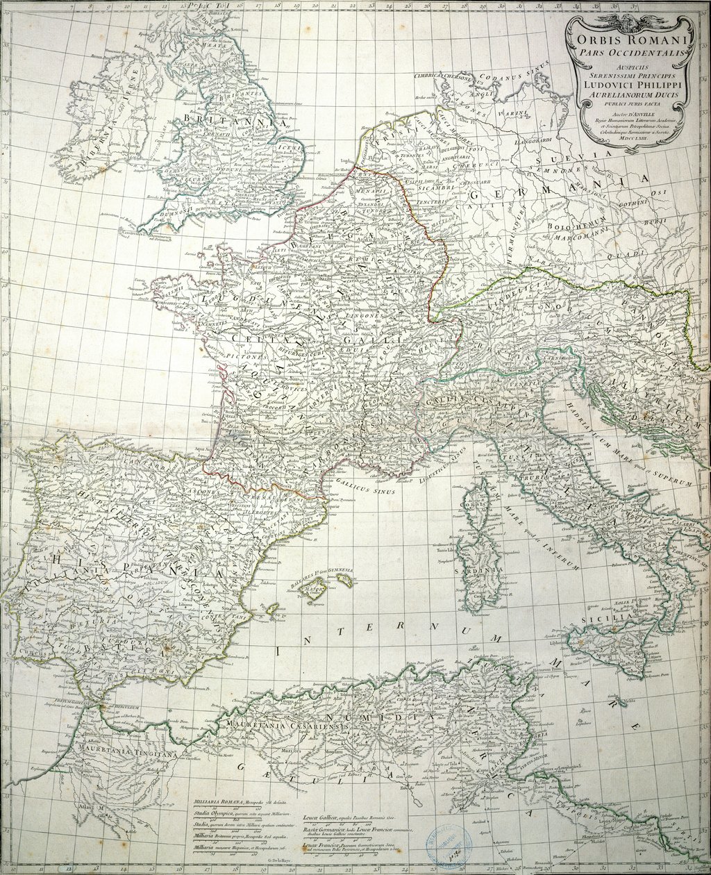
Map of the Western Part of the Roman Empire, 1763 by Jean-Baptiste d'Anville

Map of the Western Part of the Roman Empire, 1763

(Map of the western part of the Roman Empire, 1763 )


Jean-Baptiste d'Anville

€ 136.39
Includes 13.5% VAT
   Configure art print
1763  ·  coloured engraving  ·  Image ID: 146288

Nonclassified artists  ·  Cartography

Map of the Western Part of the Roman Empire, 1763 by Jean-Baptiste d'Anville. Available as an art print on canvas, photo paper, watercolor board, natural paper, or Japanese paper.
plan · britannia · gallia · italia · germania · numidia · hispania · great britain · france · italy · germany · north africa · spain · europe · Archives du Ministere des Affaires Etrangeres, Paris, France / Bridgeman Images
AR/3D   View in 3D / AR zu Favoriten hinzufügen   Add to favorites    Change wall color    View picture in a room
0 Reviews

Configure art print

Picture Frame

Medium & Stretcher

Glass & Passepartout

Miscellaneous & Extras

 Save / compare configuration
Preview Icon

Summary

Gemälde
Veredelung
Keilrahmen
Museumslizenz

€ 136.39
(inkl. 20% MwSt)
   Add to cart

Bildschärfe: PERFEKT

If you'd like us to adjust the brightness, colors, or crop the image, we're happy to do this for you at no extra cost. Just get in touch!

Similar artworks selected for you

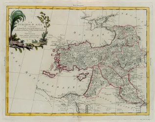
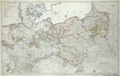
Map of Europe A Map of Europe, Divided into Its Empires and Kingdoms, by J. Palairet with Several Improvements and Additions from D Map of Europe Map of Europe. Second Half of the 19th Century. Italian Atlas. Stabilimento Civelli. Milan. Wallis The Empire of Charlemagne from World Known to the Ancients, engraving by G. Zuliani taken from Tome IV of the Newest Atlas published in Venice in 1785 by Antonio Zatta, Private Collection Geographic map of Europe at the time of Napoleon I. In “Atlante Storico Geografico” by K. von Sruner Europe Divided into Its Empires, Kingdoms, States, Republics The English Channel Map of the Region of New Map of Europe Done from the Most Accurate Observations Communicated to the Royal Society Map of Europe in 1743. Map of Europe The map was published in Nuremberg by Christoph Fembo (1823) and shows Europe Europe and Western Asia, in Map of Europe Europe - by A Europe, from Map of Europe, 1841 Ottoman Empire in 1696 by Jaillot Map of the Ottoman and Persian Empires (Cropped) Europe divided into its main states, engraving by G. Zuliani taken from Tome I of the Newest Atlas published in Venice in 1776 by Antonio Zatta Europe, engraving Asian Turkey, Including Antolia, Georgia, Armenia, Kurdestan, Diarbec, Irak-Arabi, Syria, Engraving by G. Zuliani Map of Europe, published in 1700, Paris Italy Map of the Prussian States in 1799 Western Part of Roman Empire. Map.
Show more similar artworks

More motifs from the category Cartography

Copy of The Map of Mockbeggar Hall, with his situation in the spacious country called anywhere, c.1633, from the Ballad of Roxborough Map of Exeter, from Civitates Orbis Terrarum by Georg Braun (1541-1622) and Frans Hogenberg (1535-90), c. 1572-1617 Wyld’s Official Map of the Suez Maritime Canal, 1869 An Astronomer, detail from a map of the planets, from ‘A Celestial Atlas, or The Harmony of the Universe’ (Atlas coelestis seu harmonia macrocosmica), published by Joannes Janssonius, Amsterdam, 1660-61 Map of Barth, from Map of Rome, from A Map of The King A Map of the World, Corrected from the Observations Communicated to the Royal Societies of London and Paris, to the Right Honourable Richard Boyle, 1711 Walliss Folded Map of the City of London and Westminster, 1799 Map of the Battle of Pułtusk, published by William Blackwood and Sons, Edinburgh and London, 1848 Map of the Island of Tinos with the Venetian fleet, 17th century Detail from Europe and Central Asia, from an Atlas of the World in 33 Maps, Venice, 1st September 1553 Map of Belluno, from The City of Jerusalem and the surrounding area, detail from the Madaba mosaic map, Byzantine, 6th century Fol. 34v, Map of Australia, from
View More from "Cartography"

A selection of our top sellers

Head of a skeleton with a burning cigarette Eiger, Mönch and Jungfrau in the Morning Sun Soft Hard The Noon The Lady of Shalott Girl with a Rake in Fjord Landscape Profile Portrait of a Young Woman Beethoven Frieze Harbour of Trieste Cartoon by Daumier: Series “Les Gens de justice”, published in “Charivari” of 15/08/1845. A lawyer pleading in court while sleeping. P. Modersohn-Becker, Girl Japanese Vase with Roses and Anemones, 1890 Free Curve to the Point - Accompanying Sound of Geometric Curves, 1925 Nude in an Interior The Sun Bathers, 1927
Show more artworks


What our customers think about us


Frequently Asked Questions about Meisterdrucke


Personalizing your art print at Meisterdrucke is simple and intuitive: Choose a frame, set the image size, pick a printing medium, and add suitable glazing or a stretcher frame. We also offer additional customization options like mats, fillets, and spacers. If you have any questions, our customer service team is ready to help you create your perfect artwork.

At Meisterdrucke, you can visualize your configured artwork directly in your own room. Simply upload a photo of your space and see how the artwork looks in it. If you're visiting us on a mobile device — phone or tablet — our augmented reality feature brings the picture to life and projects it right into your room. A unique experience that combines art and technology.

Choosing the right medium is often a matter of personal taste. To give you a better idea, we've provided some images for each medium. We also offer a sample set of all paper variants, so you can decide not just visually but by touch as well. You can order the sample set free of charge — only shipping costs apply.

Don't worry! At Meisterdrucke, we don't just process orders mechanically. Every order is manually reviewed by our team. If we spot any inconsistencies or issues with your configuration, we'll get in touch with you right away. And of course, our friendly and patient support team is always here to help you with your configuration. We'll work with you by phone or email to adjust your image so the final result is exactly what you had in mind.


Still have questions?

Are you interested in an art print from our manufactory but still unsure? Do you need advice on choosing the medium or help with the order?

Our experts are happy to assist you.

+43 4257 29415
support@meisterdrucke.com
Mo-Do: 7:00 - 16:00 | Fr: 7:00 - 13:00

Still have questions?

Are you interested in an art print from our manufactory but still unsure? Do you need advice on choosing the medium or help with the order?

Our experts are happy to assist you.

+43 4257 29415
support@meisterdrucke.com
Mo-Do: 7:00 - 16:00 | Fr: 7:00 - 13:00


Meisterdrucke

   Kärntner Strasse 46
        9586 Finkenstein am Faaker See
        Austria
        +43 4257 29415
        support@meisterdrucke.com
Other languages

                   
Erfahrungen & Bewertungen zu Meisterdrucke
Post.at DHL Express Quehenberger Cargoboard
Kaiser Franz Joseph

Meisterdrucke
Kärntner Strasse 46
9586 Finkenstein am Faaker See · Austria
+43 4257 29415 · support@meisterdrucke.com
Post.at DHL Express Quehenberger Cargoboard


(c) 2026 meisterdrucke.ie