support@meisterdrucke.com  ·  0043 4257 29415

Deutsch English Italiano Español Français Nederlands Português Svenska Polski Dansk
Search by artist, work title or style – e.g. Monet, Starry Night, Impressionism, Hokusai wave, nude. Describe the scene – e.g. green meadow, abstract with lots of red, dark oil painting, standing nude next to a tree.

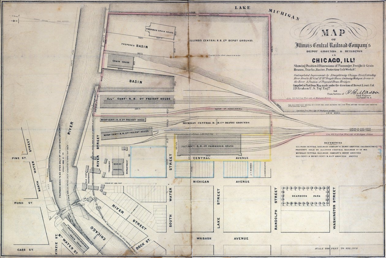
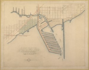
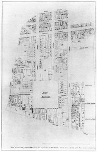
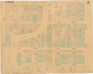
Map of Illinois Central Railroad Company’s depot grounds and buildings in Chicago, 1855 by Edward Mendel

Map of Illinois Central Railroad Company’s depot grounds and buildings in Chicago, 1855

(Map of Illinois Central Railroad Companys depot grounds and buildings in Chicago, 1855 )


Edward Mendel

€ 154.44
Includes 13.5% VAT
   Configure art print
1855  ·  lithograph  ·  Image ID: 363758

Nonclassified artists  ·  Cartography

Map of Illinois Central Railroad Company’s depot grounds and buildings in Chicago, 1855 by Edward Mendel. Available as an art print on canvas, photo paper, watercolor board, natural paper, or Japanese paper.
street map · american city · illinois central railroad company · railway depot · industrialisation · rail · freight · america · plan · industrial · Newberry Library, Chicago, Illinois, USA / Bridgeman Images
AR/3D   View in 3D / AR zu Favoriten hinzufügen   Add to favorites    Change wall color    View picture in a room
0 Reviews

Configure art print

Picture Frame

Medium & Stretcher

Glass & Passepartout

Miscellaneous & Extras

 Save / compare configuration
Preview Icon

Summary

Gemälde
Veredelung
Keilrahmen
Museumslizenz

€ 154.44
(inkl. 20% MwSt)
   Add to cart

Bildschärfe: PERFEKT

If you'd like us to adjust the brightness, colors, or crop the image, we're happy to do this for you at no extra cost. Just get in touch!

Similar artworks selected for you

Ground Plan of the Thirteen Markets in the City of New York, 1833 Plate 78: 2 Drawings from The Plan of Chicago, 1909: Suggested Location and Arrangement of the... Frankford Ave. and Wheatsheaf Lane, Hexamer General Surveys, 1895 Plate 79 2 Drawings from The Plan of Chicago: Suggested Location and Arrangement Hexamer General Survey; Volume 25, Plate 2432-2433 Royal Victoria and Albert and King George V Docks 1934 Plate 72 from The Plan of Chicago, 1909: Chicago. Sketch Diagram of Docks Suggested at the Mouth Plan of the Proposed Improvements at Charing Cross, St. Martins Lane and Entrance to the Strand, engraved by James Basire, 1826 Tabor St. and Olney Road, Hexamer General Surveys, 1894 Seneca lands in 1802 Grays Ferry Chemical Works, Grays Ferry Rd. (north side) between Thirty-fourth St. and Thirty-sixth St., Hexamer General Surveys, 1888 A Map of Manhattanville Situated on York Island Map of the Gold Coast Area Map of Willesden, London (litho) Plan of proposed street running from Charing Cross to Portland Place, 1848 Map of Willesden, London A Map of the Town of Antrim, plate from Map of Philadelphia Lead Works, 1889 Construction drawing for the 2-2-2 locomotive by R. & W. Hawthorn & Co. for the Great Northern Railway Co. Plan of the Duke of Portland Plan of Shakespeare Map of the city of New York, made under the direction of the Commissioners of the Metropolitan Fire Department, showing the location of buildings in the possession and use of the Metropolitan Fire Department and of the Metropolitan Police Department Providence Mill, Little Elk Creek, Maryland, Hexamer General Surveys The New and Accurate Plan of the Town and Port of Leverpool, from a survey, engraved by Thomas Kitchin Map of Fredericksburg, December 1862 Dudley - Mine-workings: lithograph Ralph Walker Faculty of Sciences of Rennes Maps of the City of Philadelphia, volume 1, plate 2, 1860
Show more similar artworks

More motifs from the category Cartography

Galathes, 11th King of the Gauls, with a map of Gaul behind, detail from a tapestry on the history of the Kings of the Gauls, Arras Workshop, c.1530 Map Depicting North Africa, from an Atlas by Ptolemy, 1st Half of the 16th Century Map of Rome, from Ms 1288 f.25 Map of Brazil, from Dutch Marine Maps, 1637 Map of Britain in 640, from “The Northumbrian Kingdom” in “A Short History of the English People” by J. R. Green, published 1893 Map showing the Molucca Islands off Halmahera, 1640 Detail from a Renaissance map of Europe, after Jacopo Russo, 1528 Map of the route followed by Hernando Cortés (1485-1547) during the conquest of Mexico Map of the Tribe of Asher, 1590 Map of Valencia, from ’Civitates Orbis Terrarum’ by Georg Braun (1541-1622) and Frans Hogenberg (1535-90) c.1572-1617 Ms. 988, Vol. 3, fol. 7 Plan and Map of the Town, Citadel and Surroundings of Amiens, from the ’Atlas Louis XIV’, 1683-88 Map of Roman Kent, England, from “A Short History of the English People” by J. R. Green, published 1893 Map of Fort Rosalie des Natchez, Louisiana Map of the Battle of Neerwinden, published by William Blackwood and Sons, Edinburgh and London, 1848 Map of Herefordshire, 1695
View More from "Cartography"

A selection of our top sellers

Woman with Parasol Turned to the Left, 1886 The Bathing Pool The Kiss, 1907-08 “Mary Rose” The Roundel in the Hedge Garden with a Flower Waterer Red Cavalry, 1928-32 Nude in an Interior Bear in Snow, 1940 Drifting Clouds Roman art: “Spring”, Flora picking flowers. Fresco from the Villa of Varano in Stabiae, near Pompeii. 15 BC-60 AD. National Archaeological Museum, Naples Camelot, illustration from Whimsical, 1930 Back from the Hunt, 1890, Milan The Kiss, 1895 Women of Tahiti, On the Beach, 1891
Show more artworks


What our customers think about us


Frequently Asked Questions about Meisterdrucke


Personalizing your art print at Meisterdrucke is simple and intuitive: Choose a frame, set the image size, pick a printing medium, and add suitable glazing or a stretcher frame. We also offer additional customization options like mats, fillets, and spacers. If you have any questions, our customer service team is ready to help you create your perfect artwork.

At Meisterdrucke, you can visualize your configured artwork directly in your own room. Simply upload a photo of your space and see how the artwork looks in it. If you're visiting us on a mobile device — phone or tablet — our augmented reality feature brings the picture to life and projects it right into your room. A unique experience that combines art and technology.

Choosing the right medium is often a matter of personal taste. To give you a better idea, we've provided some images for each medium. We also offer a sample set of all paper variants, so you can decide not just visually but by touch as well. You can order the sample set free of charge — only shipping costs apply.

Don't worry! At Meisterdrucke, we don't just process orders mechanically. Every order is manually reviewed by our team. If we spot any inconsistencies or issues with your configuration, we'll get in touch with you right away. And of course, our friendly and patient support team is always here to help you with your configuration. We'll work with you by phone or email to adjust your image so the final result is exactly what you had in mind.


Still have questions?

Are you interested in an art print from our manufactory but still unsure? Do you need advice on choosing the medium or help with the order?

Our experts are happy to assist you.

+43 4257 29415
support@meisterdrucke.com

Mo-Do: 7:00 - 16:00 | Fr: 7:00 - 13:00

Still have questions?

Are you interested in an art print from our manufactory but still unsure? Do you need advice on choosing the medium or help with the order?

Our experts are happy to assist you.

+43 4257 29415
support@meisterdrucke.com
Mo-Do: 7:00 - 16:00 | Fr: 7:00 - 13:00


Meisterdrucke

   Kärntner Strasse 46
        9586 Finkenstein am Faaker See
        Austria
        +43 4257 29415
        support@meisterdrucke.com
Other languages

                   
Erfahrungen & Bewertungen zu Meisterdrucke
Post.at DHL Express Quehenberger Cargoboard
Kaiser Franz Joseph

Meisterdrucke
Kärntner Strasse 46
9586 Finkenstein am Faaker See · Austria
+43 4257 29415 · support@meisterdrucke.com
Post.at DHL Express Quehenberger Cargoboard


(c) 2026 meisterdrucke.ie