support@meisterdrucke.com  ·  0043 4257 29415

Deutsch English Italiano Español Français Nederlands Português Svenska Polski Dansk
Search by artist, work title or style – e.g. Monet, Starry Night, Impressionism, Hokusai wave, nude. Describe the scene – e.g. green meadow, abstract with lots of red, dark oil painting, standing nude next to a tree.

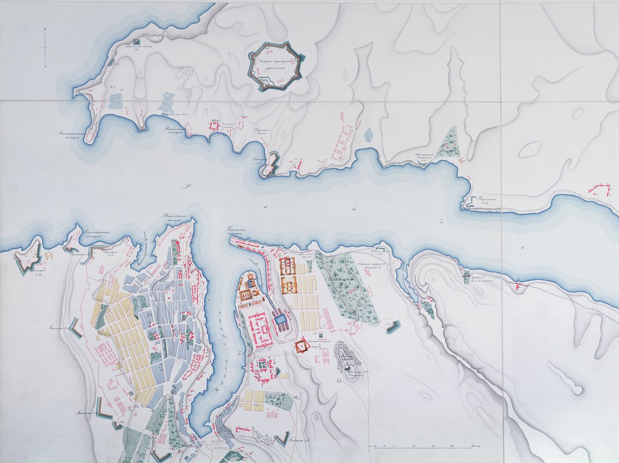
Map of Sevastopol, 1854 by Russian School

Map of Sevastopol, 1854

(Map of Sevastopol, 1854 )


Russian School

€ 144.19
Includes 13.5% VAT
   Configure art print
1854  ·  colour lithograph  ·  Image ID: 441841

Cultural Circles  ·  Cartography

Map of Sevastopol, 1854 by Russian School. Available as an art print on canvas, photo paper, watercolor board, natural paper, or Japanese paper.
crimea · mapping · carte · harbour · port · geography · geographical · cartography · coast · strategic city · aerial view · Archives des Tsars, St. Petersburg, Russia / Bridgeman Images
AR/3D   View in 3D / AR zu Favoriten hinzufügen   Add to favorites    Change wall color    View picture in a room
0 Reviews

Configure art print

Picture Frame

Medium & Stretcher

Glass & Passepartout

Miscellaneous & Extras

 Save / compare configuration
Preview Icon

Summary

Gemälde
Veredelung
Keilrahmen
Museumslizenz

€ 144.19
(inkl. 20% MwSt)
   Add to cart

Bildschärfe: PERFEKT

If you'd like us to adjust the brightness, colors, or crop the image, we're happy to do this for you at no extra cost. Just get in touch!

Similar artworks selected for you

Plan for the Construction of the Coast Batteries for the Defence of Breton Harbour in 1848 Map of Friderichstad and Its Situation Plan of the Siege of Sebastopol, 1883 Plan of the Siege of Sebastopol 1854-55, engraved by Robert Walker, pub. William Mackenzie, c.1860 A Sketch of the River Tagus from the Bar of Alcacova up to Coffin Map showing the Siege of Sevastopol, Crimean War, 1854-1855, 1893. Map of Rhode Island, from The Port of Mahon and surrounding area, from Cala Murte to Cala Rafalet Roy Military Survey of Scotland Map of the Operations of the American Army in the Valley of Mexico in August and September 1847 during the Mexican-American War Peterhof, Russia: Elevation of the English Palace and plan of the park Greece, the Peiraeus or Port Drako Surveyed by Commander Thomas Graves, H.M.S. Beacon 1840 (Detail) Map of Rhode Island at the time of its occupation 1780-81 by the French Army on the orders of Jean-Baptiste de Vimeur Count of Rochambeau Reconnaissance of King Map for the Battle of Austerlitz, December 2nd, 1805 Peterhof, Russia: Elevation of the English Palace and Plan of the Park Wonsan Chongyong Map of Düsseldorf Black Sea Sebastopol from a Russian Survey of 1836 England East Coast Entrance to the River Humber Surveyed by Staff Captain J. Parsons, Royal Navy Map of the bay and city of S. Phelipe de Portobelo Map of Phillipsburg, from Sketch of the Fortress of Ghuznee. Taken by Storm on the 23rd July 1839 Plan of Jerusalem in 1308, illustration from a facsimile edition of Liber de Expeditione Terrae Sanctae by Marino Sanuto di Torcello Map of the St. Lawrence Estuary Venice Liquid Streets (2008) Geological Map of the Cutch Desert, 1870 Map of Sofala, Mozambique, from A Plan of St. Philips Castle and Fortifications in the Island of Minorca
Show more similar artworks

More art prints by Russian School

St. George and the Dragon, Russian Icon from Vologda, 15th Century Archangel Gabriel (Angel with Golden Hair), Russian icon, 12th century Soviet poster of Stalin reading a telegram, 1949 The Nativity, Russian icon, 16th century Icon Old Testament Trinity, 16th century icon The Saviour, early 14th century Mother of God of Vladimir, icon from northwestern Russia, late 17th century Last Judgement, Novgorod Icon The Insurrection of the Decembrists at Senate Square, St. Petersburg, on 14th December, 1825 Russian sailor in the uniform of the Russian Navy at the end of the nineteenth century Portrait of Elizabeth Petrovna (1709-62), Empress of Russia, c. 1750 The Black Madonna of Jasna Gora, Byzantine-Russian Icon Abacus, bead calculator, probably 19th century Orlov tea service from the Imperial Porcelain Factory, St Petersburg, c. 1765
Show more works by Russian School

More motifs from the category Cartography

Map of Novara, from Civitates Orbis Terrarum by Georg Braun (1541-1622) and Frans Hogenberg (1535-90), c.1572-1617 Drawing for the map of the moon, 1794 Map of the Trans-Siberian Railway, produced by J. Bartholomew and Co., c.1920 Map of Seville, Cadiz, and Malaga, from Plan of the enclosed gardens and Château de Gaillon, from Map of the World, Based on Descriptions and Co-ordinates Given in Map of Fort Rosalie des Natchez, Louisiana Map illustrating the Welsh wars of William Rufus and Henry I, from ’A Short History of the English People’ by J. R. Green, published 1893 Map of Africa, published in 1700, Paris Map of the Tribe of Asher, 1590 Battle of Waterloo, Map of the Battlefield, engraved by Jacowick, 1816 Map of the County of Cornwall, 1579 Map of Naples, from ‘Civitates Orbis Terrarum’ by Georg Braun (1541-1622) and Frans Hogenberg (1535-90), c.1572 New and accurate map of the West Indies Map of Leipzig, from „Civitates Orbis Terrarum“ by Georg Braun (1541-1622) and Frans Hogenberg (1535-90), c. 1572
View More from "Cartography"

A selection of our top sellers

The Chocolate Girl La Belle Chocolatière de Vienne, c. 1745 Neptune Spring, from a series depicting the four seasons, 1573 Summer, 1573 The times of day: The evening, 1821-1822 Painting from the Tomb of the Diver from the southern cemetery at Paestum, 480-470 BC Two Reclining Figures Cat in a Rainbow Danaë Ad Parnassum Anguish Wheatfield with Crows The Ambassadors The Accolade, 1901. Sower at Sunset
Show more artworks


What our customers think about us


Frequently Asked Questions about Meisterdrucke


Personalizing your art print at Meisterdrucke is simple and intuitive: Choose a frame, set the image size, pick a printing medium, and add suitable glazing or a stretcher frame. We also offer additional customization options like mats, fillets, and spacers. If you have any questions, our customer service team is ready to help you create your perfect artwork.

At Meisterdrucke, you can visualize your configured artwork directly in your own room. Simply upload a photo of your space and see how the artwork looks in it. If you're visiting us on a mobile device — phone or tablet — our augmented reality feature brings the picture to life and projects it right into your room. A unique experience that combines art and technology.

Choosing the right medium is often a matter of personal taste. To give you a better idea, we've provided some images for each medium. We also offer a sample set of all paper variants, so you can decide not just visually but by touch as well. You can order the sample set free of charge — only shipping costs apply.

Don't worry! At Meisterdrucke, we don't just process orders mechanically. Every order is manually reviewed by our team. If we spot any inconsistencies or issues with your configuration, we'll get in touch with you right away. And of course, our friendly and patient support team is always here to help you with your configuration. We'll work with you by phone or email to adjust your image so the final result is exactly what you had in mind.


Still have questions?

Are you interested in an art print from our manufactory but still unsure? Do you need advice on choosing the medium or help with the order?

Our experts are happy to assist you.

+43 4257 29415
support@meisterdrucke.com
Mo-Do: 7:00 - 16:00 | Fr: 7:00 - 13:00

Still have questions?

Are you interested in an art print from our manufactory but still unsure? Do you need advice on choosing the medium or help with the order?

Our experts are happy to assist you.

+43 4257 29415
support@meisterdrucke.com
Mo-Do: 7:00 - 16:00 | Fr: 7:00 - 13:00


Meisterdrucke

   Kärntner Strasse 46
        9586 Finkenstein am Faaker See
        Austria
        +43 4257 29415
        support@meisterdrucke.com
Other languages

                   
Erfahrungen & Bewertungen zu Meisterdrucke
Post.at DHL Express Quehenberger Cargoboard
Kaiser Franz Joseph

Meisterdrucke
Kärntner Strasse 46
9586 Finkenstein am Faaker See · Austria
+43 4257 29415 · support@meisterdrucke.com
Post.at DHL Express Quehenberger Cargoboard


(c) 2026 meisterdrucke.ie