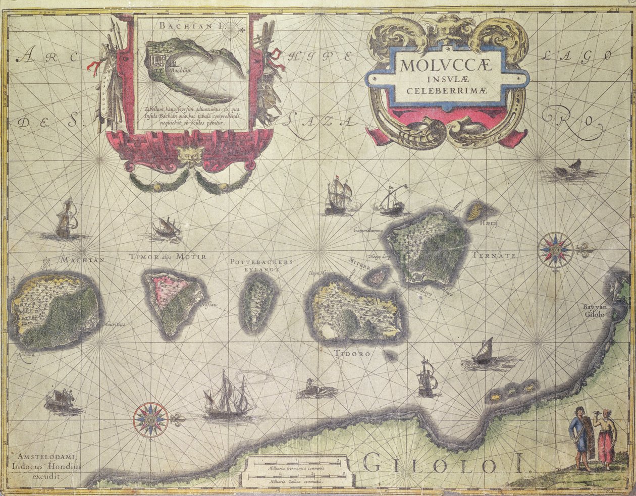
Map showing the Molucca Islands off Halmahera, 1640 by Joannes Jansson

Map showing the Molucca Islands off Halmahera, 1640

(Map showing the Molucca Islands off Halmahera, 1640 )


Joannes Jansson

€ 129.74
Enthält 13.5% MwSt.
   Configure art print
1640  ·  coloured engraving  ·  Picture ID: 136237

Nonclassified artists  ·  Cartography

Map showing the Molucca Islands off Halmahera, 1640 by Joannes Jansson. Available as an art print on canvas, photo paper, watercolor board, uncoated paper or Japanese paper.
cartography · cartouche · explorer · spice islands · maluku · molucca sea · moluccas · chart · ships · native · navigation · mapping · exploration · iles · moluques · Private Collection / Bridgeman Images
Other color variations of this picture  
AR/3D   View in 3D / AR zu Favoriten hinzufügen   Add to favorites    Select wall color    View painting in a room
0 Reviews

Configure art print

Picture Frame

Medium & Stretcher

Glass & Passepartout

Miscellaneous & Extras

 Save / compare configuration
Preview Icon

Summary

Gemälde
Veredelung
Keilrahmen
Museumslizenz

€ 129.74
(inkl. 20% MwSt)
   Add to cart

Bildschärfe: PERFEKT

Should you desire adjustments to brightness and color, or a custom crop of the motif, we are happy to make these changes at no additional cost to you. Please do not hesitate to contact us.

Similar artworks selected for you

L East Friesland 1584 Map Freti Magellanici ac Novi Freti Vulgo Le Maire Exactissima Delineatio European Coast, Map on Parchment by Willem and Joan Blaeu Map Part of the Coast of Norway and Sweden Map of Part of the Coast of Norway and Sweden Map showing the Island of Crete, c.1570, by Abraham Ortelius The coast of England from the Southforeland to Orfordness Map of the Coasts of Flanders, Normandy, and England Map of the island of Malta Majorca, Minorca, and Ibiza, including the coasts of Catalonia and Valencia, in Western Atlantic Ocean Map of the Coast of Flanders, Normandy and England A chart of the North Sea A general chart of the northern navigation Malta A chart of the sea coasts of England, Flanders and Holland, c.1672 Pascaart van de Noort Zee verthoonende in zich alle de Custen en havens daer rontom gelegen Nice on the Mediterranean Map of the Coast of Norway and Sweden between Merdøy and Uddevalla Map of East Africa and Madagascar Caribbean, Honduras and Florida, in Map of the Coast of Norway and Sweden Between Merdøy and Uddevalla The Windward Passage from Jamaica, Between the East End of Cuba, and the West End of Hispaniola
Show more similar artworks

Other art prints by Joannes Jansson

Map of New Belgium with a View of New Amsterdam, compiled by Nicolaes Visscher c.1651-55 The Antarctic Pole Historical Geographical Map of Palestine. Jansson Atlas Representation of the Seven Wonders of Antiquity: The Mausoleum of Halicarnassus in the Atlas by Jansson Jannsonius Representation of the Seven Wonders of Antiquity: the Colossus of Rhodes. Atlas of Jansson Jannsonius, 1630 Map of the Ottoman Empire, from the Sichuan and Shanxi, China America Pars Meridionalis, page 93 of Northeastern China Representation of the Seven Wonders of Antiquity: the Gardens of Babylon. Atlas of Jansson Jannsonius, 1630 Representation of the Seven Wonders of Antiquity: the Temple of Diana (Artemis) in Ephesus. Atlas of Jansson Jannsonius, 1630 Frontispiece of the Fifth Volume of Jansson Map showing the Molucca Islands off Halmahera, 1640 New Map of Switzerland Representation of the Seven Wonders of Antiquity: The Statue of Jupiter by Phidias in
Discover more works by Joannes Jansson

Other motives from the category Cartography

Map of the Voyage of the Argonauts, from the Map of the theatre of the Boer War Detail of a Map of the County of Nottinghamshire Showing the Town of Nottingham Map of the Gold-Bearing Regions in Peru Map for the Battle of Austerlitz, December 2nd, 1805 Map of Ostia, from Map of the Battle of Vitoria, published by William Blackwood and Sons, Edinburgh and London, 1848 Map of Europe, Published in 1700, Paris Map of Manchester Map of the Countries of the Persian Gulf, from the Map of the parts of Europe and Asia adjacent to Constantinople, from Map of France, Spain and North-West Africa, from the Military Map of Corsica Plan and Map of the Town and Citadel of Bayonne, from the Map of France, c. 1914
View More from "Cartography"

Excerpt from our top sellers

Danaë The Soul of the Rose, 1908 The Bathing Pool Reduced Weight Senecio (Old Man) Two Riders on the Beach Sunny Day in the Countryside Moon rising Over the Sea The Blue Room The Holy Trinity Starry Night, c.1850-65 Madonna with Child and Two Angels Winter Landscape with Skaters Hunters in the Snow The Virgin with Angels
Show More Artworks


What our customers think about us


Frequently Asked Questions about Meisterdrucke


Personalizing your art print at Meisterdrucke is a simple and intuitive process that allows you to design an artwork exactly to your specifications: Choose a frame, determine the image size, decide on a printing medium, and add suitable glazing or a stretcher frame. We also offer customization options such as mats, fillets, and spacers. Our customer service is available to help you design your perfect artwork.

At Meisterdrucke, you have the fascinating option to visualize the artwork you configured directly in your own space. For a tailored preview, simply upload a photo of your room and let the artwork appear on it. If you visit us via a mobile device, be it a phone or tablet, our augmented reality feature brings the image to life and seamlessly projects it into your space. An experience that uniquely combines art and technology.

Choosing the medium is often a matter of personal taste. To give you a clearer idea, we have provided some images for each medium. For a holistic experience, we also offer you a sample set of all paper variants so you can make a decision not just visually but also haptically. You can take advantage of the sample set free of charge – only the shipping costs will apply. You can order the sample set directly.

Do not worry. At Meisterdrucke, we do not proceed mechanically. We manually review each order. If there are any inconsistencies or peculiarities in the configuration, we will immediately contact you. Of course, our courteous and patient support is always at your side to assist you with the configuration. Together with you, we adjust your image by phone or email so that the final result exactly meets your expectations.


Do you have any questions?

Are you interested in an art print from our manufactory but still unsure? Do you need advice on choosing the medium or help with the order?

Our experts are happy to assist you.

+43 4257 29415
support@meisterdrucke.com
Mo-Do: 7:00 - 16:00 | Fr: 7:00 - 13:00

Do you have any questions?

Are you interested in an art print from our manufactory but still unsure? Do you need advice on choosing the medium or help with the order?

Our experts are happy to assist you.

+43 4257 29415
support@meisterdrucke.com
Mo-Do: 7:00 - 16:00 | Fr: 7:00 - 13:00


Meisterdrucke

   Kärntner Strasse 46
        9586 Finkenstein am Faaker See
        Austria
        +43 4257 29415
        support@meisterdrucke.com
Other languages

                   
Erfahrungen & Bewertungen zu Meisterdrucke
Post.at DHL Express Quehenberger Cargoboard
Kaiser Franz Joseph

Meisterdrucke
Kärntner Strasse 46
9586 Finkenstein am Faaker See · Austria
+43 4257 29415 · office@meisterdrucke.com
Post.at DHL Express Quehenberger Cargoboard


Meisterdrucke 2716 Bewertungen auf ProvenExpert.com

(c) 2025 meisterdrucke.ie