support@meisterdrucke.com  ·  0043 4257 29415

Deutsch English Italiano Español Français Nederlands Português Svenska Polski Dansk
Search by artist, work title or style – e.g. Monet, Starry Night, Impressionism, Hokusai wave, nude. Describe the scene – e.g. green meadow, abstract with lots of red, dark oil painting, standing nude next to a tree.

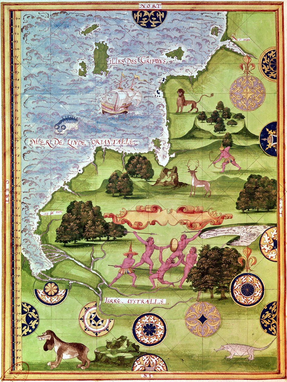
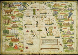
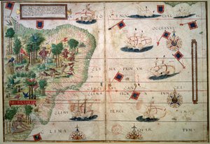
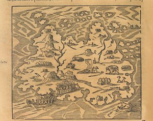
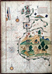
Fol. 34v, Map of Australia, from 'Cosmographie Universelle', 1555 by Guillaume Le Testu

Fol. 34v, Map of Australia, from 'Cosmographie Universelle', 1555

(Fol.34v Map of Australia, from 'Cosmographie Universelle', 1555 )


Guillaume Le Testu

€ 144.19
Includes 13.5% VAT
   Configure art print
1555  ·  Watercolor on paper  ·  Image ID: 97315

Nonclassified artists  ·  Cartography

Fol. 34v, Map of Australia, from 'Cosmographie Universelle', 1555 by Guillaume Le Testu. Available as an art print on canvas, photo paper, watercolor board, natural paper, or Japanese paper.
cosmographie · islands · island · ship · compass · chart · plan · natives · native · combat · fighting · fight · hunting · wild animal · crocodile · sea monster · ship · indian ocean · navigation · Australian · Min. Defense - Service Historique de l'Armee de Terre,France / Bridgeman Images
Other color versions of this image  
AR/3D   View in 3D / AR zu Favoriten hinzufügen   Add to favorites    Change wall color    View picture in a room

Note: Only reviews with comments are displayed. Reviews can be submitted directly after purchase in your customer account.

Configure art print

Picture Frame

Medium & Stretcher

Glass & Passepartout

Miscellaneous & Extras

 Save / compare configuration
Preview Icon

Summary

Gemälde
Veredelung
Keilrahmen
Museumslizenz

€ 144.19
(inkl. 20% MwSt)
   Add to cart

Bildschärfe: PERFEKT

If you'd like us to adjust the brightness, colors, or crop the image, we're happy to do this for you at no extra cost. Just get in touch!

Similar artworks selected for you

Fol. 41v, Map of Australia, from The Spice Trade in the Moloccas, from Fol. 31v Map of Australia and Magellan Island from “Cosmographie Universelle”, 1555 Fol. 54v Map of Florida, from “Cosmographie Universelle”, 1555 Fol. 44v Map of Brazil, from Fol. 39v Map of the Magellan Straits, from “Cosmographie Universelle”, 1555 Hydrographic Map of Brazil Fol.56v Map of Florida, Canada and Labrador, from F.52v Map of Florida and the Antilles, from Fol. 10v Map of Scandinavia and Northern Russia, from Fol. 47v Map of Peru, from Atlas by Diego Homem of South America, showing Indians in their settlements, Spanish Expeditionary Force Camp and Men in Armour Arabia and India, from the Brazil from the The Indes Portuguese nautical atlas. Page of the Atlas Miller manuscript made in 1519 by Pierre and Georges Reinel, Lopo Homem (cartographers) and Antoine de Hollande (miniaturist) Map of the China Sea, from a facsimile of the Miller Atlas by Pedro and Jorge Reinel, and Lopo Homem, made in 1519 The French Arrive at Port Royal, from Siege and Attack Tactics in Clashes Between Natives and Conquerors Miller Atlas, c1519 Map of the City of Jerusalem, from “Peregrinatio in Terram Sanctam” by Bernhard von Breydenbach (1440-97) Techniques of Siege and Attack, from Americae Tertia Pars Hydrographic map of Brazil Map of China (Cathay), with descriptions of small scenes, delimitation of the kingdoms with its sovereign represented each time History of America: Description of methods of siege and attack, Indians fighting Spanish armies. Recit of the captivity of Hans Staden, German explorer who left with the Spanish fleets to Brazil, captured by the Tupinamba Indians. Engraving from Ameri Map of Trinity Island in the Antilles from Universal Cosmography Portolan of the West Coast of Africa with the Canary Islands. Geographic map by the Portuguese Luis Lazare (16th century) Methods of Sieging and Attacking, from 1592 Map of Africa
Show more similar artworks

More art prints by Guillaume Le Testu

Fol. 34v, Map of Australia, from Fol. 31v Map of Australia and Magellan Island from “Cosmographie Universelle”, 1555 Fol. 7v: Map of the North Pole, from Fol. 30v Map of the Sea of Maluku, from the Fol. 9v, Map of Western Europe, from Fol. 41v, Map of Australia, from F.52v Map of Florida and the Antilles, from Fol. 39v Map of the Magellan Straits, from “Cosmographie Universelle”, 1555 Fol. 54v Map of Florida, from “Cosmographie Universelle”, 1555 Fol. 57v Map of Canada and Florida, from Fol.56v Map of Florida, Canada and Labrador, from Fol. 47v Map of Peru, from Fol. 44v Map of Brazil, from Fol. 40v, Map of the Magellan Straits, from Fol. 10v Map of Scandinavia and Northern Russia, from
Show more works by Guillaume Le Testu

More motifs from the category Cartography

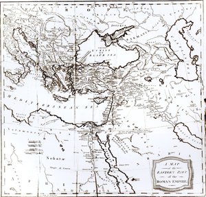
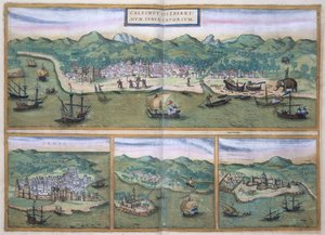
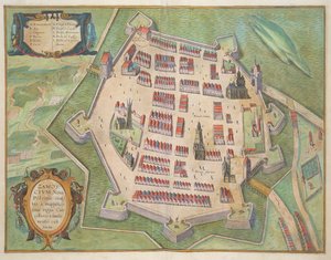
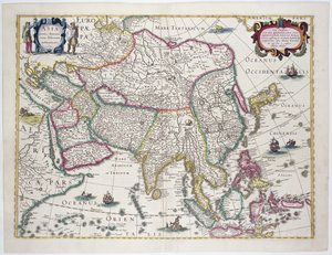
Map of Asia, from the Map of Wilnis, from ’Civitates Orbis Terrarum’ by Georg Braun (1541-1622) and Frans Hogenberg (1535-90), c.1572-1617 Map of the Eastern Part of the Roman Empire, from Fol.56v Map of Florida, Canada and Labrador, from Map of South West Point, Virginia, from ’Guerre de l’Amérique’, 1782 Map of Calicut, from Patagonia, from a Series of World Maps published by John Tallis and Co., New York and London, 1850s Miniature Nautical Map of the Adriatic, 1624 Fol. 99 Map of Saint-Savinien on the Charente River in 1713, from Map of Zamość, from The Countye Palatine of Chester, engraved by Jodocus Hondius (1563-1612) from John Speed Map of Bermuda General map including Arabia, Japan, the Korean peninsula and the greater part of the Indonesian archipelago, 1631 Map of Armenia Map of the Southern Sky, with representations of constellations, decorated with the crest of Cardinal Lang von Wellenburg, and a dedication to him with his coats of arms and the Imperial copyright, 15
View More from "Cartography"

A selection of our top sellers

First Steps The Two Crowns Woman at a Window The Ascent into the Heavenly Paradise The Yellow Books, 1887 Bell Rock Lighthouse Blooming Chestnut Tree Architects Dream The School Examination Sails on the Sea, Valencia Scenography for “The Magic Flute”, opera by Wolfgang Amadeus Mozart, realised by Karl Schinkel (1781-1841) Water Serpents II Trail in the woods, c. 1874-77 The Moret Bridge in the Summer, 1888 The Magpie
Show more artworks


What our customers think about us


Frequently Asked Questions about Meisterdrucke


Personalizing your art print at Meisterdrucke is simple and intuitive: Choose a frame, set the image size, pick a printing medium, and add suitable glazing or a stretcher frame. We also offer additional customization options like mats, fillets, and spacers. If you have any questions, our customer service team is ready to help you create your perfect artwork.

At Meisterdrucke, you can visualize your configured artwork directly in your own room. Simply upload a photo of your space and see how the artwork looks in it. If you're visiting us on a mobile device — phone or tablet — our augmented reality feature brings the picture to life and projects it right into your room. A unique experience that combines art and technology.

Choosing the right medium is often a matter of personal taste. To give you a better idea, we've provided some images for each medium. We also offer a sample set of all paper variants, so you can decide not just visually but by touch as well. You can order the sample set free of charge — only shipping costs apply.

Don't worry! At Meisterdrucke, we don't just process orders mechanically. Every order is manually reviewed by our team. If we spot any inconsistencies or issues with your configuration, we'll get in touch with you right away. And of course, our friendly and patient support team is always here to help you with your configuration. We'll work with you by phone or email to adjust your image so the final result is exactly what you had in mind.


Still have questions?

Are you interested in an art print from our manufactory but still unsure? Do you need advice on choosing the medium or help with the order?

Our experts are happy to assist you.

+43 4257 29415
support@meisterdrucke.com

Mo-Do: 7:00 - 16:00 | Fr: 7:00 - 13:00

Still have questions?

Are you interested in an art print from our manufactory but still unsure? Do you need advice on choosing the medium or help with the order?

Our experts are happy to assist you.

+43 4257 29415
support@meisterdrucke.com
Mo-Do: 7:00 - 16:00 | Fr: 7:00 - 13:00


Meisterdrucke

   Kärntner Strasse 46
        9586 Finkenstein am Faaker See
        Austria
        +43 4257 29415
        support@meisterdrucke.com
Other languages

                   
Erfahrungen & Bewertungen zu Meisterdrucke
Post.at DHL Express Quehenberger Cargoboard
Kaiser Franz Joseph

Meisterdrucke
Kärntner Strasse 46
9586 Finkenstein am Faaker See · Austria
+43 4257 29415 · support@meisterdrucke.com
Post.at DHL Express Quehenberger Cargoboard


(c) 2026 meisterdrucke.ie