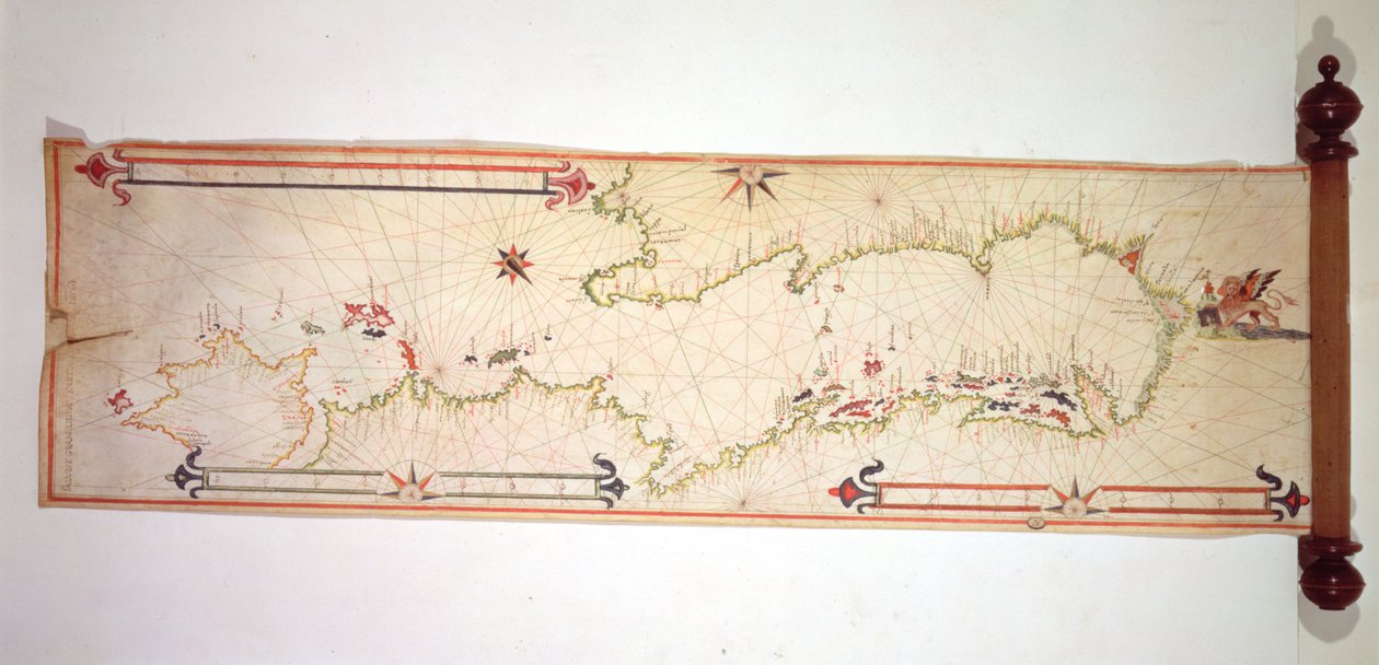
Miniature Nautical Map of the Adriatic, 1624 by Alvise Gramolin

Miniature Nautical Map of the Adriatic, 1624

(Miniature Nautical Map of the Adriatic, 1624 (parchment))


Alvise Gramolin

€ 112.94
Enthält 13.5% MwSt.
   Configure art print
1624  ·  parchment  ·  Picture ID: 361552

Nonclassified artists  ·  Cartography

Miniature Nautical Map of the Adriatic, 1624 by Alvise Gramolin. Available as an art print on canvas, photo paper, watercolor board, uncoated paper or Japanese paper.
cartography · lion of venice · Museo Correr, Venice, Italy / Bridgeman Images
AR/3D   View in 3D / AR zu Favoriten hinzufügen   Add to favorites    Select wall color    View painting in a room
0 Reviews

Configure art print

Picture Frame

Medium & Stretcher

Glass & Passepartout

Miscellaneous & Extras

 Save / compare configuration
Preview Icon

Summary

Gemälde
Veredelung
Keilrahmen
Museumslizenz

€ 112.94
(inkl. 20% MwSt)
   Add to cart

Bildschärfe: PERFEKT

Should you desire adjustments to brightness and color, or a custom crop of the motif, we are happy to make these changes at no additional cost to you. Please do not hesitate to contact us.

Similar artworks selected for you

Adriatic chart Mediterranean and Black Seas 1546 Outline of the Island of St. John of Puerto Rico This Type of Early Vellum Sea Chart Originated in the Mediterranean in the 13th Century Italy, Greece and the Cyclades (detail) Chart of Mediterranean, Black and Caspian Seas, c.1620 World Planisphere Map of the Islands of Java; Madura; Bali and other islands The Aegean Sea, from a Nautical Atlas, 1651 This Type of Early Vellum Sea Chart Originated in the Mediterranean in the 13th Century Greek Archipelago, c.1620 Chart of the Eastern Mediterranean, c.1600 The Pacific Ocean, from an Atlas of the World in 33 Maps, Venice, 1st September 1553 Provence and Italy (detail) Chart of the Mediterranean, Showing Italy and the North African Coast Chart of southern Mediterranean and Adriatic The Peloponnese, from portolan atlas consisting of six charts, Parchment. 1646 Add. 21592, f.1r Map of Europe and Asia. Portolano, in twenty-one maps, of countries in both hemispheres Map of the Mediterranean, 1625 Isles of Scilly The Island of Crete, from a Nautical Atlas, 1651 (Detail) Western Coast of Europe and Northwest Africa Map of the Mediterranean Sea, the Black Sea, and the Northeast Atlantic Ocean Map of Formosa (Taiwan) The Mediterranean, Black Sea and North East Atlantic, c.1550 Molucca (Maluku) Islands, E. Indies, Indonesia Sea chart of the north coast of Ireland, c.1600 Miniature Nautical Map of the Central Mediterranean, 1560 Map showing Bouro and Ceram (Seram), Indonesia
Show more similar artworks

Other motives from the category Cartography

Historical Map of Berlin, Published by Verlag von Gebrueder Rocca, Berlin 1838 Map of the Battle of Stockach, published by William Blackwood and Sons, Edinburgh and London, 1848 Northern Europe, from an Atlas of the World in 33 maps, Venice, 1st September 1553 (ink on vellum) Map of the Proposed Route to China from British Burmah Map of Flanders at the Time of the Thirty Years War (1618-48), from Map of The Moluccan Island, Engraved by Jodocus Hondius, 1630 Map of the City of Ancient Rome During Its Greatness, BC 30-AD 400 Renaissance map of Europe, Jacopo Russo (after) 1528 Map of London showing the Birmingham, Bristol, Thames Junction railway, 1839 Map of Florida, Canada and Labrador (from Map of Europe, Published in 1700, Paris Map of French Possessions and Spheres of Influence in Africa and a View of the River Senegal, Cover of a School Exercise Book Town Map of Constantinople, Turkey, c.1650 Patagonia, from a Series of World Maps published by John Tallis und Co., New York and London, 1850s Partial Map of the Middle East in the 1890s, from
View More from "Cartography"

Excerpt from our top sellers

The Palace of the Queen of the Night, Set Design for Landscape on Saint-Martin Island Coffee Garden at Ammersee The Tree of Crows The Stadtbahn Pavilion of the Vienna Underground Railway, Design Showing the Exterior and a View of the Railway Platform, c.1894-97 Vertumnus Man and Woman, Embrace Alpine Hut in Rainy Weather Lady in Yellow A Moonlit Lane. Two Lovers at a Gate Fishing Boats on the Beach at Les Saintes-Maries-de-la-Mer The Dream The Resurrection Emilie Floege The Japanese Footbridge and the Water Lily Pool, Giverny
Show More Artworks


What our customers think about us


Frequently Asked Questions about Meisterdrucke


Personalizing your art print at Meisterdrucke is a simple and intuitive process that allows you to design an artwork exactly to your specifications: Choose a frame, determine the image size, decide on a printing medium, and add suitable glazing or a stretcher frame. We also offer customization options such as mats, fillets, and spacers. Our customer service is available to help you design your perfect artwork.

At Meisterdrucke, you have the fascinating option to visualize the artwork you configured directly in your own space. For a tailored preview, simply upload a photo of your room and let the artwork appear on it. If you visit us via a mobile device, be it a phone or tablet, our augmented reality feature brings the image to life and seamlessly projects it into your space. An experience that uniquely combines art and technology.

Choosing the medium is often a matter of personal taste. To give you a clearer idea, we have provided some images for each medium. For a holistic experience, we also offer you a sample set of all paper variants so you can make a decision not just visually but also haptically. You can take advantage of the sample set free of charge – only the shipping costs will apply. You can order the sample set directly.

Do not worry. At Meisterdrucke, we do not proceed mechanically. We manually review each order. If there are any inconsistencies or peculiarities in the configuration, we will immediately contact you. Of course, our courteous and patient support is always at your side to assist you with the configuration. Together with you, we adjust your image by phone or email so that the final result exactly meets your expectations.


Do you have any questions?

Are you interested in an art print from our manufactory but still unsure? Do you need advice on choosing the medium or help with the order?

Our experts are happy to assist you.

+43 4257 29415
support@meisterdrucke.com
Mo-Do: 7:00 - 16:00 | Fr: 7:00 - 13:00

Do you have any questions?

Are you interested in an art print from our manufactory but still unsure? Do you need advice on choosing the medium or help with the order?

Our experts are happy to assist you.

+43 4257 29415
support@meisterdrucke.com
Mo-Do: 7:00 - 16:00 | Fr: 7:00 - 13:00


Meisterdrucke

   Kärntner Strasse 46
        9586 Finkenstein am Faaker See
        Austria
        +43 4257 29415
        support@meisterdrucke.com
Other languages

                   
Erfahrungen & Bewertungen zu Meisterdrucke
Post.at DHL Express Quehenberger Cargoboard
Kaiser Franz Joseph

Meisterdrucke
Kärntner Strasse 46
9586 Finkenstein am Faaker See · Austria
+43 4257 29415 · office@meisterdrucke.com
Post.at DHL Express Quehenberger Cargoboard


Meisterdrucke 2707 Bewertungen auf ProvenExpert.com

(c) 2025 meisterdrucke.ie