support@meisterdrucke.com  ·  0043 4257 29415

Deutsch English Italiano Español Français Nederlands Português Svenska Polski Dansk
Search by artist, work title or style – e.g. Monet, Starry Night, Impressionism, Hokusai wave, nude. Describe the scene – e.g. green meadow, abstract with lots of red, dark oil painting, standing nude next to a tree.

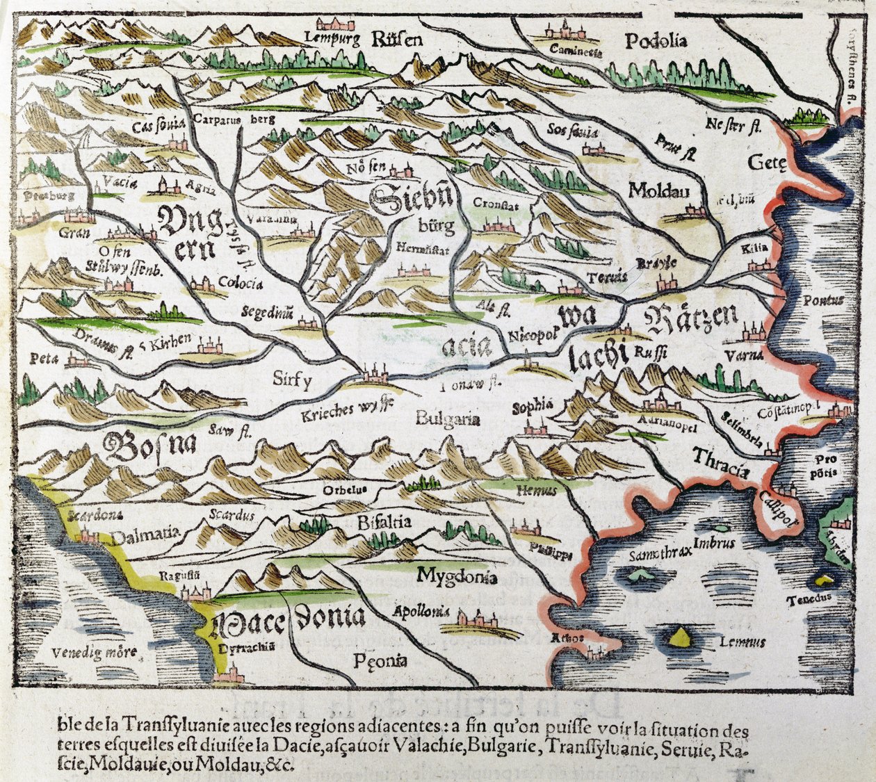
Map of Central Europe, from 'Cosmographia Universalis', published in 1555 by Sebastian Munster

Map of Central Europe, from 'Cosmographia Universalis', published in 1555

(Map of Central Europe, from 'Cosmographia Universalis', published in 1555 (colour woodcut))


Sebastian Munster

€ 126.23
Includes 13.5% VAT
   Configure art print
1555  ·  colour woodcut  ·  Image ID: 262783

Nonclassified artists  ·  Cartography

Map of Central Europe, from 'Cosmographia Universalis', published in 1555 by Sebastian Munster. Available as an art print on canvas, photo paper, watercolor board, natural paper, or Japanese paper.
carte de l' · europe centrale · hungary · transylvania · moldavia · bosnia · macedonia · bulgaria · european · eastern · Private Collection / Bridgeman Images
Other color versions of this image  
AR/3D   View in 3D / AR zu Favoriten hinzufügen   Add to favorites    Change wall color    View picture in a room
0 Reviews

Configure art print

Picture Frame

Medium & Stretcher

Glass & Passepartout

Miscellaneous & Extras

 Save / compare configuration
Preview Icon

Summary

Gemälde
Veredelung
Keilrahmen
Museumslizenz

€ 126.23
(inkl. 20% MwSt)
   Add to cart

Bildschärfe: PERFEKT

If you'd like us to adjust the brightness, colors, or crop the image, we're happy to do this for you at no extra cost. Just get in touch!

Similar artworks selected for you

Typus Vindeliciae Ssive Utriusque Bavariae: Secundum Antiquam & Recentiorum Situm, ab Joanne Aventino Olim Descriptus... Geography Map of the Territory of Bavaria in Germany from Italy, Austria, Slovenia, north Croatia, center-north Bosnia and Herzegovina Map of Friuli Venezia Giulia Region, from Theatrum Orbis Terrarum by Abraham Ortelius Schlavoniae, Croatiae, Carniae, Istriae, Bosniae, Finitimarumque Regionum Nova Descriptio, Auctore Augustino Hirsuogelio Geography Map of the Territories of Slavonia, Croatia, Bosnia and Dalmatia from Geography map of the territory of Bohemia from Map of Central and Northern Europe Detail of Roman Gaul from the Peutinger map copy Picardy, Nord-Pas de Calais, France Map of Lazio Region, from Theatrum Orbis Terrarum Map of Bavaria, Germany, from Theatrum Orbis Terrarum by Abraham Ortelius State: Bavaria, Germany Map of Hungary and Balkans 1683 Map of the City of Jerusalem, from “Peregrinatio in Terram Sanctam” by Bernhard von Breydenbach (1440-97) Geography Map of Baden-Wuerttemberg Territory of Germany Taken from Theatrum Orbis Terrarum by Abraham Ortelius Germany, Austria La Gaule, its rivers and mountains - in Map of Russia From: Rerum Moscoviticarum commentarii Romania Map of Wurttemberg, from Theatrum Orbis Terrarum by Abraham Ortelius Geography map of the Loire territory with the castles and towns bordering the river (Beaumont, Aigueperse, Clermont and Montferan, Beauregard, Cignac, Montaigu, Puy Guillaume) taken from Silesia Typus Descriptio and Descriptus et Editus Martino Heilwid Neilsense, and Nobili Viro Nicolao Rhedinger Dedicatus Anno 1561 Geography Map of the Territory South of Frankfurt in Germany near Poland from Map of Salzburg diocese, Austria, from Theatrum Orbis Terrarum Eastern Part of the Canton of Bern. No. 395. Engraving, ca. 1 Map of the Region of Piedmont, Italy, from Theatrum Orbis Terrarum Nord-Pas de Calais, France Theatrum Orbis Terrarum, 1570. Map of Western Andalusia by Abraham Ortelius and Jeronimo de Chaves France, Switzerland, Italy Northern Italy (engraving)
Show more similar artworks

Similar artworks selected for you

Typus Vindeliciae Ssive Utriusque Bavariae: Secundum Antiquam & Recentiorum Situm, ab Joanne Aventino Olim Descriptus... Geography Map of the Territory of Bavaria in Germany from Italy, Austria, Slovenia, north Croatia, center-north Bosnia and Herzegovina Map of Friuli Venezia Giulia Region, from Theatrum Orbis Terrarum by Abraham Ortelius Schlavoniae, Croatiae, Carniae, Istriae, Bosniae, Finitimarumque Regionum Nova Descriptio, Auctore Augustino Hirsuogelio Geography Map of the Territories of Slavonia, Croatia, Bosnia and Dalmatia from Geography map of the territory of Bohemia from Map of Central and Northern Europe Detail of Roman Gaul from the Peutinger map copy Picardy, Nord-Pas de Calais, France Map of Lazio Region, from Theatrum Orbis Terrarum Map of Bavaria, Germany, from Theatrum Orbis Terrarum by Abraham Ortelius State: Bavaria, Germany Map of Hungary and Balkans 1683 Map of the City of Jerusalem, from “Peregrinatio in Terram Sanctam” by Bernhard von Breydenbach (1440-97) Geography Map of Baden-Wuerttemberg Territory of Germany Taken from Theatrum Orbis Terrarum by Abraham Ortelius Germany, Austria La Gaule, its rivers and mountains - in Map of Russia From: Rerum Moscoviticarum commentarii Romania Map of Wurttemberg, from Theatrum Orbis Terrarum by Abraham Ortelius Geography map of the Loire territory with the castles and towns bordering the river (Beaumont, Aigueperse, Clermont and Montferan, Beauregard, Cignac, Montaigu, Puy Guillaume) taken from Silesia Typus Descriptio and Descriptus et Editus Martino Heilwid Neilsense, and Nobili Viro Nicolao Rhedinger Dedicatus Anno 1561 Geography Map of the Territory South of Frankfurt in Germany near Poland from Map of Salzburg diocese, Austria, from Theatrum Orbis Terrarum Eastern Part of the Canton of Bern. No. 395. Engraving, ca. 1 Map of the Region of Piedmont, Italy, from Theatrum Orbis Terrarum Nord-Pas de Calais, France Theatrum Orbis Terrarum, 1570. Map of Western Andalusia by Abraham Ortelius and Jeronimo de Chaves France, Switzerland, Italy Northern Italy (engraving)
Show more similar artworks

More art prints by Sebastian Munster

Europa regina, Queen Europe, from the Cosmographia, 1570 Monstrous Whale Devouring Humans, from the 1550 Edition of Cosmographia by Sebastian Münster Sea and terrestrial monsters, illustration from Cosmographia Universalis by Sebastian Munster (1489-1552) 1537 Map of the World by Sebastian Munster Riga from the Cosmographia Detailed view of Liège with legend Map of Central Europe, from A witch summons a three-headed demon, from the 1550 edition of Title page of Cosmographia, 1544 Map of America showing the Atlantic and Pacific Oceans Plan of Augsburg, from Map of North America, Novae insulae, XVII nova tabula, Sebastian Munster Cosmographia, Fol 608, 1544 Qubilai (Kubilai Khan, First Emperor of the Mongolian Yuan Dynasty) - in Cosmographia, reverse of title page, 1544
Show more works by Sebastian Munster

More art prints by Sebastian Munster

Europa regina, Queen Europe, from the Cosmographia, 1570 Monstrous Whale Devouring Humans, from the 1550 Edition of Cosmographia by Sebastian Münster Sea and terrestrial monsters, illustration from Cosmographia Universalis by Sebastian Munster (1489-1552) 1537 Map of the World by Sebastian Munster Riga from the Cosmographia Detailed view of Liège with legend Map of Central Europe, from A witch summons a three-headed demon, from the 1550 edition of Title page of Cosmographia, 1544 Map of America showing the Atlantic and Pacific Oceans Plan of Augsburg, from Map of North America, Novae insulae, XVII nova tabula, Sebastian Munster Cosmographia, Fol 608, 1544 Qubilai (Kubilai Khan, First Emperor of the Mongolian Yuan Dynasty) - in Cosmographia, reverse of title page, 1544
Show more works by Sebastian Munster

More motifs from the category Cartography

Map of Córdoba, from Civitates Orbis Terrarum by Georg Braun (1541-1622) and Frans Hogenberg (1535-90), c. 1572-1617 Map of the Coast of New England, Observed and Described by Captain John Smith (1580-1631), 1614, from An imaginary map of Czartorysk Double Hemisphere World Map, 1587 Typus Orbis Terrarum, map of the world, from Ortelius Map of the newly discovered Nova Zembla, illustration from Diarium Nauticum, seu vera descriptio trium navigationum admirandarum... by Gerrit de Veer, 1598 Indian Campaign of 1832: Map of the Country, 1832 Improved Map of India, published in London 1820 Map of Persia, from the Theatrum Orbis Terrarum, published by Abraham Ortelius (1527-98), Antwerp, c. 1590 Map of the mouth of the Chicago River, Illinois with the plan of the proposed piers for improving the harbour, 1830 Map of Lübeck and Hamburg, from Map of the Tribe of Asher, 1590 Map of the East Indies, published 1635 in Amsterdam Map of London, 1852 Map of the Battle of Marengo, published by William Blackwood and Sons, Edinburgh and London, 1848
View More from "Cartography"

More motifs from the category Cartography

Map of Córdoba, from Civitates Orbis Terrarum by Georg Braun (1541-1622) and Frans Hogenberg (1535-90), c. 1572-1617 Map of the Coast of New England, Observed and Described by Captain John Smith (1580-1631), 1614, from An imaginary map of Czartorysk Double Hemisphere World Map, 1587 Typus Orbis Terrarum, map of the world, from Ortelius Map of the newly discovered Nova Zembla, illustration from Diarium Nauticum, seu vera descriptio trium navigationum admirandarum... by Gerrit de Veer, 1598 Indian Campaign of 1832: Map of the Country, 1832 Improved Map of India, published in London 1820 Map of Persia, from the Theatrum Orbis Terrarum, published by Abraham Ortelius (1527-98), Antwerp, c. 1590 Map of the mouth of the Chicago River, Illinois with the plan of the proposed piers for improving the harbour, 1830 Map of Lübeck and Hamburg, from Map of the Tribe of Asher, 1590 Map of the East Indies, published 1635 in Amsterdam Map of London, 1852 Map of the Battle of Marengo, published by William Blackwood and Sons, Edinburgh and London, 1848
View More from "Cartography"

A selection of our top sellers

View of Arles with Iris Flowers in the Foreground Drifting Clouds The Tortoise Trainer The Sun Fast Sinks in the West Small Rhythmic Landscape The Temptation of St. Anthony, right-hand panel, detail of a couple riding a fish The Magic Circle Boreas, 1903 Isle of the Dead, 1883 Poppies The Geneva Window, eight panels depicting scenes from early Irish literature, 1929 Hypnosis Autumn Sun and Trees Ploughing in Nivernais, 1849 Woman Artist - Marcella
Show more artworks

A selection of our top sellers

View of Arles with Iris Flowers in the Foreground Drifting Clouds The Tortoise Trainer The Sun Fast Sinks in the West Small Rhythmic Landscape The Temptation of St. Anthony, right-hand panel, detail of a couple riding a fish The Magic Circle Boreas, 1903 Isle of the Dead, 1883 Poppies The Geneva Window, eight panels depicting scenes from early Irish literature, 1929 Hypnosis Autumn Sun and Trees Ploughing in Nivernais, 1849 Woman Artist - Marcella
Show more artworks


What our customers think about us


Frequently Asked Questions about Meisterdrucke


Personalizing your art print at Meisterdrucke is simple and intuitive: Choose a frame, set the image size, pick a printing medium, and add suitable glazing or a stretcher frame. We also offer additional customization options like mats, fillets, and spacers. If you have any questions, our customer service team is ready to help you create your perfect artwork.

At Meisterdrucke, you can visualize your configured artwork directly in your own room. Simply upload a photo of your space and see how the artwork looks in it. If you're visiting us on a mobile device — phone or tablet — our augmented reality feature brings the picture to life and projects it right into your room. A unique experience that combines art and technology.

Choosing the right medium is often a matter of personal taste. To give you a better idea, we've provided some images for each medium. We also offer a sample set of all paper variants, so you can decide not just visually but by touch as well. You can order the sample set free of charge — only shipping costs apply.

Don't worry! At Meisterdrucke, we don't just process orders mechanically. Every order is manually reviewed by our team. If we spot any inconsistencies or issues with your configuration, we'll get in touch with you right away. And of course, our friendly and patient support team is always here to help you with your configuration. We'll work with you by phone or email to adjust your image so the final result is exactly what you had in mind.


Still have questions?

Are you interested in an art print from our manufactory but still unsure? Do you need advice on choosing the medium or help with the order?

Our experts are happy to assist you.

+43 4257 29415
support@meisterdrucke.com
Mo-Do: 7:00 - 16:00 | Fr: 7:00 - 13:00

Still have questions?

Are you interested in an art print from our manufactory but still unsure? Do you need advice on choosing the medium or help with the order?

Our experts are happy to assist you.

+43 4257 29415
support@meisterdrucke.com
Mo-Do: 7:00 - 16:00 | Fr: 7:00 - 13:00


Meisterdrucke

   Kärntner Strasse 46
        9586 Finkenstein am Faaker See
        Austria
        +43 4257 29415
        support@meisterdrucke.com
Other languages

                   
Erfahrungen & Bewertungen zu Meisterdrucke
Post.at DHL Express Quehenberger Cargoboard
Kaiser Franz Joseph

Meisterdrucke
Kärntner Strasse 46
9586 Finkenstein am Faaker See · Austria
+43 4257 29415 · support@meisterdrucke.com
Post.at DHL Express Quehenberger Cargoboard


(c) 2026 meisterdrucke.ie