Search by artist, work title or style – e.g. Monet, Starry Night, Impressionism, Hokusai wave, nude. Describe the scene – e.g. green meadow, abstract with lots of red, dark oil painting, standing nude next to a tree.

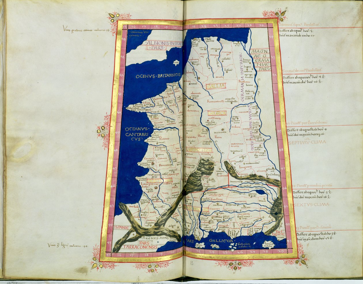
Map of Gaul, Belgium, Lyon and Aquitaine by Ptolemy

Map of Gaul, Belgium, Lyon and Aquitaine

(Ms Lat 463 fol.81v-82r Map of Gaul, Belgium, Lyon and Aquitaine )


Ptolemy

€ 129.74
Enthält 13.5% MwSt.
   Configure art print
Undated  ·  vellum  ·  Picture ID: 52854

Ancient Art  ·  Cartography

Map of Gaul, Belgium, Lyon and Aquitaine by Ptolemy. Available as an art print on canvas, photo paper, watercolor board, uncoated paper or Japanese paper.
world map · gaul · belgium · lyonnaise · gallia · belgica · lugdunensis · aquitannia · france · roman empire · Biblioteca Estense, Modena, Italy / Bridgeman Images
AR/3D   View in 3D / AR zu Favoriten hinzufügen   Add to favorites    Select wall color    View painting in a room
0 Reviews

Configure art print

Picture Frame

Medium & Stretcher

Glass & Passepartout

Miscellaneous & Extras

 Save / compare configuration
Preview Icon

Summary

Gemälde
Veredelung
Keilrahmen
Museumslizenz

€ 129.74
(inkl. 20% MwSt)
   Add to cart

Bildschärfe: PERFEKT

Should you desire adjustments to brightness and color, or a custom crop of the motif, we are happy to make these changes at no additional cost to you. Please do not hesitate to contact us.

Similar artworks selected for you

Map of Phoenicia, Mesopotamia and Babylon Map of Europe, a page from Liber Floridus Ho Lago. 1 of 24 charts of the world including several calendars and tables. Map of the Holy Land, based on descriptions and co-ordinates given in Cosmographica, by Ptolemy (Claudius Ptolemaeus of Alexandria) published in Ulm, Germany, by Johann Reger Map, illustration from "The Liber Insularum Archipelagi" Map of Italy based on Ptolemy Map of the Holy Land The Black Sea, in Scale: [ca. 1:14 500 000]. Additional Places: Persian Gulf, Gulf of Oman., c.1550-60 Ischia, 1642 Southampton, Hampshire: Description of, by J. Norden, with map: 1595 Geographia by Ptolemy Map of Scotland by John Harding, c.1450 Map of the world, from "Insularium Illustratum", by Enrico Martello, being an account of the islands, chiefly of the Mediterranean, Italian, c.1470 Africa - in Map of Sarmatia From: Rudimenta Cosmographica Map of Lower Egypt, from the Notebook of Sir Walter Raleigh, c.1606-08 Plan of Hormuz, from the Portuguese manuscript, the Livro do Estado da India Oriental of Pedro Barreto de Resende Map of the City of Jerusalem, from Itinerary Map Showing the Route Between London and Naples, from Matthew Paris Province of Munster, Ireland, c.1595 Map of North Africa, from a notebook comprising an historical gazetteer, library-lists, etc.; c.1606-08 Portuguese illustration of Goa, from the manuscript Livro do Estado da India Oriental of Pedro Barreto de Resende, Sloane MS 197 Catalan Atlas, Sheet 7 and 8 Pocket atlas and nautical almanac Map of Africa and the Cape of Good Hope, from the Map of England and Wales, from the Illustration from the Western Mediterranean, bound in an atlas of twenty-five charts with diagrams and tables
Show more similar artworks

Other art prints by Ptolemy

Map of the known world, from Map of the world, based on descriptions and co-ordinates given in Map of North Africa and West Africa, published in Strasbourg in 1522 Map of Africa, Plate 18 from an Atlas of the World, 1486 Map of Phoenicia, Mesopotamia and Babylon Map Depicting the North of Africa, from an Atlas by Ptolemy, 1st Half 16th Century Map of Central Europe (detail) Map of Spain and Portugal, from Map of the British Isles, from Ulm Ptolemy World Map Map of Southern Africa (published in Strasbourg in 1522) Map of the World, Based on Descriptions and Coordinates Given in Map of France, from Map of Arabia, the Persian Gulf and the Indian Sea Map of the World, 1486
Discover more works by Ptolemy

Other motives from the category Cartography

Map of Western Europe, from Miniature Nautical Map of the Central Mediterranean, 1560 Map of Rotterdam and Gouda, from Map of Great Britain, France and Spain Ethiopia, the Red Sea and Saudi Arabia, from an Atlas of the World in 33 Maps, Venice, 1st September 1553 (Detail) Susquehannock Warrior (detail) Map of Central Europe, from Drawing for the map of the moon Australia, from a Series of World Maps Published by John Tallis and Co., London and New York, 1850s General Map Including Arabia, Japan, the Korean Peninsula and the Greater Part of the Indonesian Archipelago, 1631 Map of the Battle of the Nile, published by William Blackwood and Sons, Edinburgh and London, 1848 Map of Ancient Egypt, drawn and engraved by Sydney Hall, c.1826 Map of Turkey, Arabia and Persia, after Guillaume de L Map of Flanders at the Time of the Thirty Years War (1618-48), from Map of the Moon, Illustration from Sidereus Nuncius by Galileo Galilei, 1610
View More from "Cartography"

Excerpt from our top sellers

The Sin The Artist The Chocolate Girl (La Belle Chocolatière de Vienne) Self-Portrait as the Allegory of Painting Cotopaxi The young Napoleon Bonaparte studying Lensing Galaxy Cluster (Webb Danaë In Bed: The Kiss Krumau Alpine Hut in Rainy Weather Summer Irises Painting from the Tomb of the Diver from the Southern Cemetery at Paestum, 480-470 BC Orchard with Roses
Show More Artworks


What our customers think about us


Frequently Asked Questions about Meisterdrucke


Personalizing your art print at Meisterdrucke is a simple and intuitive process that allows you to design an artwork exactly to your specifications: Choose a frame, determine the image size, decide on a printing medium, and add suitable glazing or a stretcher frame. We also offer customization options such as mats, fillets, and spacers. Our customer service is available to help you design your perfect artwork.

At Meisterdrucke, you have the fascinating option to visualize the artwork you configured directly in your own space. For a tailored preview, simply upload a photo of your room and let the artwork appear on it. If you visit us via a mobile device, be it a phone or tablet, our augmented reality feature brings the image to life and seamlessly projects it into your space. An experience that uniquely combines art and technology.

Choosing the medium is often a matter of personal taste. To give you a clearer idea, we have provided some images for each medium. For a holistic experience, we also offer you a sample set of all paper variants so you can make a decision not just visually but also haptically. You can take advantage of the sample set free of charge – only the shipping costs will apply. You can order the sample set directly.

Do not worry. At Meisterdrucke, we do not proceed mechanically. We manually review each order. If there are any inconsistencies or peculiarities in the configuration, we will immediately contact you. Of course, our courteous and patient support is always at your side to assist you with the configuration. Together with you, we adjust your image by phone or email so that the final result exactly meets your expectations.


Do you have any questions?

Are you interested in an art print from our manufactory but still unsure? Do you need advice on choosing the medium or help with the order?

Our experts are happy to assist you.

+43 4257 29415
support@meisterdrucke.com
Mo-Do: 7:00 - 16:00 | Fr: 7:00 - 13:00

Do you have any questions?

Are you interested in an art print from our manufactory but still unsure? Do you need advice on choosing the medium or help with the order?

Our experts are happy to assist you.

+43 4257 29415
support@meisterdrucke.com
Mo-Do: 7:00 - 16:00 | Fr: 7:00 - 13:00


Meisterdrucke

   Kärntner Strasse 46
        9586 Finkenstein am Faaker See
        Austria
        +43 4257 29415
        support@meisterdrucke.com
Other languages

                   
Erfahrungen & Bewertungen zu Meisterdrucke
Post.at DHL Express Quehenberger Cargoboard
Kaiser Franz Joseph

Meisterdrucke
Kärntner Strasse 46
9586 Finkenstein am Faaker See · Austria
+43 4257 29415 · office@meisterdrucke.com
Post.at DHL Express Quehenberger Cargoboard


Meisterdrucke 2745 Bewertungen auf ProvenExpert.com

(c) 2025 meisterdrucke.ie