Map of Epirus for

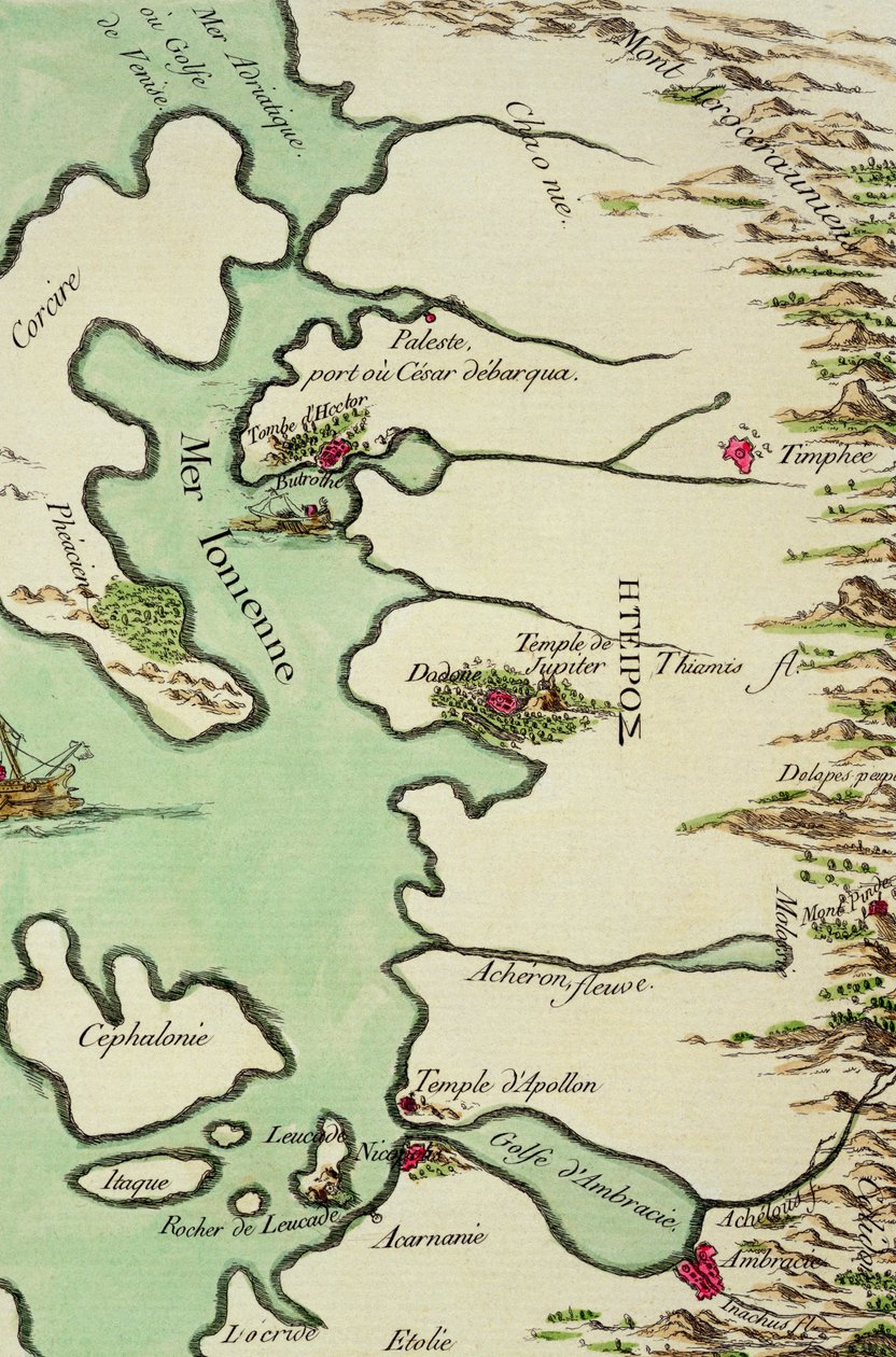
Map of Epirus for 'Andromache' by Jean Racine, from Volume I of 'Research on the Costumes and Theatre of All Nations'

(Map of Epirus for 'Andromache' by Jean Racine, from Volume I of 'Research on the Costumes and Theatre of All Nations', 1802 )


Philippe Chery

€ 145.5
Enthält 13.5% MwSt.
   Configure art print
1802  ·  coloured engraving  ·  Picture ID: 303450

Genre painting  ·  Cartography

Map of Epirus for 'Andromache' by Jean Racine, from Volume I of 'Research on the Costumes and Theatre of All Nations' by Philippe Chery. Available as an art print on canvas, photo paper, watercolor board, uncoated paper or Japanese paper.
print · ancient · andromaque · coast · mountains · tomb of hector · ionian sea · Private Collection / Bridgeman Images
AR/3D   View in 3D / AR zu Favoriten hinzufügen   Add to favorites    Select wall color    View painting in a room
0 Reviews

Configure art print

Picture Frame

Medium & Stretcher

Glass & Passepartout

Miscellaneous & Extras

 Save / compare configuration
Preview Icon

Summary

Gemälde
Veredelung
Keilrahmen
Museumslizenz

€ 145.5
(inkl. 20% MwSt)
   Add to cart

Bildschärfe: PERFEKT

Should you desire adjustments to brightness and color, or a custom crop of the motif, we are happy to make these changes at no additional cost to you. Please do not hesitate to contact us.

Similar artworks selected for you

Map of Central America in the 16th Century Map of Central America. 16th century. The Gulf of Benin, part of the Gulf of Guinea, based on a map of Urbano Monte The Plantation of Ulster Island of Cuba, Florida and Gulf of Mexico, engraving from Portland Bill to Portsmouth: The Pursuit of the Spanish Armada by the English Fleet Detail of Heligoland from a map of Denmark, 1730 Plan Showing the Strait of Constantinople (now the Strait of Bosphorus) - in Map of North Africa and West Africa, published in Strasbourg in 1522 Theatrum Orbis Terrarum Harbor of Palos, by Abraham Ortelius (1528-1598), Plate South Part of New England as it is Planted this Year 1634 The Pillars of Hercules Map of the Sea of Maluku, from the Cosmographie Universelle Map of the Island of Martinique, 1599 A Chart of Khios and Adjacent Mainland, c.1420 Historical Geographical Map of Palestine According to the Atlas of Abraham Ortelius, Amsterdam Map of the Coast of Africa and the River Gambia Donegal and Sligo Bays, Ireland, c.1600 S. Phelipe de Porto Bello Map of the Dardanelles, First World War, 1915, c1920 Ireland Just So Stories by Rudyard Kipling Roy Military Survey of Scotland Map of the bay and city of S. Phelipe de Portobelo Turtle Island and Santo Domingo from a 17th century map by Pierre Vandier The New Islands, Behind Spain Towards the Orient by the Land of India Map Depicting the North of Africa, from an Atlas by Ptolemy, 1st Half 16th Century Schleswig-Holstein, Germany
Show more similar artworks

Other art prints by Philippe Chery

Agamemnon, Costume for Map of Epirus for Titus, Costume for Orestes, costume for Hermione, costume for Antiochus, costume for Thamar, an Israelite in the Retinue of Esther, costume for Achilles in Armour, costume for Pyrrhus, costume for Nero, Costume for Chorus of Israelite Women, costumes for Lictors and Soldiers from the Retinue of Titus, costumes for Andromache, costume for Mademoiselle George, 1825 Soldiers of the Praetorian Guard, costumes for
Discover more works by Philippe Chery

Other motives from the category Cartography

Map of Greece, Hungary and Their Surrounding Countries World Map; Vera Totius Expeditionis Nauticae, charting the circumnavigation of the globe by Sir Francis Drake and Thomas Cavendish c.1595 Mappa Mundi, c.1290 A New and Accurate Map of the World Map of the Austro-Hungarian empire, illustration from a French geography school textbook, 1905 A Map of Chelsea, 1746 Map of Surrey, described and divided into hundreds Map of the Paris to St. Germain Railway, by A.M. Perrot Sketch Map of London showing the position of the London, Chatham and Dover Railway Renaissance map of Europe, Jacopo Russo (after) 1528 Map of the Siege of St. Jean d Map of Bergen, from Map of Asia, Tartaria, Japan, the Philippines and the East Indies, engraved by G. van Gouwen, c.1690 Map of the Suez Canal, c.1870 Map of Walbrook Ward and Dowgate Ward, London
View More from "Cartography"

Excerpt from our top sellers

Tiger Four Foxes Fishermen at Sea Newt Pond Lady in Yellow Impression, Sunrise The Birth of Venus (edited) Princess Tuvstarr is Still Sitting There Wistfully Looking into the Water, 1913 Vampire Boys Bathing The Plague Comes Woman with a Veil Oak Grove Ice at Bennecourt Lake Geneva with Mont-Blanc in Morning Red
Show More Artworks


What our customers think about us


Frequently Asked Questions about Meisterdrucke


Personalizing your art print at Meisterdrucke is a simple and intuitive process that allows you to design an artwork exactly to your specifications: Choose a frame, determine the image size, decide on a printing medium, and add suitable glazing or a stretcher frame. We also offer customization options such as mats, fillets, and spacers. Our customer service is available to help you design your perfect artwork.

At Meisterdrucke, you have the fascinating option to visualize the artwork you configured directly in your own space. For a tailored preview, simply upload a photo of your room and let the artwork appear on it. If you visit us via a mobile device, be it a phone or tablet, our augmented reality feature brings the image to life and seamlessly projects it into your space. An experience that uniquely combines art and technology.

Choosing the medium is often a matter of personal taste. To give you a clearer idea, we have provided some images for each medium. For a holistic experience, we also offer you a sample set of all paper variants so you can make a decision not just visually but also haptically. You can take advantage of the sample set free of charge – only the shipping costs will apply. You can order the sample set directly.

Do not worry. At Meisterdrucke, we do not proceed mechanically. We manually review each order. If there are any inconsistencies or peculiarities in the configuration, we will immediately contact you. Of course, our courteous and patient support is always at your side to assist you with the configuration. Together with you, we adjust your image by phone or email so that the final result exactly meets your expectations.


Do you have any questions?

Are you interested in an art print from our manufactory but still unsure? Do you need advice on choosing the medium or help with the order?

Our experts are happy to assist you.

+43 4257 29415
support@meisterdrucke.com
Mo-Do: 7:00 - 16:00 | Fr: 7:00 - 13:00

Do you have any questions?

Are you interested in an art print from our manufactory but still unsure? Do you need advice on choosing the medium or help with the order?

Our experts are happy to assist you.

+43 4257 29415
support@meisterdrucke.com
Mo-Do: 7:00 - 16:00 | Fr: 7:00 - 13:00


Meisterdrucke

   Kärntner Strasse 46
        9586 Finkenstein am Faaker See
        Austria
        +43 4257 29415
        support@meisterdrucke.com
Other languages

                   
Erfahrungen & Bewertungen zu Meisterdrucke
Post.at DHL Express Quehenberger Cargoboard
Kaiser Franz Joseph

Meisterdrucke
Kärntner Strasse 46
9586 Finkenstein am Faaker See · Austria
+43 4257 29415 · office@meisterdrucke.com
Post.at DHL Express Quehenberger Cargoboard


Meisterdrucke 2717 Bewertungen auf ProvenExpert.com

(c) 2025 meisterdrucke.ie