support@meisterdrucke.com  ·  0043 4257 29415

Deutsch English Italiano Español Français Nederlands Português Svenska Polski Dansk
Search by artist, work title or style – e.g. Monet, Starry Night, Impressionism, Hokusai wave, nude. Describe the scene – e.g. green meadow, abstract with lots of red, dark oil painting, standing nude next to a tree.

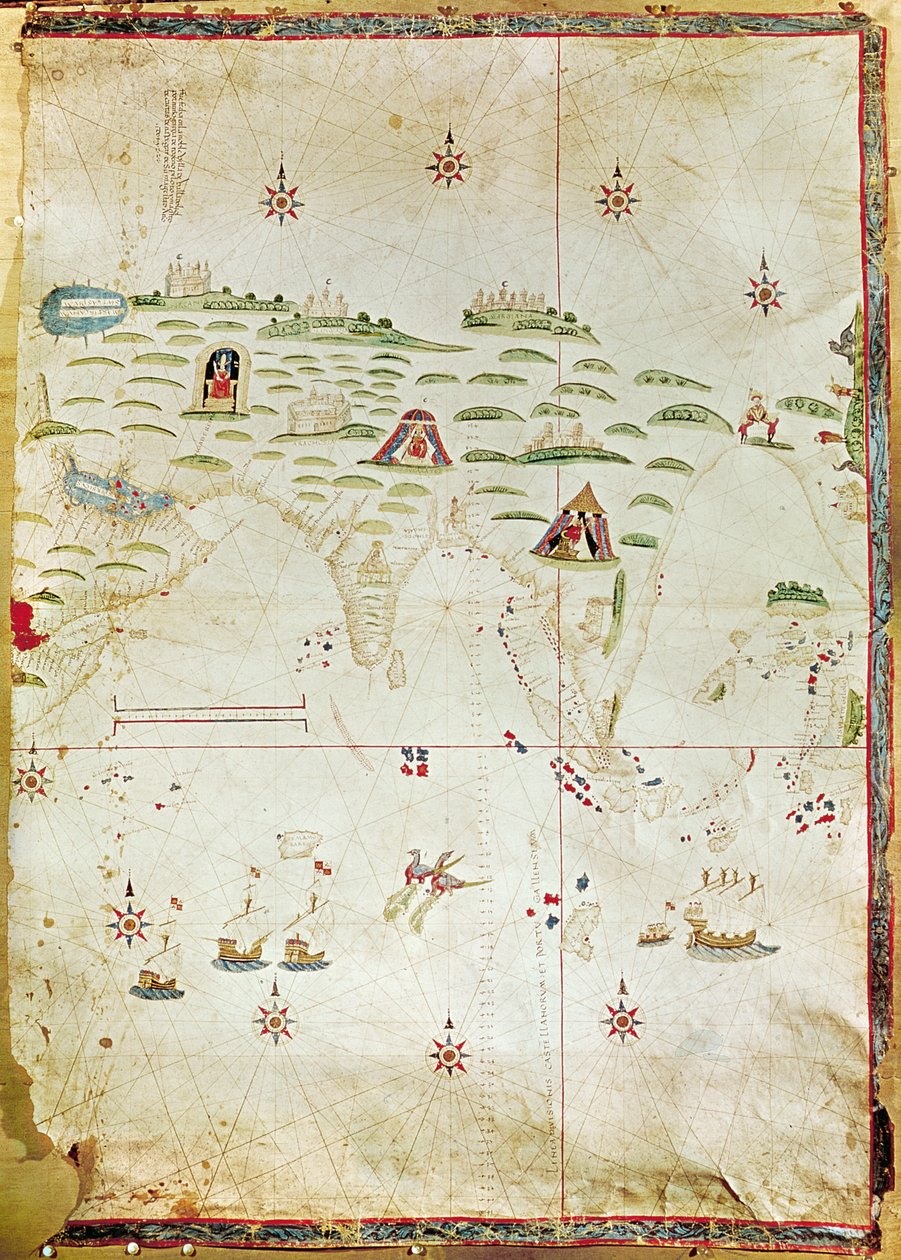
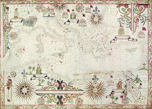
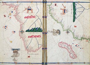
Map of the Moluccas, 1522 by Nuno Garcia de Toreno

Map of the Moluccas, 1522

(Map of the Moluccas, 1522 (manuscript on vellum))


Nuno Garcia de Toreno

€ 148.49
Includes 13.5% VAT
   Configure art print
1522  ·  manuscript on vellum  ·  Image ID: 104412

Nonclassified artists  ·  Cartography

Map of the Moluccas, 1522 by Nuno Garcia de Toreno. Available as an art print on canvas, photo paper, watercolor board, natural paper, or Japanese paper.
Biblioteca Reale, Turin, Italy / Bridgeman Images
AR/3D   View in 3D / AR zu Favoriten hinzufügen   Add to favorites    Change wall color    View picture in a room

Note: Only reviews with comments are displayed. Reviews can be submitted directly after purchase in your customer account.

Configure art print

Picture Frame

Medium & Stretcher

Glass & Passepartout

Miscellaneous & Extras

 Save / compare configuration
Preview Icon

Summary

Gemälde
Veredelung
Keilrahmen
Museumslizenz

€ 148.49
(inkl. 20% MwSt)
   Add to cart

Bildschärfe: PERFEKT

If you'd like us to adjust the brightness, colors, or crop the image, we're happy to do this for you at no extra cost. Just get in touch!

Similar artworks selected for you

Chart of Arabia and the Eastern Mediterranean, Part of a Portolan Atlas, c.1650 A Mediterranean Chart Showing the North East Atlantic Mediterranean Sea, from portolan atlas of six charts, by Placido Caloiro and Francesco Oliva, 1646 The Mediterranean, Black Sea and North East Atlantic, c.1550 Map of the Mediterranean, 1625 Europe, from a 19th-century copy of the nautical planisphere by Juan de la Cosa Marine chart of the Mediterranean Sea and the Black Sea Nautical chart of the Mediterranean Sea and the Black Sea, 1440s Nautical chart of the Mediterranean Sea and the Black Sea The Atlantic coasts of Europe and the Western Mediterranean, from a nautical atlas Detail of Africa and the Mediterranean Basin, by Juan de la Cosa, marine chart Add. 31318 B Map of Europe, Asia Minor, and Africa, as far south as Cape Rosso, vellum The entire Mediterranean Basin, from a nautical chart A Portolan Chart of the Atlantic Ocean and Adjacent Continents Portolan Chart North Africa, from a nautical atlas, 1520 (detail) Portulan chart of Mediterranean Sea and NE Atlantic The Mediterranean Basin, from a nautical atlas, 1646 Coasts of Europe and North Africa Fol. 5v Map of Great Britain, Europe and North West Africa, from Portugaliae Monumenta Cartographica, an account of the discoveries of Fernão Gomes from 1470-75, 1563 Portolan of the West Coast of Africa with the Canary Islands. Geographic map by the Portuguese Luis Lazare (16th century) Aegean Sea, from Portolan Atlas Consisting of Six Charts Copy of Catalan Map of Europe, North Africa and the Middle East A Nautical Map, detail of Western Europe, 1564 Guillmus Soleri civis maioricaru me fecit Ms. Ital. 550.0.3.15, fol. 4v-5r, Map of Africa and the Cape of Good Hope, from the Nautical Chart of Mediterranean Area, Including Europe with British Isles and Part of Scandinavia A Nautical Map, detail of the Gran Turco, 1564 A Nautical Map, 1564
Show more similar artworks

More motifs from the category Cartography

The Middle East, from an Atlas of the World in 33 Maps, Venice, 1st September 1553 Map of Bremen, from Map of the Magellan Straits, Patagonia, from the Mercator Atlas published by Jodocus Hondius (1563-1612), Amsterdam, 1606 Map of the City of Florence Map of Paris and its Surroundings, from Map of the Caribbean Islands Map of the Christian Constellations as depicted by Julius Schiller, from “The Celestial Atlas, or The Harmony of the Universe” (Atlas coelestis seu harmonia macrocosmica), published by Joannes Janssonius, A Map of Aurelia, from Map of South Africa Illustrating Dr. Livingstone Map of Iceland Map of Spain and Portugal, from “Geographia” Detail of the Right Bank, from the map of Paris c. 1540, known as the Plan de la Tapisserie, made as a tapestry c. 1570, 1818 colour engraving Map of Paris, 1723 Sketch map of Africa, from Map of Paris c.1540, known as the Plan de la Tapisserie, made as a tapestry c.1571, 1818
View More from "Cartography"

A selection of our top sellers

Nighthawks Reclining Nude Woman Reading a Book Psyche entering Cupid The Waterlily Pond, 1904 Dog Garden in Bloom, Arles, July 1888 Boreas, 1903 Self-Portrait with Physalis Bell Rock Lighthouse Poppies The Two Crowns Griffin Facing the Throne, Throne Room, Knossos, Crete 1550-1450 BC Autumn Sun and Trees Girl by a Birch Trunk (also: Girl at a Tree) Angel Traveller
Show more artworks


What our customers think about us


Frequently Asked Questions about Meisterdrucke


Personalizing your art print at Meisterdrucke is simple and intuitive: Choose a frame, set the image size, pick a printing medium, and add suitable glazing or a stretcher frame. We also offer additional customization options like mats, fillets, and spacers. If you have any questions, our customer service team is ready to help you create your perfect artwork.

At Meisterdrucke, you can visualize your configured artwork directly in your own room. Simply upload a photo of your space and see how the artwork looks in it. If you're visiting us on a mobile device — phone or tablet — our augmented reality feature brings the picture to life and projects it right into your room. A unique experience that combines art and technology.

Choosing the right medium is often a matter of personal taste. To give you a better idea, we've provided some images for each medium. We also offer a sample set of all paper variants, so you can decide not just visually but by touch as well. You can order the sample set free of charge — only shipping costs apply.

Don't worry! At Meisterdrucke, we don't just process orders mechanically. Every order is manually reviewed by our team. If we spot any inconsistencies or issues with your configuration, we'll get in touch with you right away. And of course, our friendly and patient support team is always here to help you with your configuration. We'll work with you by phone or email to adjust your image so the final result is exactly what you had in mind.


Still have questions?

Are you interested in an art print from our manufactory but still unsure? Do you need advice on choosing the medium or help with the order?

Our experts are happy to assist you.

+43 4257 29415
support@meisterdrucke.com

Mo-Do: 7:00 - 16:00 | Fr: 7:00 - 13:00

Still have questions?

Are you interested in an art print from our manufactory but still unsure? Do you need advice on choosing the medium or help with the order?

Our experts are happy to assist you.

+43 4257 29415
support@meisterdrucke.com
Mo-Do: 7:00 - 16:00 | Fr: 7:00 - 13:00


Meisterdrucke

   Kärntner Strasse 46
        9586 Finkenstein am Faaker See
        Austria
        +43 4257 29415
        support@meisterdrucke.com
Other languages

                   
Erfahrungen & Bewertungen zu Meisterdrucke
Post.at DHL Express Quehenberger Cargoboard
Kaiser Franz Joseph

Meisterdrucke
Kärntner Strasse 46
9586 Finkenstein am Faaker See · Austria
+43 4257 29415 · support@meisterdrucke.com
Post.at DHL Express Quehenberger Cargoboard


(c) 2026 meisterdrucke.ie