Search by artist, work title or style – e.g. Monet, Starry Night, Impressionism, Hokusai wave, nude. Describe the scene – e.g. green meadow, abstract with lots of red, dark oil painting, standing nude next to a tree.

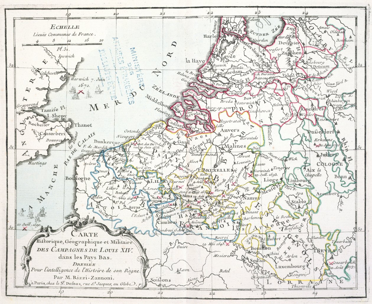
Map Showing the Military Campaigns of Louis XIV in the Low Countries, from Atlas Géographique et Militaire, Published in Paris, 1763 by Giovanni Antonio Rizzi-Zannoni

Map Showing the Military Campaigns of Louis XIV in the Low Countries, from Atlas Géographique et Militaire, Published in Paris, 1763

(Map showing the military campaigns of Louis XIV in the Low Countries, from Atlas géographique et militaire, published in Paris, 1763 (colour engraving))


Giovanni Antonio Rizzi-Zannoni

€ 127.59
Enthält 13.5% MwSt.
   Configure art print
1763  ·  coloured engraving  ·  Picture ID: 365625

Nonclassified artists  ·  Cartography

Map Showing the Military Campaigns of Louis XIV in the Low Countries, from Atlas Géographique et Militaire, Published in Paris, 1763 by Giovanni Antonio Rizzi-Zannoni. Available as an art print on canvas, photo paper, watercolor board, uncoated paper or Japanese paper.
campaign · campaigns · low countries · pays bas · netherlands · louis xiv · france · battles · aggression · military · atlas · Archives du Ministere des Affaires Etrangeres, Paris, France / Bridgeman Images
AR/3D   View in 3D / AR zu Favoriten hinzufügen   Add to favorites    Select wall color    View painting in a room
0 Reviews

Configure art print

Picture Frame

Medium & Stretcher

Glass & Passepartout

Miscellaneous & Extras

 Save / compare configuration
Preview Icon

Summary

Gemälde
Veredelung
Keilrahmen
Museumslizenz

€ 127.59
(inkl. 20% MwSt)
   Add to cart

Bildschärfe: PERFEKT

Should you desire adjustments to brightness and color, or a custom crop of the motif, we are happy to make these changes at no additional cost to you. Please do not hesitate to contact us.

Similar artworks selected for you

Poland (excepted Voivodeships: Lubusz, West Pomeranian, Lower Silesian), Lithuania, Latvia, Estonia, Belarus, Ukraine (Oblast: Chernihiv, Kiev, Zhytomyr, Rivne, Volyn, Vinnytsia, Khmelnytsky, Ternopil, Lviv) Map of West Germany and Netherlands Unknown Map of the Flanders Campaign Between French Army and Austrian Army France (Region: Upper Normandy, Nord-Pas-de-Calais, Champagne-Ardenne, Picardy), Belgium, Netherlands, Germany (State: Lower Saxony, North Rhine-Westphalia, Hesse, Rhineland-Palatinate, Saarland), Luxembourg Extent of the English Conquests in France, AD 1429 Holland Including the Seven United Provinces of the Low Countries, from France (Region: Nord-Pas-de-Calais), large part of Belgium (except south-east), Netherlands (Zeeland, North Brabant) Map of Holland and Belgium Map of Poland and Lithuania Central Europe to Illustrate the Campaigns of Napoleon Map of Germany (1703) Map of the County of Flanders (present-day Western and Eastern Flanders of Belgium) France (Region: Nord-Pas-de-Calais, Picardy, Champagne-Ardenne, Lorraine, Île-de-France), Belgium, Netherlands (Province: Zeeland, North Brabant, Limburg), Germany (State: North Rhine-Westphalia, Rhineland-Palatinate, Saarland), Luxembourg Low Countries Belgium, Netherlands, Germany, Poland (Voivodeship: Pomeranian, West Pomeranian, Lubusz, Lower Silesian, Opolskie, Silesian), Republic Czech, Austria, Slovenia, Italy (Region: Friuli-Venezia Giulia, north Veneto, Trentino-Alto Adige, north Lombardy), Swit France at the Treaty of Bretigni Map of France at the times of King Charles VI Map of France at the times of King Charles VII and after the expulsion of the English between 1422 and 1461 (Plate from Houze Map of Belgium Land Map of the Electorate of Brandenburg with Royal Prussian Privilege Low Countries Map of Germany Gaul divided into Roman provinces - Plate extracted from Holland Map of the Austrian Empire Belgium, Luxembourg The Wiflispurgergow / Gerardo Mercatore Author Map of France, Gallia Antique, from
Show more similar artworks

Other motives from the category Cartography

Map of Luxembourg, from London Underground Map Map of Nouvelle-France (Canada) 1699 Map of Cumberland Map of the world with possessions of the British Empire coloured red, c.1870 Map of Northampton and adjacent counties, from Town Map of Constantinople, Turkey, c.1650 Map of the Holy Land, published in Amsterdam, 1629 Map of East London, plates 20-21, from Map of England and Wales Map of South America Map of Florida Map of Candia and Corfu, from Bologna (detail) Map of Strasbourg, from
View More from "Cartography"

Excerpt from our top sellers

The Origin of the World Alley to the Capponcina Haboku-Sansui The Temptation of St. Anthony, right hand panel, detail of a couple riding a fish View of Vétheuil. 1880 Genealogical Tree of the Rougon-Macquart Family The Chocolate Girl (La Belle Chocolatière de Vienne) Sunlight in the Blue Room View of the Dents-du-Midi from Champéry Yellow Red Blue The Great Piece of Turf Soft Hard Poster for the 14th Exhibition of Vienna Secession, 1902 The School of Athens, from the Stanza della Segnatura The Music
Show More Artworks


What our customers think about us


Frequently Asked Questions about Meisterdrucke


Personalizing your art print at Meisterdrucke is a simple and intuitive process that allows you to design an artwork exactly to your specifications: Choose a frame, determine the image size, decide on a printing medium, and add suitable glazing or a stretcher frame. We also offer customization options such as mats, fillets, and spacers. Our customer service is available to help you design your perfect artwork.

At Meisterdrucke, you have the fascinating option to visualize the artwork you configured directly in your own space. For a tailored preview, simply upload a photo of your room and let the artwork appear on it. If you visit us via a mobile device, be it a phone or tablet, our augmented reality feature brings the image to life and seamlessly projects it into your space. An experience that uniquely combines art and technology.

Choosing the medium is often a matter of personal taste. To give you a clearer idea, we have provided some images for each medium. For a holistic experience, we also offer you a sample set of all paper variants so you can make a decision not just visually but also haptically. You can take advantage of the sample set free of charge – only the shipping costs will apply. You can order the sample set directly.

Do not worry. At Meisterdrucke, we do not proceed mechanically. We manually review each order. If there are any inconsistencies or peculiarities in the configuration, we will immediately contact you. Of course, our courteous and patient support is always at your side to assist you with the configuration. Together with you, we adjust your image by phone or email so that the final result exactly meets your expectations.


Do you have any questions?

Are you interested in an art print from our manufactory but still unsure? Do you need advice on choosing the medium or help with the order?

Our experts are happy to assist you.

+43 4257 29415
support@meisterdrucke.com
Mo-Do: 7:00 - 16:00 | Fr: 7:00 - 13:00

Do you have any questions?

Are you interested in an art print from our manufactory but still unsure? Do you need advice on choosing the medium or help with the order?

Our experts are happy to assist you.

+43 4257 29415
support@meisterdrucke.com
Mo-Do: 7:00 - 16:00 | Fr: 7:00 - 13:00


Meisterdrucke

   Kärntner Strasse 46
        9586 Finkenstein am Faaker See
        Austria
        +43 4257 29415
        support@meisterdrucke.com
Other languages

                   
Erfahrungen & Bewertungen zu Meisterdrucke
Post.at DHL Express Quehenberger Cargoboard
Kaiser Franz Joseph

Meisterdrucke
Kärntner Strasse 46
9586 Finkenstein am Faaker See · Austria
+43 4257 29415 · office@meisterdrucke.com
Post.at DHL Express Quehenberger Cargoboard


Meisterdrucke 2764 Bewertungen auf ProvenExpert.com

(c) 2025 meisterdrucke.ie