Search by artist, work title or style – e.g. Monet, Starry Night, Impressionism, Hokusai wave, nude. Describe the scene – e.g. green meadow, abstract with lots of red, dark oil painting, standing nude next to a tree.

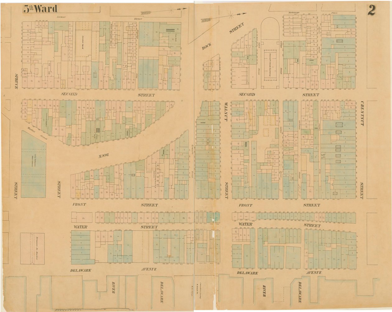
Maps of the City of Philadelphia, Volume 1, Plate 2 by Ernest Hexamer

Maps of the City of Philadelphia, Volume 1, Plate 2

(Maps of the City of Philadelphia, volume 1, plate 2, 1860 (hand-coloured engraving))


Ernest Hexamer

€ 128.15
Enthält 13.5% MwSt.
   Configure art print
1860  ·  hand-coloured engraving  ·  Picture ID: 193430

Nonclassified artists  ·  Cartography

Maps of the City of Philadelphia, Volume 1, Plate 2 by Ernest Hexamer. Available as an art print on canvas, photo paper, watercolor board, uncoated paper or Japanese paper.
maps · mapping · cartography · philadelphia · urban · city · town · north america · north american · blue · green · street · streets · blocks · grid · development · Free Library of Philadelphia / Bridgeman Images
AR/3D   View in 3D / AR zu Favoriten hinzufügen   Add to favorites    Select wall color    View painting in a room
0 Reviews

Configure art print

Picture Frame

Medium & Stretcher

Glass & Passepartout

Miscellaneous & Extras

 Save / compare configuration
Preview Icon

Summary

Gemälde
Veredelung
Keilrahmen
Museumslizenz

€ 128.15
(inkl. 20% MwSt)
   Add to cart

Bildschärfe: PERFEKT

Should you desire adjustments to brightness and color, or a custom crop of the motif, we are happy to make these changes at no additional cost to you. Please do not hesitate to contact us.

Similar artworks selected for you

Insurance Map of the City of Philadelphia; volume 2, plate15, 1887 A Map of Manhattanville Situated on York Island Map of the Gold Coast Area Ground Plan of the Thirteen Markets in the City of New York, 1833 Sanborn Fire Insurance Map from Spickard, Grundy County, Missouri Plan of the Duke of Portland Sanborn Fire Insurance Map from Lansing, Ingham County, Michigan Astoria, Part of Long Island City, Town of Newtown, Queens, Co. L.I Plate 79 2 Drawings from The Plan of Chicago: Suggested Location and Arrangement Map of the city of New York, made under the direction of the Commissioners of the Metropolitan Fire Department, showing the location of buildings in the possession and use of the Metropolitan Fire Department and of the Metropolitan Police Department A Plan of the Town of New Haven Available also through the Library of Congress Web site as a raster image. Includes index. Stamped in black ink at upper left of title page Plate 5, Map of the Whole Incorporated City of Philadelphia, 1867 Plate 78: 2 Drawings from The Plan of Chicago, 1909: Suggested Location and Arrangement of the... Grays Ferry Chemical Works, Grays Ferry Rd. (north side) between Thirty-fourth St. and Thirty-sixth St., Hexamer General Surveys, 1888 A map from Map of the City and County Environs of New York with Original Characters and Illustrations, 1850 Fireman Map of the city of New York, showing its political divisions and subdivisions Glossop October 1911. 27 Sheets Glossop New-York City, County, and vicinity Map of the City of New York Philadelphia, 1848 Waller County, Texas Map Showing the High and Low Water Mark and the Original City Grants of Land Under Water Made to Various Parties from 1686 to 1873, Extending from Battery to Fifty-first Street, Judson and East Rivers Map of the County of New York, Showing the Wards and Police Precincts, and Location of Station Houses, 1870 Map of the City of New York
Show more similar artworks

Other art prints by Ernest Hexamer

Marley Paper Mills, Maryland, Hexamer General Surveys, 1880 Manantico Bleach and Dye Works, Hexamer General Surveys, Volume 12, Plate 1101 Maps of the City of Philadelphia, Volume 1, Plate 2 Tabor St. and Olney Road, Hexamer General Surveys, 1894 Hexamer General Survey; Volume 25, Plate 2432-2433 Marley Mill, Little Elkton Creek, Maryland, Hexamer General Surveys, 1867 Providence Mill, Fair Hill, Maryland, Hexamer General Surveys Providence Mill, Fairhill, Maryland, Hexamer General Surveys Hexamer General Survey; volume 1, plate 21, 1866 West Amwell Mill, Big Elk Creek, Maryland, Hexamer General Surveys, 1876 Record Pulp Mill, Elkton, Maryland, Hexamer General Surveys, 1808 Volume 14, Rancocas Chemical Works, Hexamer General Surveys, Burlington, New Jersey, 1878 Hexamer General Surveys, Volume 11, Plate 960 H.B. Smith Machine Company R.W.L. Rasin & Co. Chemical Fertilizer Works, Baltimore, Maryland, Hexamer General Surveys
Discover more works by Ernest Hexamer

Other motives from the category Cartography

Map of Unique London Eateries and Bars Map and fortifications of Neuf-Brisach Map tracing Magellan Map of Civil War England and a View of Prague, 1632 Mount Sinai and the Red Sea, from an Atlas of the World in 33 Maps, Venice, 1st September 1553 (detail) A Map of Old London Bridge, London, 1746 Map of the City of London, 1633 Map of the Ladrones Islands, from an account of the Voyage of Ferdinand Magellan Photograph of a French Map Showing the Battlefields of Verdun, September 1916 Map of the Northern Sky with Representations of the Constellations Map of the parish of St Giles in the Fields, London Map of Montpellier, Tours, and Poitiers, from Map of North America, plotting the expeditions of Sir Alexander Mackenzie in 1789 and 1798 to the Arctic Ocean Map Showing Egypt to Ethiopia Map of Berlin, 1737
View More from "Cartography"

Excerpt from our top sellers

Fir Forest I Waterlilies, Evening Cupid and Psyche The Tower of Babel (Vienna) Cliff Walk at Pourville De Munnekeholm with the Aduardergasthuis in the Foreground and the West-Indisch Huis in the Background Roses School of Athens, from the Stanza della Segnatura, 1510-11 Lunch The Soup, Version II The Garden of Earthly Delights Pine Trees The Battle of Trafalgar, 1805 Wiltshire Landscape, 1937 Poppy Field Iron Rolling Mill
Show More Artworks


What our customers think about us


Frequently Asked Questions about Meisterdrucke


Personalizing your art print at Meisterdrucke is a simple and intuitive process that allows you to design an artwork exactly to your specifications: Choose a frame, determine the image size, decide on a printing medium, and add suitable glazing or a stretcher frame. We also offer customization options such as mats, fillets, and spacers. Our customer service is available to help you design your perfect artwork.

At Meisterdrucke, you have the fascinating option to visualize the artwork you configured directly in your own space. For a tailored preview, simply upload a photo of your room and let the artwork appear on it. If you visit us via a mobile device, be it a phone or tablet, our augmented reality feature brings the image to life and seamlessly projects it into your space. An experience that uniquely combines art and technology.

Choosing the medium is often a matter of personal taste. To give you a clearer idea, we have provided some images for each medium. For a holistic experience, we also offer you a sample set of all paper variants so you can make a decision not just visually but also haptically. You can take advantage of the sample set free of charge – only the shipping costs will apply. You can order the sample set directly.

Do not worry. At Meisterdrucke, we do not proceed mechanically. We manually review each order. If there are any inconsistencies or peculiarities in the configuration, we will immediately contact you. Of course, our courteous and patient support is always at your side to assist you with the configuration. Together with you, we adjust your image by phone or email so that the final result exactly meets your expectations.


Do you have any questions?

Are you interested in an art print from our manufactory but still unsure? Do you need advice on choosing the medium or help with the order?

Our experts are happy to assist you.

+43 4257 29415
support@meisterdrucke.com
Mo-Do: 7:00 - 16:00 | Fr: 7:00 - 13:00

Do you have any questions?

Are you interested in an art print from our manufactory but still unsure? Do you need advice on choosing the medium or help with the order?

Our experts are happy to assist you.

+43 4257 29415
support@meisterdrucke.com
Mo-Do: 7:00 - 16:00 | Fr: 7:00 - 13:00


Meisterdrucke

   Kärntner Strasse 46
        9586 Finkenstein am Faaker See
        Austria
        +43 4257 29415
        support@meisterdrucke.com
Other languages

                   
Erfahrungen & Bewertungen zu Meisterdrucke
Post.at DHL Express Quehenberger Cargoboard
Kaiser Franz Joseph

Meisterdrucke
Kärntner Strasse 46
9586 Finkenstein am Faaker See · Austria
+43 4257 29415 · office@meisterdrucke.com
Post.at DHL Express Quehenberger Cargoboard


Meisterdrucke 2723 Bewertungen auf ProvenExpert.com

(c) 2025 meisterdrucke.ie