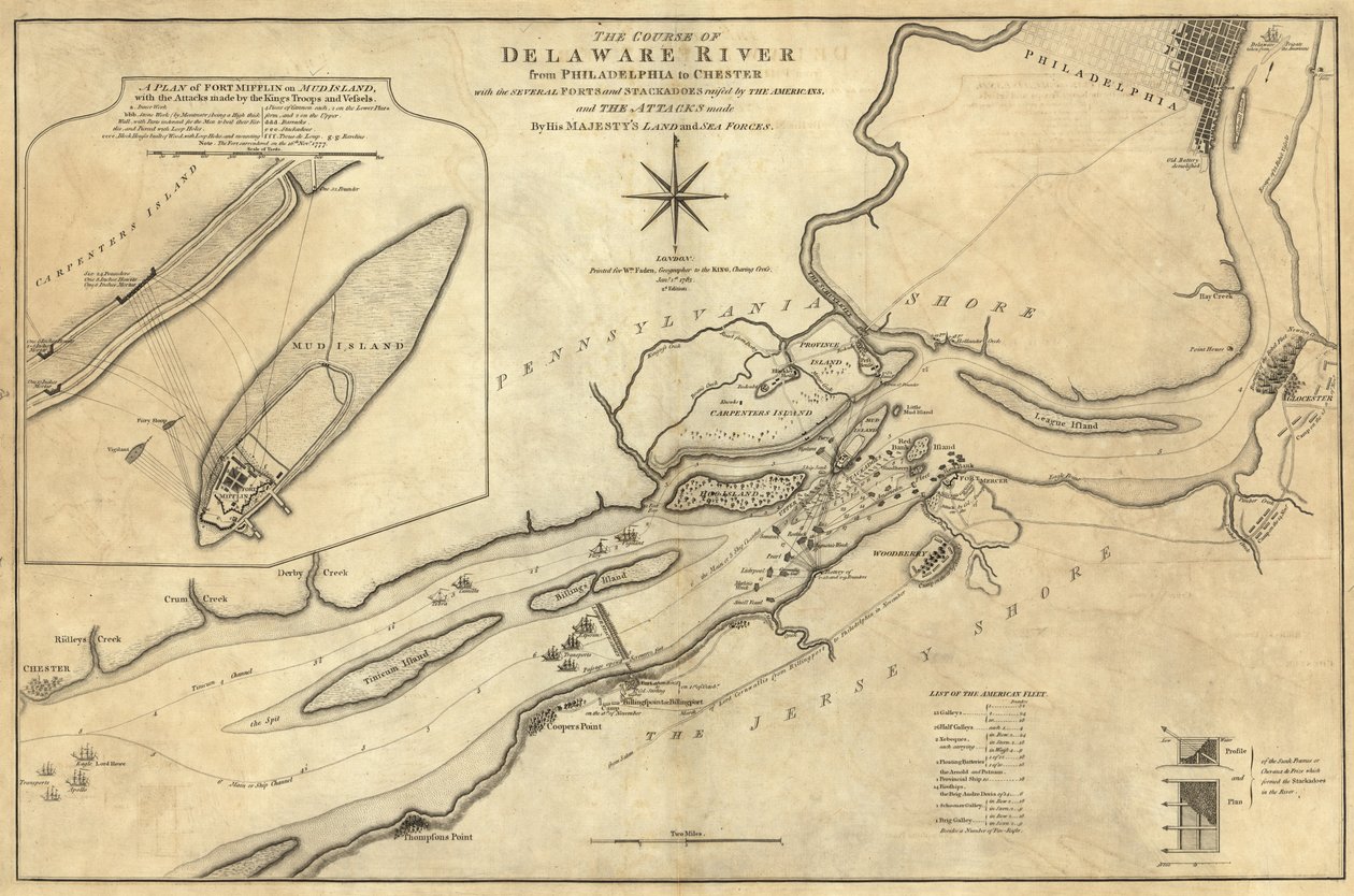
Course of Delaware River from Philadelphia to Chester by William Faden

Course of Delaware River from Philadelphia to Chester


William Faden

€ 134.09
Enthält 13.5% MwSt.
   Configure art print
Undated  ·  Map  ·  Picture ID: 1429310

Nonclassified artists

Course of Delaware River from Philadelphia to Chester by William Faden. Available as an art print on canvas, photo paper, watercolor board, uncoated paper or Japanese paper.
Library of Congress, Washington D.C., USA / Bridgeman Images
AR/3D   View in 3D / AR zu Favoriten hinzufügen   Add to favorites    Select wall color    View painting in a room
0 Reviews

Configure art print

Picture Frame

Medium & Stretcher

Glass & Passepartout

Miscellaneous & Extras

 Save / compare configuration
Preview Icon

Summary

Gemälde
Veredelung
Keilrahmen
Museumslizenz

€ 134.09
(inkl. 20% MwSt)
   Add to cart

Bildschärfe: PERFEKT

Should you desire adjustments to brightness and color, or a custom crop of the motif, we are happy to make these changes at no additional cost to you. Please do not hesitate to contact us.

Similar artworks selected for you

The Course of Delaware River from Philadelphia to Chester, North America A chart of Delaware Bay and river, containing a full and exact description of the shores, creeks, harbours, soundings, shoals, sands and bearings of the most considerable land marks, from the Capes to Philadelphia Map of Hoogly River Plan of Charlestown, South Carolina A Topographical Map of the Northern Part of New York Island A Plan of Charlestown, S.C. by Faden Disposition of British Troops, with Fortifications North of Fort Knipehausen to Fort Independence A Plan of River St. Laurence by Jeffreys An Exact Plan of Charles Town Bar and Harbour, from an Actual Survey with the Attack of Fort Sullivan, on the 28 June 1776, by His Majesty A Topographical Sketch of New York Chart of Port Royal in South Carolina, United States of America George Washington The harbour of Fowey, Cornwall Section of the Northern Course of the Canal from the Tide in the Elk River at Frenchtown to the Forked [Oak] in Mr. Rudulph Map of Yorktown, Virginia, October 1781 Battle of Green Spring, Map of the Land on the Left Bank of the James River Opposite Jamestown in Virginia Where the Battle of July 6 Particular Map of the Course of the St. Louis River from the Savage Village to Below the English Detour, Lakes Pontchartrain & Maurepas and the Rivers & Bayous Leading to Them An Authentic Plan of the Town and Harbour of Cap-François in the Isle of St. Domingo Map of the mouth of the Chicago River, Illinois with the plan of the proposed piers for improving the harbour A Plan of the Harbour Near Singapore by Captain D.L. Ross, FRS Marine Surveyor General British map of the Siege of Yorktown, 1781 Chart of the harbour of Point de Galle. Surveyed in January and March 1800, by Captain David Inverarity. To whom this plate is inscribed, by his most obliged A.Dalrymple. A correct chart of the city and harbour of Dublin, Ireland The Battle of Falkirk, 28 January 1746 Christ Church Parish, South Carolina - (Charleston District) Plan of the Battle of Navarino, 21 October 1827 A Plan of New York Island Captain Snow A plan of Fort Montgomery & Fort Clinton, 1774-1779
Show more similar artworks

Other art prints by William Faden

Ancient Britain. Map. Ancient Asia Minor. Map. Ancient Gaul Map Ancient Greece. Aegean Sea. Asia Minor. Map. Ancient Italy Map Ancient Egypt. Map. Composite World Atlas Australia and New Zealand. New Holland. Map. Palestine Map Ancient Spain and Portugal. Map. Plan of Charlestown, South Carolina Indians in the Fur Trade in Canada Western Part of Roman Empire. Map. A Map of a Part of Yucatan or of That Part of the Eastern Shore Within the Bay of Honduras Alloted to Great Britain for the Cutting of Logwood, in Consequence of the Convention Signed with Spain on the 14th July 1786. By a Bay Man. Composite World Atlas by William Faden
Discover more works by William Faden

Excerpt from our top sellers

The Resurrection of Christ (detail) View of Constantinople and the Bosphorus Fish Magic Song of the Angels Reclining Nude Woman Reading a Book Holy Trinity (Troitsa) Four Foxes The Night Watch Portrait of Joan of Arc with flag and lilies on the background of Notre Dame Cathedral The Foxes Star of the Hero The Creation of the World Representing the Cosmic Sphere of the Earth (Back Panels of the Triptych A Stroll on the Beach Sunny Day in the Countryside The Lute Player
Show More Artworks


What our customers think about us


Frequently Asked Questions about Meisterdrucke


Personalizing your art print at Meisterdrucke is a simple and intuitive process that allows you to design an artwork exactly to your specifications: Choose a frame, determine the image size, decide on a printing medium, and add suitable glazing or a stretcher frame. We also offer customization options such as mats, fillets, and spacers. Our customer service is available to help you design your perfect artwork.

At Meisterdrucke, you have the fascinating option to visualize the artwork you configured directly in your own space. For a tailored preview, simply upload a photo of your room and let the artwork appear on it. If you visit us via a mobile device, be it a phone or tablet, our augmented reality feature brings the image to life and seamlessly projects it into your space. An experience that uniquely combines art and technology.

Choosing the medium is often a matter of personal taste. To give you a clearer idea, we have provided some images for each medium. For a holistic experience, we also offer you a sample set of all paper variants so you can make a decision not just visually but also haptically. You can take advantage of the sample set free of charge – only the shipping costs will apply. You can order the sample set directly.

Do not worry. At Meisterdrucke, we do not proceed mechanically. We manually review each order. If there are any inconsistencies or peculiarities in the configuration, we will immediately contact you. Of course, our courteous and patient support is always at your side to assist you with the configuration. Together with you, we adjust your image by phone or email so that the final result exactly meets your expectations.


Do you have any questions?

Are you interested in an art print from our manufactory but still unsure? Do you need advice on choosing the medium or help with the order?

Our experts are happy to assist you.

+43 4257 29415
support@meisterdrucke.com
Mo-Do: 7:00 - 16:00 | Fr: 7:00 - 13:00

Do you have any questions?

Are you interested in an art print from our manufactory but still unsure? Do you need advice on choosing the medium or help with the order?

Our experts are happy to assist you.

+43 4257 29415
support@meisterdrucke.com
Mo-Do: 7:00 - 16:00 | Fr: 7:00 - 13:00


Meisterdrucke

   Kärntner Strasse 46
        9586 Finkenstein am Faaker See
        Austria
        +43 4257 29415
        support@meisterdrucke.com
Other languages

                   
Erfahrungen & Bewertungen zu Meisterdrucke
Post.at DHL Express Quehenberger Cargoboard
Kaiser Franz Joseph

Meisterdrucke
Kärntner Strasse 46
9586 Finkenstein am Faaker See · Austria
+43 4257 29415 · office@meisterdrucke.com
Post.at DHL Express Quehenberger Cargoboard


Meisterdrucke 2717 Bewertungen auf ProvenExpert.com

(c) 2025 meisterdrucke.ie