Map of Central Europe, from

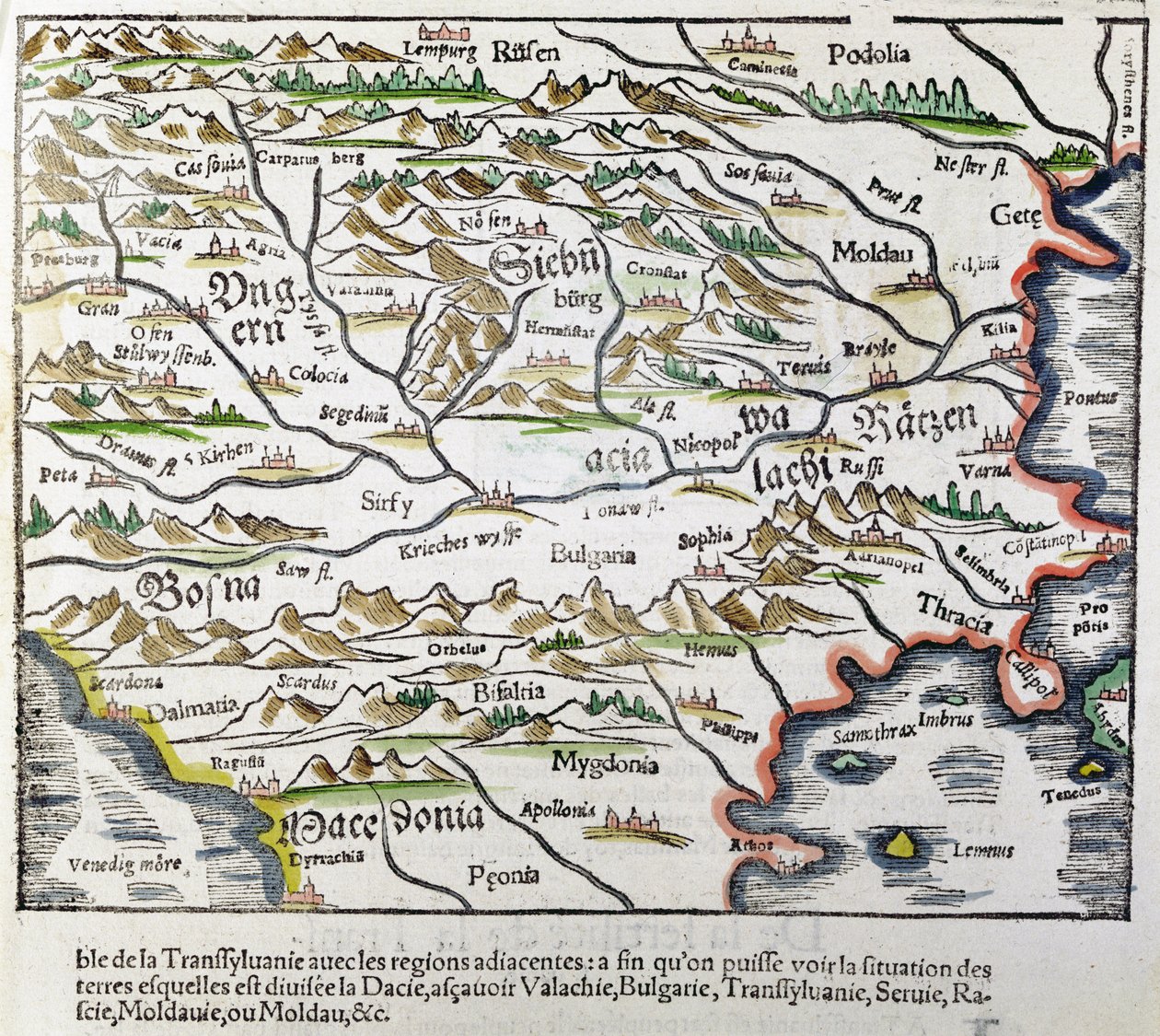
Map of Central Europe, from 'Cosmographia Universalis', Published in 1555

(Map of Central Europe, from 'Cosmographia Universalis', published in 1555 (colour woodcut))


Sebastian Munster

€ 117.19
Enthält 13.5% MwSt.
   Configure art print
1555  ·  colour woodcut  ·  Picture ID: 262783

Nonclassified artists  ·  Cartography

Map of Central Europe, from 'Cosmographia Universalis', Published in 1555 by Sebastian Munster. Available as an art print on canvas, photo paper, watercolor board, uncoated paper or Japanese paper.
carte de l' · europe centrale · hungary · transylvania · moldavia · bosnia · macedonia · bulgaria · european · eastern · Private Collection / Bridgeman Images
Other color variations of this picture  
zu Favoriten hinzufügen   Add to favorites    Select wall color    View painting in a room AR/3D   View in 3D / AR
0 Reviews

Configure art print

Picture Frame

Medium & Stretcher

Glass & Passepartout

Miscellaneous & Extras

 Save / compare configuration
Preview Icon

Summary

Gemälde
Veredelung
Keilrahmen
Museumslizenz

€ 117.19
(inkl. 20% MwSt)
   Add to cart

Bildschärfe: PERFEKT

Should you desire adjustments to brightness and color, or a custom crop of the motif, we are happy to make these changes at no additional cost to you. Please do not hesitate to contact us.

Similar artworks selected for you

Typus Vindeliciae Ssive Utriusque Bavariae: Secundum Antiquam & Recentiorum Situm, ab Joanne Aventino Olim Descriptus... Geography Map of the Territory of Bavaria in Germany from Italy, Austria, Slovenia, north Croatia, center-north Bosnia and Herzegovina Map of Friuli Venezia Giulia Region, from Theatrum Orbis Terrarum by Abraham Ortelius Schlavoniae, Croatiae, Carniae, Istriae, Bosniae, Finitimarumque Regionum Nova Descriptio, Auctore Augustino Hirsuogelio Geography Map of the Territories of Slavonia, Croatia, Bosnia and Dalmatia from Geography map of the territory of Bohemia from Detail of Roman Gaul from the Peutinger map copy Picardy, Nord-Pas de Calais, France Map of Central and Northern Europe Map of Lazio Region, from Theatrum Orbis Terrarum Map of Bavaria, Germany, from Theatrum Orbis Terrarum by Abraham Ortelius Map of Hungary and Balkans 1683 Map of the City of Jerusalem, from State: Bavaria, Germany Geography Map of Baden-Wuerttemberg Territory of Germany Taken from Theatrum Orbis Terrarum by Abraham Ortelius Germany, Austria La Gaule, its rivers and mountains - in Romania Map of Russia From: Rerum Moscoviticarum commentarii Geography map of the Loire territory with the castles and towns bordering the river (Beaumont, Aigueperse, Clermont and Montferan, Beauregard, Cignac, Montaigu, Puy Guillaume) taken from Silesia Typus Descriptio and Descriptus et Editus Martino Heilwid Neilsense, and Nobili Viro Nicolao Rhedinger Dedicatus Anno 1561 Geography Map of the Territory South of Frankfurt in Germany near Poland from Map of Wurttemberg, from Theatrum Orbis Terrarum by Abraham Ortelius Map of Salzburg diocese, Austria, from Theatrum Orbis Terrarum Eastern Part of the Canton of Bern. No. 395. Engraving, ca. 1 Map of the Region of Piedmont, Italy, from Theatrum Orbis Terrarum Theatrum Orbis Terrarum, 1570. Map of Western Andalusia by Abraham Ortelius and Jeronimo de Chaves Nord-Pas de Calais, France France, Switzerland, Italy Northern Italy (engraving)
Show more similar artworks

Other art prints by Sebastian Munster

Europa Regina, Queen Europe from the Cosmographia (1570) Sea and terrestrial monsters Riga from the Cosmographia Detailed view of Liège with legend Map of Central Europe, from A witch summons a three headed demon, from 1550 edition of Cosmographia by Sebastian Munster Map of America showing the Atlantic and Pacific Oceans Title page of Cosmographia, 1544 Monstrous whale devouring humans, from 1550 edition of Cosmographia by Sebastian Munster City of Rome, c.1550 Mining with water wheel, from 1550 edition of Cosmographia by Sebastian Munster Europe, from Cosmographia, 1544 Fantastic Creatures in Africa Cosmographia, Fol 853, 1544 Qubilai (Kubilai Khan, First Emperor of the Mongolian Yuan Dynasty) - in
Discover more works by Sebastian Munster

Other motives from the category Cartography

The Velasco Map, facsimile, 1610 Sketch Map of Africa, from Map of Aleppo, c.1600 A map of the model of Roman London on exhibition in the Undercroft of All-Hallows-by-the-Tower Map of Durham Map of Florida, from Map of London, from Estate map of Belchamp St. Paul, 1576 (detail) Map of Cambridge, from Caius Map of Virginia, discovered and described by Captain John Smith, 1606, engraved by William Hole, published 1612 Map of Suresnes and its annexe, Puteaux, 1669 Map of Nijmegen, from A New and Correct Map of the Trading Part of the West Indies Septentrionalium terrarum descriptio, map of the Arctic, 1595 Map of the City and Portuguese Port of Goa, India
View More from "Cartography"

Excerpt from our top sellers

Kite Flying The Geographer Winter Landscape with Skaters Lowlands Judith with the Head of Holofernes Annunciation (post restoration) Colored Leaves at Kaianji Temple Sailing Ship in the Fog Merry Christmas Ice at Bennecourt View of Arles with Irises in the Foreground Adele Bloch-Bauer The Wild Hunt of Odin The Interior of the Palm House Yacht Approaching the Coast
Show More Artworks


What our customers think about us


Frequently Asked Questions about Meisterdrucke


Personalizing your art print at Meisterdrucke is a simple and intuitive process that allows you to design an artwork exactly to your specifications: Choose a frame, determine the image size, decide on a printing medium, and add suitable glazing or a stretcher frame. We also offer customization options such as mats, fillets, and spacers. Our customer service is available to help you design your perfect artwork.

At Meisterdrucke, you have the fascinating option to visualize the artwork you configured directly in your own space. For a tailored preview, simply upload a photo of your room and let the artwork appear on it. If you visit us via a mobile device, be it a phone or tablet, our augmented reality feature brings the image to life and seamlessly projects it into your space. An experience that uniquely combines art and technology.

Choosing the medium is often a matter of personal taste. To give you a clearer idea, we have provided some images for each medium. For a holistic experience, we also offer you a sample set of all paper variants so you can make a decision not just visually but also haptically. You can take advantage of the sample set free of charge – only the shipping costs will apply. You can order the sample set directly.

Do not worry. At Meisterdrucke, we do not proceed mechanically. We manually review each order. If there are any inconsistencies or peculiarities in the configuration, we will immediately contact you. Of course, our courteous and patient support is always at your side to assist you with the configuration. Together with you, we adjust your image by phone or email so that the final result exactly meets your expectations.


Do you have any questions?

Are you interested in an art print from our manufactory but still unsure? Do you need advice on choosing the medium or help with the order?

Our experts are happy to assist you.

+43 4257 29415
support@meisterdrucke.com
Mo-Do: 7:00 - 16:00 | Fr: 7:00 - 13:00

Do you have any questions?

Are you interested in an art print from our manufactory but still unsure? Do you need advice on choosing the medium or help with the order?

Our experts are happy to assist you.

+43 4257 29415
support@meisterdrucke.com
Mo-Do: 7:00 - 16:00 | Fr: 7:00 - 13:00


Meisterdrucke

   Kärntner Strasse 46
        9586 Finkenstein am Faaker See
        Austria
        +43 4257 29415
        support@meisterdrucke.com
Other languages

                   
Erfahrungen & Bewertungen zu Meisterdrucke
Partner Logos

Kaiser Franz Joseph

Meisterdrucke
Kärntner Strasse 46
9586 Finkenstein am Faaker See · Austria
+43 4257 29415 · office@meisterdrucke.com
Partner Logos


(c) 2025 meisterdrucke.ie