Search by artist, work title or style – e.g. Monet, Starry Night, Impressionism, Hokusai wave, nude. Describe the scene – e.g. green meadow, abstract with lots of red, dark oil painting, standing nude next to a tree.

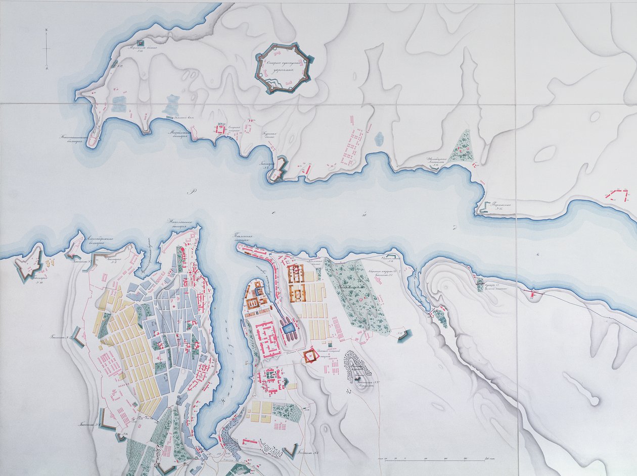
Map of Sevastopol by Russian School

Map of Sevastopol

(Map of Sevastopol, 1854 )


Russian School

€ 133.77
Enthält 13.5% MwSt.
   Configure art print
1854  ·  colour lithograph  ·  Picture ID: 441841

Cultural Circles  ·  Cartography

Map of Sevastopol by Russian School. Available as an art print on canvas, photo paper, watercolor board, uncoated paper or Japanese paper.
crimea · mapping · carte · harbour · port · geography · geographical · cartography · coast · strategic city · aerial view · Archives des Tsars, St. Petersburg, Russia / Bridgeman Images
AR/3D   View in 3D / AR zu Favoriten hinzufügen   Add to favorites    Select wall color    View painting in a room
0 Reviews

Configure art print

Picture Frame

Medium & Stretcher

Glass & Passepartout

Miscellaneous & Extras

 Save / compare configuration
Preview Icon

Summary

Gemälde
Veredelung
Keilrahmen
Museumslizenz

€ 133.77
(inkl. 20% MwSt)
   Add to cart

Bildschärfe: PERFEKT

Should you desire adjustments to brightness and color, or a custom crop of the motif, we are happy to make these changes at no additional cost to you. Please do not hesitate to contact us.

Similar artworks selected for you

Plan for the Construction of the Coast Batteries for the Defence of Breton Harbour in 1848 Map of Friderichstad and Its Situation Plan of the Siege of Sebastopol, 1883 Plan of the Siege of Sebastopol 1854-55, engraved by Robert Walker, pub. William Mackenzie, c.1860 A Sketch of the River Tagus from the Bar of Alcacova up to Coffin Map showing the Siege of Sevastopol, Crimean War, 1854-1855, 1893 Map of Rhode Island, from The Port of Mahon and surrounding area, from Cala Murte to Cala Rafalet Roy Military Survey of Scotland Map of the Operations of the American Army in the Valley of Mexico in August and September 1847 during the Mexican-American War Peterhof, Russia: Elevation of the English Palace and plan of the park Greece, the Peiraeus or Port Drako Surveyed by Commander Thomas Graves, H.M.S. Beacon 1840 (Detail) Map of Rhode Island at the time of its occupation 1780-81 by the French Army on the orders of Jean-Baptiste de Vimeur Count of Rochambeau Reconnaissance of King Map for the Battle of Austerlitz, December 2nd, 1805 Peterhof, Russia: Elevation of the English Palace and Plan of the Park Wonsan Chongyong Map of Düsseldorf Black Sea Sebastopol from a Russian Survey of 1836 England East Coast Entrance to the River Humber Surveyed by Staff Captain J. Parsons, Royal Navy Map of the bay and city of S. Phelipe de Portobelo Map of Phillipsburg, from Sketch of the Fortress of Ghuznee. Taken by Storm on the 23rd July 1839 Plan of Jerusalem in 1308, illustration from a facsimile edition of Liber de Expeditione Terrae Sanctae by Marino Sanuto di Torcello Venice Liquid Streets (2008) Map of the St. Lawrence Estuary Geological Map of the Cutch Desert, 1870 Map of Sofala, Mozambique, from A Plan of St. Philips Castle and Fortifications in the Island of Minorca
Show more similar artworks

Other art prints by Russian School

St. George and the Dragon, Russian Icon from Vologda, 15th Century Soviet Poster of Stalin Reading a Telegram, 1949 Archangel Gabriel (Angel with Golden Hair), Russian Icon, 12th Century Icon Old Testament Trinity, 16th century icon Last Judgement, Novgorod Icon Russian sailor in the Uniform of the Russian Navy at the end of the nineteenth century Portrait of Elizabeth Petrovna, Empress of Russia, c.1750 Orlov Tea service from the Imperial Porcelain Factory, St Petersburg Mother of God of Vladimir, Icon from North Western Russia, Late 17th Century Portrait of Avdotia Istomina The Saviour, early 14th century Cornflowers and Ears of Corn, Faberge Workshop, 1880s Siberian Tiger Attacking a Cossack Portrait of Mikhail Aleksandrovich Bakunin, 1838
Discover more works by Russian School

Other motives from the category Cartography

Map of the Kingdom of Great Britain and Ireland, 1610 Map of Scotland in 1290, from Map of South-Eastern Asia and Northern Australia Map of Fisk-Kill and the Position of the French Army A New Map of the English Plantations in America World Map, from The Continent of Africa, from an Atlas of the World in 33 Maps, Venice, 1st September 1553 Map of the Kingdom of Hungary A Map of Bloomsbury and Holborn, London Map of Namur, from Map of the Mediterranean, Europe and Africa, 1300 Map of European Russia showing its Earliest Extent, its Encroachments upon Adjacent Countries, and the Present Boundary of the Empire Map of Countries First Discovered by Christopher Columbus (1451-1506) 1500 Map of Flanders at the Time of the Thirty Years War (1618-48), from Map of Europe, Published in 1700, Paris
View More from "Cartography"

Excerpt from our top sellers

Dining Room on the Garden, 1934-35 The Sistine Madonna Boys Bathing The Bookworm The Gare Saint-Lazare: Arrival of a Train Alpine Hut in Rainy Weather Homage to Jacquin ( The Boulevard Montmartre on a Winter Morning Sadko View of Venice: The Ducal Palace, Dogana and Part of San Giorgio Woman at Dawn Mending the Sail, 1896 After the Bath Self-Portrait at a Young Age Bear In Snow
Show More Artworks


What our customers think about us


Frequently Asked Questions about Meisterdrucke


Personalizing your art print at Meisterdrucke is a simple and intuitive process that allows you to design an artwork exactly to your specifications: Choose a frame, determine the image size, decide on a printing medium, and add suitable glazing or a stretcher frame. We also offer customization options such as mats, fillets, and spacers. Our customer service is available to help you design your perfect artwork.

At Meisterdrucke, you have the fascinating option to visualize the artwork you configured directly in your own space. For a tailored preview, simply upload a photo of your room and let the artwork appear on it. If you visit us via a mobile device, be it a phone or tablet, our augmented reality feature brings the image to life and seamlessly projects it into your space. An experience that uniquely combines art and technology.

Choosing the medium is often a matter of personal taste. To give you a clearer idea, we have provided some images for each medium. For a holistic experience, we also offer you a sample set of all paper variants so you can make a decision not just visually but also haptically. You can take advantage of the sample set free of charge – only the shipping costs will apply. You can order the sample set directly.

Do not worry. At Meisterdrucke, we do not proceed mechanically. We manually review each order. If there are any inconsistencies or peculiarities in the configuration, we will immediately contact you. Of course, our courteous and patient support is always at your side to assist you with the configuration. Together with you, we adjust your image by phone or email so that the final result exactly meets your expectations.


Do you have any questions?

Are you interested in an art print from our manufactory but still unsure? Do you need advice on choosing the medium or help with the order?

Our experts are happy to assist you.

+43 4257 29415
support@meisterdrucke.com
Mo-Do: 7:00 - 16:00 | Fr: 7:00 - 13:00

Do you have any questions?

Are you interested in an art print from our manufactory but still unsure? Do you need advice on choosing the medium or help with the order?

Our experts are happy to assist you.

+43 4257 29415
support@meisterdrucke.com
Mo-Do: 7:00 - 16:00 | Fr: 7:00 - 13:00


Meisterdrucke

   Kärntner Strasse 46
        9586 Finkenstein am Faaker See
        Austria
        +43 4257 29415
        support@meisterdrucke.com
Other languages

                   
Erfahrungen & Bewertungen zu Meisterdrucke
Post.at DHL Express Quehenberger Cargoboard
Kaiser Franz Joseph

Meisterdrucke
Kärntner Strasse 46
9586 Finkenstein am Faaker See · Austria
+43 4257 29415 · office@meisterdrucke.com
Post.at DHL Express Quehenberger Cargoboard


Meisterdrucke 2746 Bewertungen auf ProvenExpert.com

(c) 2025 meisterdrucke.ie