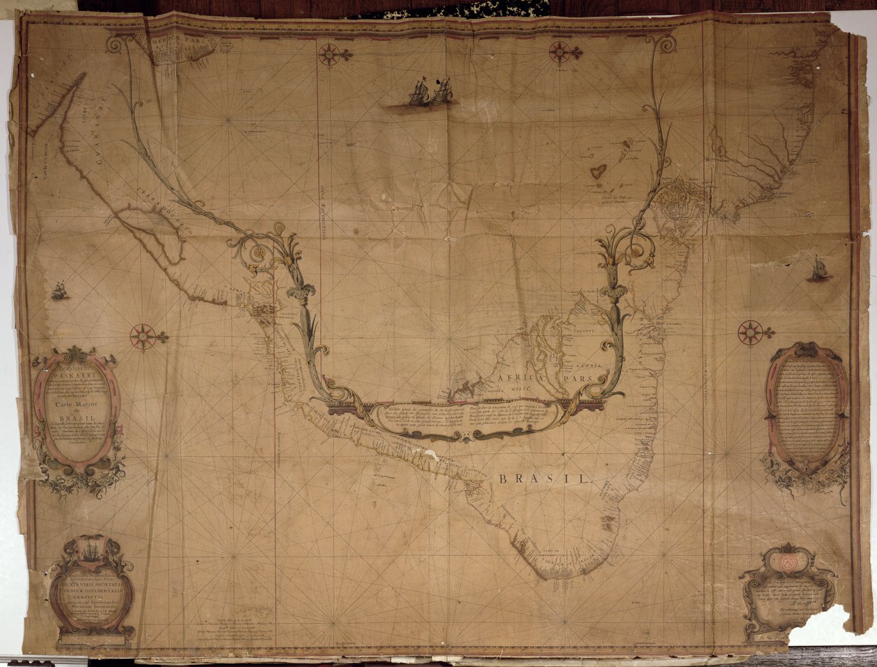
Map of Brazil, from Dutch Marine Maps, 1637 by Philip Vingboons

Map of Brazil, from Dutch Marine Maps, 1637

(Ms 1288 f.25 Map of Brazil, from Dutch Marine Maps, 1637 )


Philip Vingboons

€ 132.2
Enthält 13.5% MwSt.
   Configure art print
1637  ·  engraving  ·  Picture ID: 362187

Nonclassified artists  ·  Cartography

Map of Brazil, from Dutch Marine Maps, 1637 by Philip Vingboons. Available as an art print on canvas, photo paper, watercolor board, uncoated paper or Japanese paper.
bresil · chart · plan · south american · latin · coastline · Bibliotheque de l'Institut de France, Paris, France / Bridgeman Images
zu Favoriten hinzufügen   Add to favorites    Select wall color    View painting in a room AR/3D   View in 3D / AR
0 Reviews

Configure art print

Picture Frame

Medium & Stretcher

Glass & Passepartout

Miscellaneous & Extras

 Save / compare configuration
Preview Icon

Summary

Gemälde
Veredelung
Keilrahmen
Museumslizenz

€ 132.2
(inkl. 20% MwSt)
   Add to cart

Bildschärfe: PERFEKT

Should you desire adjustments to brightness and color, or a custom crop of the motif, we are happy to make these changes at no additional cost to you. Please do not hesitate to contact us.

Similar artworks selected for you

Printed Chart of the Estuary of the River Humber Territorial holdings of the Dutch West India Company, 1710 Chart of the North Sea dedicated to Map of the Spanish Fort at Tamsui, Later of the VOC Map of Africa, India and Sri Lanka, c.1680 Map of East Africa and Asia Map of Zeelandia and Surroundings, Formosa A Chart of the East Coast from Barton, Lincolnshire, to Dover, Kent Chart of Sumatra, 1653 The Polar Aurora, from a The Harbour of Dublin in Ireland To his excellency George Clinton, Esq. . . .This plan of the City of New York and its environs . . ., 1785 Wyre to Black Combe, from England East Coast from Thames Estuary to the Wash Valloton Map of Cape Horn, Tierra del Fuego, from Map of the greater part of New Mexico, and a portion of Upper California Western Atlantic Ocean Map of the Pacific Ocean Chart of the English Coast, Isle of Wight and Portsmouth Harbour England East Coast from Thames Estuary to the Wash Map of the Skøyen Farm, Østre Aker, with the Farm Chart of River Thames from London to the Buoy of the Noure A Chart of the East Coast of Scotland from a Sea-Atlas Containing an Hydrographical Description of Most of the Sea-Coasts of the Known Parts of the World by Samuel Thornton, 1707 (hand coloured print) Chart of Dover Strait, c.1587-88 Map of the English Channel (English South Coast and French North Coast) by Jean Rotz The description of the castle and lands of Insbeguin lying within 3 miles of Yohall on the west side thereof Tenerife Chart of Yarmouth and the Sands About It, c.1700
Show more similar artworks

Other motives from the category Cartography

Map of Britain in 792, from Map Depicting the East Coast of North America, 1647 Map showing the Island of Crete, c.1570, by Abraham Ortelius World Map of Telegraph Lines Published by the International Telegraph Bureau, 1901 Map Charting the Orbit of the Moon around the Earth, from Map of Islington, Clerkenwell, Holborn and Finsbury Northern Europe, from an Atlas of the World in 33 maps, Venice, 1st September 1553 (ink on vellum) Map of Paris, 1620 This Map of the City of New York and Island of Manhattan as Laid Out by the Commissioners Appointed by the Legislature, 1853 Asia: Map of the Continent Including Japan and the East Indies with Part of New Guinea, c.1580 Phenomena of Aratus, cosmological diagram Detail of Copy of a Catalan Map of Europe and North Africa, presented to Charles V of France in 1381 Map of the Adriatic Sea Map Depicting the Ptolemaic and Tycho Brahe Systems of Planetary Orbit, 1701 Map of Charles V, Map of Mecia de Viladestes, a portulan of Europe and North Africa, 1413
View More from "Cartography"

Excerpt from our top sellers

Camelot, illustration from The Cliff, Étretat, Sunset F. Goya, Dog Pandora The Sin The Tortoise Trainer Painting from the Tomb of the Diver from the Southern Cemetery at Paestum, 480-470 BC Seascape by Moonlight on the Sea The Butterfly Hunter After a Gale, 1903 The Dragon among Clouds The Nightmare, 1781 Olive Trees with Yellow Sky and Sun Waterlilies Native Birds, Including the Toucan, Amazon, Brazil, from
Show More Artworks


What our customers think about us


Frequently Asked Questions about Meisterdrucke


Personalizing your art print at Meisterdrucke is a simple and intuitive process that allows you to design an artwork exactly to your specifications: Choose a frame, determine the image size, decide on a printing medium, and add suitable glazing or a stretcher frame. We also offer customization options such as mats, fillets, and spacers. Our customer service is available to help you design your perfect artwork.

At Meisterdrucke, you have the fascinating option to visualize the artwork you configured directly in your own space. For a tailored preview, simply upload a photo of your room and let the artwork appear on it. If you visit us via a mobile device, be it a phone or tablet, our augmented reality feature brings the image to life and seamlessly projects it into your space. An experience that uniquely combines art and technology.

Choosing the medium is often a matter of personal taste. To give you a clearer idea, we have provided some images for each medium. For a holistic experience, we also offer you a sample set of all paper variants so you can make a decision not just visually but also haptically. You can take advantage of the sample set free of charge – only the shipping costs will apply. You can order the sample set directly.

Do not worry. At Meisterdrucke, we do not proceed mechanically. We manually review each order. If there are any inconsistencies or peculiarities in the configuration, we will immediately contact you. Of course, our courteous and patient support is always at your side to assist you with the configuration. Together with you, we adjust your image by phone or email so that the final result exactly meets your expectations.


Do you have any questions?

Are you interested in an art print from our manufactory but still unsure? Do you need advice on choosing the medium or help with the order?

Our experts are happy to assist you.

+43 4257 29415
support@meisterdrucke.com
Mo-Do: 7:00 - 16:00 | Fr: 7:00 - 13:00

Do you have any questions?

Are you interested in an art print from our manufactory but still unsure? Do you need advice on choosing the medium or help with the order?

Our experts are happy to assist you.

+43 4257 29415
support@meisterdrucke.com
Mo-Do: 7:00 - 16:00 | Fr: 7:00 - 13:00


Meisterdrucke

   Kärntner Strasse 46
        9586 Finkenstein am Faaker See
        Austria
        +43 4257 29415
        support@meisterdrucke.com
Other languages

                   
Erfahrungen & Bewertungen zu Meisterdrucke
Partner Logos

Kaiser Franz Joseph

Meisterdrucke
Kärntner Strasse 46
9586 Finkenstein am Faaker See · Austria
+43 4257 29415 · office@meisterdrucke.com
Partner Logos


(c) 2025 meisterdrucke.ie