Search by artist, work title or style – e.g. Monet, Starry Night, Impressionism, Hokusai wave, nude. Describe the scene – e.g. green meadow, abstract with lots of red, dark oil painting, standing nude next to a tree.

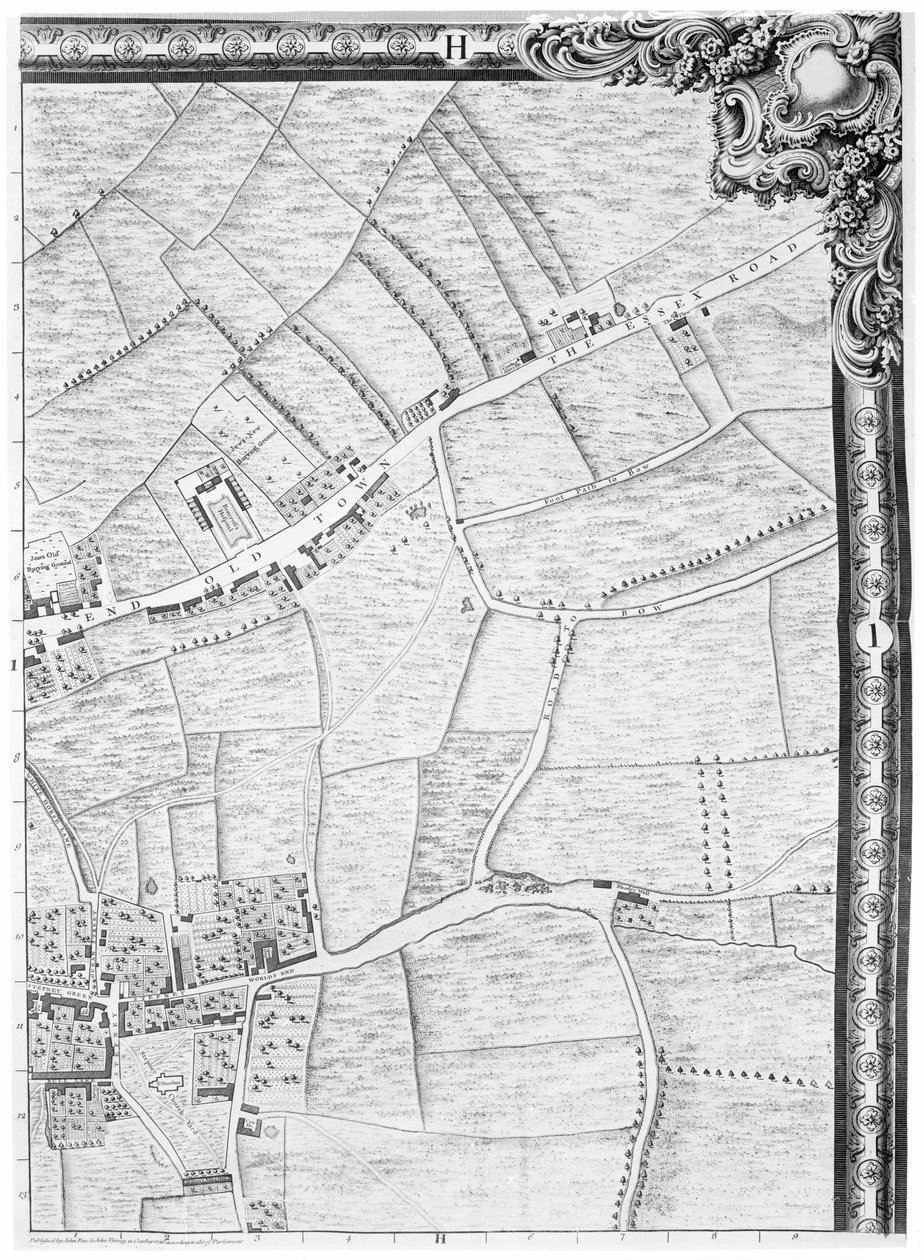
A Map of Mile End and Stepney Green, London, 1746 by John Rocque

A Map of Mile End and Stepney Green, London, 1746

(A Map of Mile End and Stepney Green, London, 1746 )


John Rocque

€ 139.45
Enthält 13.5% MwSt.
   Configure art print
1746  ·  Gravur  ·  Picture ID: 116642

Victorian Art  ·  Cartography

A Map of Mile End and Stepney Green, London, 1746 by John Rocque. Available as an art print on canvas, photo paper, watercolor board, uncoated paper or Japanese paper.
city · outskirts · village · suburb · fields · farm land · farmland · old town · essex road · road to bow · worlds end pub · rhodes well · jews new burying ground · bencrofts hospital · dunstans · church · poplar · tower hamlets · area · east end · aerial view · mile end · stepney green · london · plan · street · streets · england · english · Britain · British · capital city · Georgian · Private Collection / Bridgeman Images
Other color variations of this picture  
AR/3D   View in 3D / AR zu Favoriten hinzufügen   Add to favorites    Select wall color    View painting in a room
0 Reviews

Configure art print

Picture Frame

Medium & Stretcher

Glass & Passepartout

Miscellaneous & Extras

 Save / compare configuration
Preview Icon

Summary

Gemälde
Veredelung
Keilrahmen
Museumslizenz

€ 139.45
(inkl. 20% MwSt)
   Add to cart

Bildschärfe: PERFEKT

Should you desire adjustments to brightness and color, or a custom crop of the motif, we are happy to make these changes at no additional cost to you. Please do not hesitate to contact us.

Similar artworks selected for you

A Map of the West End and Soho, London, 1746 A Map of Chelsea, 1746 A Map of Shoreditch and Whitechapel, London, 1746 A Map of Bloomsbury and Holborn, London Plan of Kensington Palace (detail) by Joshua Rhodes, 1764 Loggan Loggan Part of Bernard Ratzer A section of a sheet from the survey of London and its environs, 1741-5, pub. 1769 Map of Islington, Clerkenwell, Holborn and Finsbury A Map of Clerkenwell, City of London, 1746 A Map of St James Plan of the Parish of St Georges, Hanover Square, London, 1907 City map of Naples with Capodimonte (detail) Agas Plan of Richmond, Syon and Kew Map of Manchester A Map of Moorfields and Hoxton, London, 1746 A Map of St Georges Fields and Newington Butts, London, 1746 A Map of St. James Hollar Bird Map of Racconigi, Engraving by Joan Blaeu, Italy Saint-Honore District in 1608, Extract from the F. Quesnel Plan Map of Westminster from
Show more similar artworks

Other art prints by John Rocque

A Map of St. James A Map of the Royal Palace and Gardens of Kensington, London, 1736 A Map of Bloomsbury and Holborn, London A Map of Old London Bridge, London, 1746 A Map of the West End and Soho, London, 1746 A Map of St Pauls and Bankside, London, 1746 A Map of Covent Garden and Westminster, London, 1746 An 18th Century Map of London. An Exact Survey of the Cities of London, Westminster, the Borough of Southwark and the Country Near Ten Miles Around Begun in 1741 & Ended in 1745 by John Rocque Land Surveyor & Engraved by Richard Parr A Map of Moorfields and Hoxton, London, 1746 Plan of London, Ratcliff Highway, Upper Shadwell Road A Map of Limehouse and Rotherhithe, London, 1746 A Map of Marylebone, London, 1746 A Map of Camberwell, London, 1746 A Map of Mile End, London, 1746 A Map of Bermondsey, London
Discover more works by John Rocque

Other motives from the category Cartography

Map of the Acropolis of the 2nd city at Troy Plan of the enclosed gardens and Chateau de Gaillon, from Map of Vicksburg Map of Austria and the German Empire Map and Prospect of London, c.1710 Map of British America Map of the Country between the River Alma and Balaklava, illustrating the Advance of the Allied Armies Map of France, c. 1914 Map of Candia and Corfu, from Map of Strawberry Hill, London Map drawn up for the Algiers expedition, 1830 Map of Brazil, from the Map of Central Europe, from the Map of Palestine, Palestina Antiqua, from Map of Europe Northern Africa and Western Asia, Orbis Veteribus Notus, from
View More from "Cartography"

Excerpt from our top sellers

The Divine Comedy, Paradiso, Canto 31: The saintly throng form a rose in the empyrean (rose celeste) - by Dante Alighieri (1265-1321) View of Arles with Irises in the Foreground The Fox, 1913 Christ in the Storm on the Lake of Galilee The Isle of the Dead The Port at Sunset, Opus 236 Profile Portrait of a Young Woman Campesinos Reading El Machete, Mexico City Tulip Fields with the Rijnsburg Windmill Polyphonically Painted White The Destruction of Herculaneum and Pompeii Madonna with Child and Two Angels Lady in Yellow The Gate of the Great Umayyad Mosque, Damascus The Temptation of St. Anthony, right hand panel, detail of a couple riding a fish
Show More Artworks


What our customers think about us


Frequently Asked Questions about Meisterdrucke


Personalizing your art print at Meisterdrucke is a simple and intuitive process that allows you to design an artwork exactly to your specifications: Choose a frame, determine the image size, decide on a printing medium, and add suitable glazing or a stretcher frame. We also offer customization options such as mats, fillets, and spacers. Our customer service is available to help you design your perfect artwork.

At Meisterdrucke, you have the fascinating option to visualize the artwork you configured directly in your own space. For a tailored preview, simply upload a photo of your room and let the artwork appear on it. If you visit us via a mobile device, be it a phone or tablet, our augmented reality feature brings the image to life and seamlessly projects it into your space. An experience that uniquely combines art and technology.

Choosing the medium is often a matter of personal taste. To give you a clearer idea, we have provided some images for each medium. For a holistic experience, we also offer you a sample set of all paper variants so you can make a decision not just visually but also haptically. You can take advantage of the sample set free of charge – only the shipping costs will apply. You can order the sample set directly.

Do not worry. At Meisterdrucke, we do not proceed mechanically. We manually review each order. If there are any inconsistencies or peculiarities in the configuration, we will immediately contact you. Of course, our courteous and patient support is always at your side to assist you with the configuration. Together with you, we adjust your image by phone or email so that the final result exactly meets your expectations.


Do you have any questions?

Are you interested in an art print from our manufactory but still unsure? Do you need advice on choosing the medium or help with the order?

Our experts are happy to assist you.

+43 4257 29415
support@meisterdrucke.com
Mo-Do: 7:00 - 16:00 | Fr: 7:00 - 13:00

Do you have any questions?

Are you interested in an art print from our manufactory but still unsure? Do you need advice on choosing the medium or help with the order?

Our experts are happy to assist you.

+43 4257 29415
support@meisterdrucke.com
Mo-Do: 7:00 - 16:00 | Fr: 7:00 - 13:00


Meisterdrucke

   Kärntner Strasse 46
        9586 Finkenstein am Faaker See
        Austria
        +43 4257 29415
        support@meisterdrucke.com
Other languages

                   
Erfahrungen & Bewertungen zu Meisterdrucke
Post.at DHL Express Quehenberger Cargoboard
Kaiser Franz Joseph

Meisterdrucke
Kärntner Strasse 46
9586 Finkenstein am Faaker See · Austria
+43 4257 29415 · office@meisterdrucke.com
Post.at DHL Express Quehenberger Cargoboard


Meisterdrucke 2764 Bewertungen auf ProvenExpert.com

(c) 2025 meisterdrucke.ie