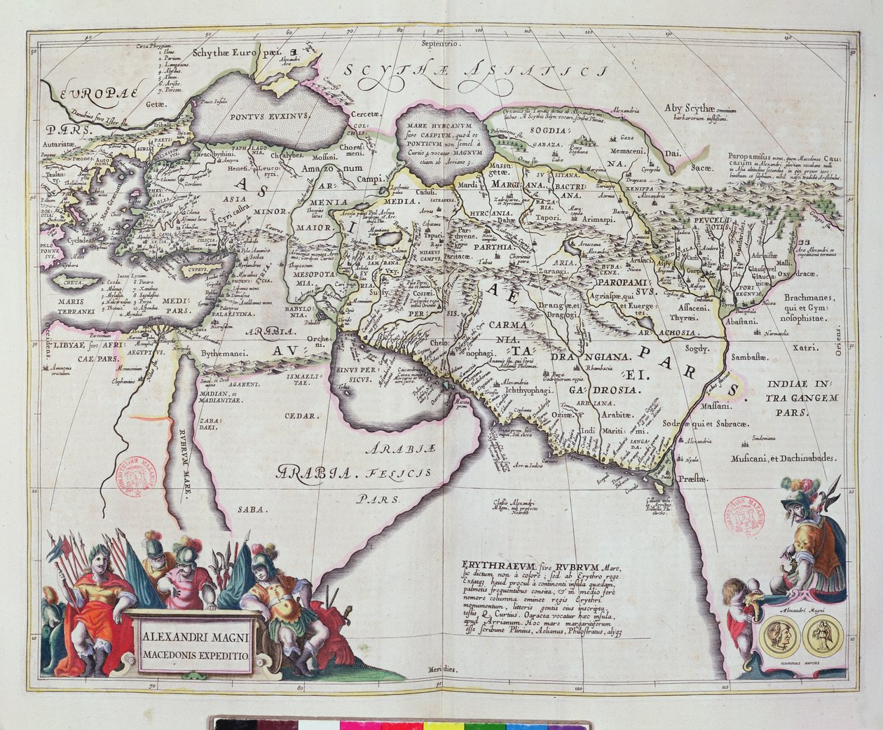
Map of the Travels of Alexander the Great (356-323 BC) from

Map of the Travels of Alexander the Great (356-323 BC) from 'Le Theatre du Monde' or 'Nouvel Atlas'

(Map of the travels of Alexander the Great (356-323 BC) from 'Le Theatre du Monde' or 'Nouvel Atlas', 1645 )


Joan Blaeu

€ 125.67
Enthält 13.5% MwSt.
   Configure art print
1645  ·  coloured engraving  ·  Picture ID: 259626

Nonclassified artists  ·  Cartography

Map of the Travels of Alexander the Great (356-323 BC) from 'Le Theatre du Monde' or 'Nouvel Atlas' by Joan Blaeu. Available as an art print on canvas, photo paper, watercolor board, uncoated paper or Japanese paper.
guillaume · jean · bleau · cartography · cartographic · middle east · arabia · empire · gulf · conquest · Bibliotheque Mazarine, Paris, France / Bridgeman Images
Other color variations of this picture  
AR/3D   View in 3D / AR zu Favoriten hinzufügen   Add to favorites    Select wall color    View painting in a room
0 Reviews

Configure art print

Picture Frame

Medium & Stretcher

Glass & Passepartout

Miscellaneous & Extras

 Save / compare configuration
Preview Icon

Summary

Gemälde
Veredelung
Keilrahmen
Museumslizenz

€ 125.67
(inkl. 20% MwSt)
   Add to cart

Bildschärfe: PERFEKT

Should you desire adjustments to brightness and color, or a custom crop of the motif, we are happy to make these changes at no additional cost to you. Please do not hesitate to contact us.

Similar artworks selected for you

Janssonius Map of Persia Persian Empire, in Map of the Turkish Empire Turkish Empire, in Italy, Balkan Peninsula, Turkey, Lebanon, Syria, Israel, Jordan, Iraq, Arabian Peninsula, Iran A Map of Turkish Possessions Including Egypt and Greece Turkey - Arabia and Iran Map of Russia From: Theatrum Orbis Terrarum General Map Including Arabia, Japan, the Korean Peninsula and the Greater Part of the Indonesian Archipelago, 1631 East Europe, Asia and north Africa - by A The Expedition of Alexander the Great, from the Map of the course of the Danube River in Germany South-east Germany, south Czech Republic, Austria, west Slovakia, west Hungary, Slovenia, Croatia, Bosnia and Herzegovina Turkey, Cyprus, Lebanon, Syria, Israel, Jordan, Iraq, Arabian Peninsula, Iran, Turkmenistan, Afghanistan, Pakistan Tartary and Northern Part of China and Korea, in The theatre of the world or the new atlas Amsterdam. Geographic map of Asia by Willem Janszoon Blaeu Map of Africa, from Map of Persia (Iran), Armenia, Anatolia (Turkey) and Arabia (Arabian Peninsula: Saudi Arabia, Kuwait, United Arab Emirates, Oman, Qatar, Yemen, Bahrain) A New Map of Asia Map of the Mediterranean with Allegorical Figures and Sea Monsters, from Map of Ottoman Empire Map of the Russian empire in the sixteenth century, copy of an original of 1571 Russia Friuli, Italy - Slovenia (Istria) with the Gulf of Trieste and Balkans (engraving) Map of the Roman Empire, Theatrum Orbis Terrarum, Abraham Ortelius, Antwerp The Turkish Empire, from Asia (engraving) Netherlands, Germany
Show more similar artworks

Other art prints by Joan Blaeu

Map of Spoleto Italy, Map of Pesaro, from Theatrum civitatum et admirandorum Italiae by Joan Blaeu, engraving Map of East Prussia Luxembourg, the Capital of the Duchy Europe Map From: Atlas Maior Map of Rome, Engraving from Theatrum Civitates et Admirandorum Italiae Map of Assisi from Theatrum Civitates et Admirandorum Italiae General View of the Observatory of Uraniborg, constructed c.1584 by Tycho Brahe (1546-1601) on the island of Hven, Denmark from View of Villa d Tycho Brahe Danish astronomer Tycho Brahe (1546 - 1601) in his observatory in Uranienburg - colour engraving by Atlas Major Ssive and cosmographed Blavania labores and sumptibus by Johannis Blaev Tycho Brahe (1546-1601) Aged 40, Amongst His Astronomical Instruments, from the Wind rose with the 32 winds of the world, from the The Two Towers (Asinelli and Garisenda), Bologna, Emilia-Romagna, Italy, copper engraving Map of China, from "Atlas Maior Sive Cosmographia Blaviana"
Discover more works by Joan Blaeu

Other motives from the category Cartography

Map of Central and North America, Published in 1700, Paris Map of the Magellan Straits, Patagonia Map of New Holland Map of Laputa (flying island top right) and Balnibarbii (main port Maldonada) from Part III: A Voyage to Laputa, Balnibarbi, Luggnagg, Glubbdubdrib, and Japan in Gulliver Map of Paris from Map of the Caucasus Reproduction of Map of Routes of St. James of Compostel, Originally Engraved by D. Serveaux 1648 Map of Asia, Tartaria, Japan, the Philippines and the East Indies, engraved by G. van Gouwen, c.1690 A New and Accurate Map of the World Map of the Proposed Route to China from British Burmah Map of Vienna Map of India, 1865 Map drawn up for the Algiers expedition, 1830 Map of Saint-Quentin, from the Map of Australia and Magellan Island from
View More from "Cartography"

Excerpt from our top sellers

Under the Wave off Kanagawa Woman with Parasol Turned to the Left, 1886 Sunny Path A Tower of Blue Horses View of a Harbor The Quarrel of Oberon and Titania The Tree of Life (Central Panel) Tulip Fields with the Rijnsburg Windmill The Wild Rabbit Poster, 1899 Seated Nude Back View Divine Mercy Three White Cottages in Saintes-Maries The Interior of the Palm House Dominant Curve Napoleon Crossing the Alps
Show More Artworks


What our customers think about us


Frequently Asked Questions about Meisterdrucke


Personalizing your art print at Meisterdrucke is a simple and intuitive process that allows you to design an artwork exactly to your specifications: Choose a frame, determine the image size, decide on a printing medium, and add suitable glazing or a stretcher frame. We also offer customization options such as mats, fillets, and spacers. Our customer service is available to help you design your perfect artwork.

At Meisterdrucke, you have the fascinating option to visualize the artwork you configured directly in your own space. For a tailored preview, simply upload a photo of your room and let the artwork appear on it. If you visit us via a mobile device, be it a phone or tablet, our augmented reality feature brings the image to life and seamlessly projects it into your space. An experience that uniquely combines art and technology.

Choosing the medium is often a matter of personal taste. To give you a clearer idea, we have provided some images for each medium. For a holistic experience, we also offer you a sample set of all paper variants so you can make a decision not just visually but also haptically. You can take advantage of the sample set free of charge – only the shipping costs will apply. You can order the sample set directly.

Do not worry. At Meisterdrucke, we do not proceed mechanically. We manually review each order. If there are any inconsistencies or peculiarities in the configuration, we will immediately contact you. Of course, our courteous and patient support is always at your side to assist you with the configuration. Together with you, we adjust your image by phone or email so that the final result exactly meets your expectations.


Do you have any questions?

Are you interested in an art print from our manufactory but still unsure? Do you need advice on choosing the medium or help with the order?

Our experts are happy to assist you.

+43 4257 29415
support@meisterdrucke.com
Mo-Do: 7:00 - 16:00 | Fr: 7:00 - 13:00

Do you have any questions?

Are you interested in an art print from our manufactory but still unsure? Do you need advice on choosing the medium or help with the order?

Our experts are happy to assist you.

+43 4257 29415
support@meisterdrucke.com
Mo-Do: 7:00 - 16:00 | Fr: 7:00 - 13:00


Meisterdrucke

   Kärntner Strasse 46
        9586 Finkenstein am Faaker See
        Austria
        +43 4257 29415
        support@meisterdrucke.com
Other languages

                   
Erfahrungen & Bewertungen zu Meisterdrucke
Post.at DHL Express Quehenberger Cargoboard
Kaiser Franz Joseph

Meisterdrucke
Kärntner Strasse 46
9586 Finkenstein am Faaker See · Austria
+43 4257 29415 · office@meisterdrucke.com
Post.at DHL Express Quehenberger Cargoboard


Meisterdrucke 2717 Bewertungen auf ProvenExpert.com

(c) 2025 meisterdrucke.ie