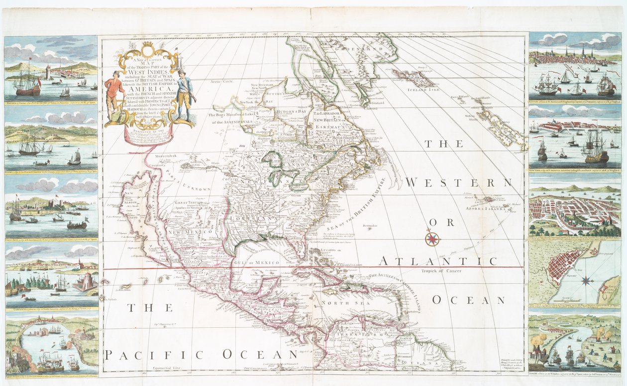
A New and Correct Map of the Trading Part of the West Indies by Henry Overton

A New and Correct Map of the Trading Part of the West Indies

(A new and correct map of the trading part of the West Indies, 1741 (hand coloured print))


Henry Overton

€ 128.77
Enthält 13.5% MwSt.
   Configure art print
1741  ·  hand coloured print  ·  Picture ID: 129459

Nonclassified artists  ·  Cartography

A New and Correct Map of the Trading Part of the West Indies by Henry Overton. Available as an art print on canvas, photo paper, watercolor board, uncoated paper or Japanese paper.
New York Public Library, USA / Bridgeman Images
AR/3D   View in 3D / AR zu Favoriten hinzufügen   Add to favorites    Select wall color    View painting in a room
0 Reviews

Configure art print

Picture Frame

Medium & Stretcher

Glass & Passepartout

Miscellaneous & Extras

 Save / compare configuration
Preview Icon

Summary

Gemälde
Veredelung
Keilrahmen
Museumslizenz

€ 128.77
(inkl. 20% MwSt)
   Add to cart

Bildschärfe: PERFEKT

Should you desire adjustments to brightness and color, or a custom crop of the motif, we are happy to make these changes at no additional cost to you. Please do not hesitate to contact us.

Similar artworks selected for you

Map of North America, c. 1720 North America Map of Central and North America (Les Indes Orientales et Occidentales et autres lieux) A Double-Page Map of North America Map of Central and North America, Published in 1700, Paris America divided into its main states, engraving by G. Zuliani taken from Tome I of the Newest Atlas published in Venice in 1776 by Antonio Zatta North America, from A New Map of the English Plantations in America Map depicting North America as Divided by the European Powers, 1774 East Canada, East United States, Mexico, Guatemala, El Salvador, Belize, Honduras, Nicaragua, Costa Rica, Panama, Antigua and Barbuda, The Bahamas, Barbados, Cuba, Dominica, Jamaica, Grenada, Haiti, Dominican Republic, Saint Kitts and Nevis, Saint Lucia South and North America Chart of the Atlantic Ocean, with the British, French & Spanish settlements in North America and the West Indies America Map of America - Corrected and Enlarged Map of the Americas Map of Indonesia The West-India Islands, 1794-1801 Hudson Bay, Land of Labrador and Greenland, engraving by G. Zuliani from Map of the Americas Map of North America A Complete Map of the West Indies Containing the Coasts of Florida, Louisiana, New Spain and Terra Firma with All the Islands America, from Map of Central America A new and correct sea chart of the whole world showing the variations of the compass as they were found in the year 1700 Frontispiece map from A Map of Carolina, Florida and the Bahama Islands Pakistan, India, Nepal, Bhutan, Bangladesh, Burma, Thailand, Laos, Cambodia, Vietnam, Malaysia, Indonesia, the Philippines North America Map of East India (South and Southeast Asia: Pakistan, India, Nepal, Bangladesh, Burma, Sri Lanka, Thailand, Malaysia, Vietnam, Cambodia, Laos, Philippines, Singapore and Indonesia)
Show more similar artworks

Other motives from the category Cartography

Map of France, c. 1914 Map of Warsaw, from Map of the Austro-Hungarian empire, illustration from a French geography school textbook, 1905 Map of Berlin, 1737 Map of the Strait of Magellan Map of the Turkish Empire, from the Mercator Atlas pub. by Jodocus Hondius Amsterdam, 1606 Indian Campaign of 1832: Map of the Country Map of Saint-Savinien on the Charente River in 1713, from Map, from The Navigation of King James V, Round Scotland, the Orkney Isles, and the Hebrides or Western Isles: Under the Conduct of That Excellent Pilot Alexander Lindsay Map of the Battle of Wagram, published by William Blackwood and Sons, Edinburgh and London, 1848 Typus Orbis Terrarum, map of the world, from Ortelius Map of Central America Map of the Kingdom of Siam Map of Scotland, Miliaria Scotia A Map of Shoreditch and Whitechapel, London, 1746
View More from "Cartography"

Excerpt from our top sellers

Summer Evening on the Beach at Skagen. The Painter and His Wife Avenue in the Park of Kammer Castle, 1912 Alpine Hut in Rainy Weather Group IXSUW, No. 1, The Swan, No. 1 The Alexander Mosaic, depicting the Battle of Issus between Alexander the Great and Darius III in 333 BC, Roman floor mosaic removed from the Casa del Fauno Woman with Parasol Turned to the Left, 1886 The Garden of Earthly Delights The Yellow Books, 1887 The Destruction of an Empire The Plague Comes Moa Bear In Snow Childhood Friends Seascape by Moonlight on the Sea The White and the Black
Show More Artworks


What our customers think about us


Frequently Asked Questions about Meisterdrucke


Personalizing your art print at Meisterdrucke is a simple and intuitive process that allows you to design an artwork exactly to your specifications: Choose a frame, determine the image size, decide on a printing medium, and add suitable glazing or a stretcher frame. We also offer customization options such as mats, fillets, and spacers. Our customer service is available to help you design your perfect artwork.

At Meisterdrucke, you have the fascinating option to visualize the artwork you configured directly in your own space. For a tailored preview, simply upload a photo of your room and let the artwork appear on it. If you visit us via a mobile device, be it a phone or tablet, our augmented reality feature brings the image to life and seamlessly projects it into your space. An experience that uniquely combines art and technology.

Choosing the medium is often a matter of personal taste. To give you a clearer idea, we have provided some images for each medium. For a holistic experience, we also offer you a sample set of all paper variants so you can make a decision not just visually but also haptically. You can take advantage of the sample set free of charge – only the shipping costs will apply. You can order the sample set directly.

Do not worry. At Meisterdrucke, we do not proceed mechanically. We manually review each order. If there are any inconsistencies or peculiarities in the configuration, we will immediately contact you. Of course, our courteous and patient support is always at your side to assist you with the configuration. Together with you, we adjust your image by phone or email so that the final result exactly meets your expectations.


Do you have any questions?

Are you interested in an art print from our manufactory but still unsure? Do you need advice on choosing the medium or help with the order?

Our experts are happy to assist you.

+43 4257 29415
support@meisterdrucke.com
Mo-Do: 7:00 - 16:00 | Fr: 7:00 - 13:00

Do you have any questions?

Are you interested in an art print from our manufactory but still unsure? Do you need advice on choosing the medium or help with the order?

Our experts are happy to assist you.

+43 4257 29415
support@meisterdrucke.com
Mo-Do: 7:00 - 16:00 | Fr: 7:00 - 13:00


Meisterdrucke

   Kärntner Strasse 46
        9586 Finkenstein am Faaker See
        Austria
        +43 4257 29415
        support@meisterdrucke.com
Other languages

                   
Erfahrungen & Bewertungen zu Meisterdrucke
Post.at DHL Express Quehenberger Cargoboard
Kaiser Franz Joseph

Meisterdrucke
Kärntner Strasse 46
9586 Finkenstein am Faaker See · Austria
+43 4257 29415 · office@meisterdrucke.com
Post.at DHL Express Quehenberger Cargoboard


Meisterdrucke 2716 Bewertungen auf ProvenExpert.com

(c) 2025 meisterdrucke.ie