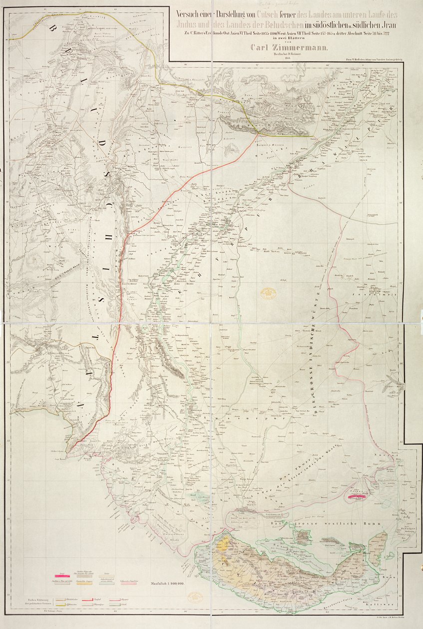
Map of the Cutch region of India and its border with neighbouring Baluchistan, by Carl Zimmerman, 1851 by German School

Map of the Cutch region of India and its border with neighbouring Baluchistan, by Carl Zimmerman, 1851

(Map of the Cutch region of India and its border with neighbouring Baluchistan, by Carl Zimmerman, 1851 )


German School

€ 143.21
Enthält 13.5% MwSt.
   Configure art print
1851  ·  colour lithograph  ·  Picture ID: 106152

Cultural Circles  ·  Cartography

Map of the Cutch region of India and its border with neighbouring Baluchistan, by Carl Zimmerman, 1851 by German School. Available as an art print on canvas, photo paper, watercolor board, uncoated paper or Japanese paper.
indian · gulf · country · cartography · state · boundaries · geographic · british empire · asia · asian · indian · british raj · mapping · boundary · rann · region · colonial · colony · territory · Private Collection / Bridgeman Images
zu Favoriten hinzufügen   Add to favorites    Select wall color    View painting in a room AR/3D   View in 3D / AR
0 Reviews

Configure art print

Picture Frame

Medium & Stretcher

Glass & Passepartout

Miscellaneous & Extras

 Save / compare configuration
Preview Icon

Summary

Gemälde
Veredelung
Keilrahmen
Museumslizenz

€ 143.21
(inkl. 20% MwSt)
   Add to cart

Bildschärfe: PERFEKT

Should you desire adjustments to brightness and color, or a custom crop of the motif, we are happy to make these changes at no additional cost to you. Please do not hesitate to contact us.

Similar artworks selected for you

Central Virginia A Map of the Province of New York with Part of Pennsylvania, and New England, from an Actual Survey by Captain Montrésor, Engineer, 1775 Outlines of the Physical and Political Divisions of South America Roy A Map of the Kingdom of Kabul Map of the Congo region, from an album belonging to Henry Morton Stanley Map from the National Library Outlines of the Physical and Political Divisions of South America Anyang County, Henan Province Telegraph Map of Upper Egypt 1882 Outlines of the Physical and Political Divisions of South America Geological and Geographical Atlas of Colorado and Portions of Adjacent Territory Map of Jemtland (1831) Map of Western India, 1816 Map of the Parish or Borough of Leeds A New Map of Mexico and Adjacent Provinces Plan of the Battles of Ligny, Quatre Bras & Waterloo fought on the 16 and 18 June 1815 by the Allied Armies commanded by the Duke of Wellington and Marshal Prince Blücher Map of the greater part of New Mexico, and a portion of Upper California Stephenson Map of the United States, 1816 Map of Central Asia Geographical Map of Ejdangerske Company in Tellemarkske Infantry Yellowstone National Park and Northwestern Wyoming Map of Leeds, surveyed by John Tuke Map of Laos and the Mekong River Showing the Route of the Voyage of Henri Mouhot, Illustration from Travels in the Central Parts of Indo-China (Siam), Cambodia, and Laos During the Years 1858, 1859 Map of the United States, 1816 The Western Part of New France or Canada, Engraving by G. Zuliani Chart of the Gulf of Finland and Baltic Sea Map of Cutch and Kathiawar, published under the direction of Colonel G.C. de Pree, S.C., Surveyor General of India, 1885
Show more similar artworks

Other art prints by German School

Poster advertising the Hamburg-Amerika Line Wyk auf Föhr, Poster Advertising the Wyk Steam Shipping Company, 1897 Poster advertising the Hamburg-Amerika Line Woman Bathing Poster for the Industrial Exhibition in Berlin, Germany, 1896 St. Brendan and a Siren, from the German Translation of Navigatio Sancti Brendani Abbatis Portrait of Kaiser Wilhelm II (1859-1941) The Whore of Babylon, from the Luther Bible King Frederick William I on Horseback with Potsdam in the background, c.1735 Fantastic Depiction of the Solar System Arthur Schopenhauer Prince Otto of Bismarck-Schoenhausen, 8th February 1891 Poster Advertising the German East Africa Line, 1890 Sylt North Sea Baths, Poster Advertising the Sylt Steamship Company, 1893 Poster advertising Hamburg-Amerika Linie routes to the West Indies and Central America
Discover more works by German School

Other motives from the category Cartography

Map of the Battle of Marengo Map of Seville, from Londinium Antiqua, map of London, published by William Darton, 1563 Map of Europe at the Time of the Third Crusade, 1190, from Map of Canada and Florida, from Map of Europe, Published in 1700, Paris Map of the Austro-Hungarian empire, illustration from a French geography school textbook, 1905 Reproduction of Map of Routes of St. James of Compostel, Originally Engraved by D. Serveaux 1648 Map of Lublin, from Map of Eastern North America: Florida to Chesapeake Bay Map of Venice, from Map of Cornwall from the Map of Africa, Published in 1700, Paris Map of the Ottoman Empire, Kingdom of Greece, and the Russian Provinces on the Black Sea Map of Sas de Gant and Surrounding Areas
View More from "Cartography"

Excerpt from our top sellers

Blue Some New Year Customs in Galloway Death and Life, c.1911 Angelus Novus The Three Sisters on the Beach St. Paul Asakusa Rice Fields During the Festival of the Cock, c.1857 The Apparition Hunters in the Snow Almond Blossom Intersecting Lines Limits of Reason, 1927 Yellow Red Blue The Wild Hunt of Odin Hands of the Puppeteer
Show More Artworks


What our customers think about us


Frequently Asked Questions about Meisterdrucke


Personalizing your art print at Meisterdrucke is a simple and intuitive process that allows you to design an artwork exactly to your specifications: Choose a frame, determine the image size, decide on a printing medium, and add suitable glazing or a stretcher frame. We also offer customization options such as mats, fillets, and spacers. Our customer service is available to help you design your perfect artwork.

At Meisterdrucke, you have the fascinating option to visualize the artwork you configured directly in your own space. For a tailored preview, simply upload a photo of your room and let the artwork appear on it. If you visit us via a mobile device, be it a phone or tablet, our augmented reality feature brings the image to life and seamlessly projects it into your space. An experience that uniquely combines art and technology.

Choosing the medium is often a matter of personal taste. To give you a clearer idea, we have provided some images for each medium. For a holistic experience, we also offer you a sample set of all paper variants so you can make a decision not just visually but also haptically. You can take advantage of the sample set free of charge – only the shipping costs will apply. You can order the sample set directly.

Do not worry. At Meisterdrucke, we do not proceed mechanically. We manually review each order. If there are any inconsistencies or peculiarities in the configuration, we will immediately contact you. Of course, our courteous and patient support is always at your side to assist you with the configuration. Together with you, we adjust your image by phone or email so that the final result exactly meets your expectations.


Do you have any questions?

Are you interested in an art print from our manufactory but still unsure? Do you need advice on choosing the medium or help with the order?

Our experts are happy to assist you.

+43 4257 29415
support@meisterdrucke.com
Mo-Do: 7:00 - 16:00 | Fr: 7:00 - 13:00

Do you have any questions?

Are you interested in an art print from our manufactory but still unsure? Do you need advice on choosing the medium or help with the order?

Our experts are happy to assist you.

+43 4257 29415
support@meisterdrucke.com
Mo-Do: 7:00 - 16:00 | Fr: 7:00 - 13:00


Meisterdrucke

   Kärntner Strasse 46
        9586 Finkenstein am Faaker See
        Austria
        +43 4257 29415
        support@meisterdrucke.com
Other languages

                   
Erfahrungen & Bewertungen zu Meisterdrucke
Partner Logos

Kaiser Franz Joseph

Meisterdrucke
Kärntner Strasse 46
9586 Finkenstein am Faaker See · Austria
+43 4257 29415 · office@meisterdrucke.com
Partner Logos


(c) 2025 meisterdrucke.ie