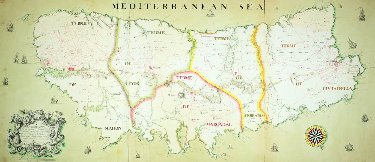
Map of the Island of Minorca, c.1740 by English School

Map of the Island of Minorca, c.1740

(Map of the Island of Minorca, c.1740 )


English School

€ 105.19
Enthält 13.5% MwSt.
   Configure art print
Undated  ·  coloured engraving  ·  Picture ID: 433179

Cultural Circles  ·  Cartography

Map of the Island of Minorca, c.1740 by English School. Available as an art print on canvas, photo paper, watercolor board, uncoated paper or Japanese paper.
menorca · balearic islands · mediterranean sea · National Museum of the Royal Navy, Portsmouth, Hampshire, UK / Bridgeman Images
zu Favoriten hinzufügen   Add to favorites    Select wall color    View painting in a room AR/3D   View in 3D / AR
0 Reviews

Configure art print

Picture Frame

Medium & Stretcher

Glass & Passepartout

Miscellaneous & Extras

 Save / compare configuration
Preview Icon

Summary

Gemälde
Veredelung
Keilrahmen
Museumslizenz

€ 105.19
(inkl. 20% MwSt)
   Add to cart

Bildschärfe: PERFEKT

Should you desire adjustments to brightness and color, or a custom crop of the motif, we are happy to make these changes at no additional cost to you. Please do not hesitate to contact us.

Similar artworks selected for you

A Map of the Route Hannibal took through Gaul and over the Alps into Italy Egypt and Syria in the 19th century - engraving in Egypt and Saudi Arabia (detail) Map of Locations Cited in the First Book of Entwurf einer historischen Architektur Map of Dauphine and Provence Tribe of Gad Nile River Delta, Red Sea and Mount Sinai, from Atlas of the World in Thirty-Three Maps Map of the Crimea and the Sea of Azov Map of the roads leading to the main Italian cities from all over Europe (Engraving) France, Germany, Austria, Switzerland Map of the Mediterranean, from Spain (Autonomous Community: Catalonia), France (Region: Burgundy, Franche-Comté, Auvergne, east Midi-Pyrénées, Languedoc-Roussillon, Rhône-Alpes, Provence-Alpes-Côte d Tribe of Gad Tribe of Reuben Department of Alpes-Maritimes in Southeast France South Piedmont and Monferrato, Italy General map of the camps and march of the army in America on the orders of Rochambeau, detail of the left side, from Guerre de l Plan of the departments of Arles The Middle East, from an Atlas of the World in 33 Maps, Venice, 1st September 1553 Map of Thracia The Jordan and the Dead Sea Map of the Borders of European Russia with Turkey, from the Mouths of the Danube to the Caucasus Chart of the Mediterranean Isle of Corsica, France Map of the Island of Elba, engraved by Jean-Baptiste Tardieu Map of North and South Carolina The Pillars of Hercules Map of the Countries of the Persian Gulf, from the Map of North Africa and West Africa, published in Strasbourg in 1522
Show more similar artworks

Other art prints by English School

Church and Cottage with Lighted Windows The Nonpareil with Portraits of Queen Victoria and Prince Albert Woman beating her husband with a shoe Portrait of a bodybuilder English Rose English Rose Lavater Lee and Sons, acrobats The Great Green Tree Frog Elephant (engraving) Princes Street Edinburgh - West End Roman Augurs View of the Acropolis of Athens Ships Arriving Map of Europe in 1910
Discover more works by English School

Other motives from the category Cartography

Earthquake Map of the World Map of the Christian Constellations as Depicted by Julius Schiller, from The Celestial Atlas Map of the Caribbean Islands and the American State of Florida Map of Charlemagne Map of Essex, 1602-03 Map of the world, based on descriptions and co-ordinates given in Galathes, 11th King of the Gauls with a map of Gaul behind, detail from a tapestry on the history of the Kings of the Gauls, Arras Workshop, c.1530 Map of Peru, from Map of Paris at the Outbreak of the French Revolution, published by William Blackwood and Sons Map of the Adriatic Sea Map of Turkey, Arabia and Persia, after Guillaume de L Map of the Coast of Africa and the River Gambia Map of Mongolia showing Japan and China, c.1680 by Frederick de Wit Map of the Moon, Illustration from Sidereus Nuncius by Galileo Galilei, 1610 Map of Tenochtitlan and the Gulf of Mexico, from Praeclara Ferdinadi Cortesii de Nova maris Oceani Hyspania Narratio by Hernando Cortes (1485-1547) 1524
View More from "Cartography"

Excerpt from our top sellers

Mont Sainte-Victoire Young Hare The Tree of Crows Chalk Paths Poppies Landscapes, Flowers and Birds: Plum, Qing Dynasty Self-Portrait with Physalis A Vase of Roses Woman in a Yellow Dress Woman with Parasol Turned to the Left, 1886 Sower at Sunset Lisbeth Rosa centifolia foliacea, from Les Roses, 1817-24 Girl with Child Blooming Front Garden
Show More Artworks


What our customers think about us


Frequently Asked Questions about Meisterdrucke


Personalizing your art print at Meisterdrucke is a simple and intuitive process that allows you to design an artwork exactly to your specifications: Choose a frame, determine the image size, decide on a printing medium, and add suitable glazing or a stretcher frame. We also offer customization options such as mats, fillets, and spacers. Our customer service is available to help you design your perfect artwork.

At Meisterdrucke, you have the fascinating option to visualize the artwork you configured directly in your own space. For a tailored preview, simply upload a photo of your room and let the artwork appear on it. If you visit us via a mobile device, be it a phone or tablet, our augmented reality feature brings the image to life and seamlessly projects it into your space. An experience that uniquely combines art and technology.

Choosing the medium is often a matter of personal taste. To give you a clearer idea, we have provided some images for each medium. For a holistic experience, we also offer you a sample set of all paper variants so you can make a decision not just visually but also haptically. You can take advantage of the sample set free of charge – only the shipping costs will apply. You can order the sample set directly.

Do not worry. At Meisterdrucke, we do not proceed mechanically. We manually review each order. If there are any inconsistencies or peculiarities in the configuration, we will immediately contact you. Of course, our courteous and patient support is always at your side to assist you with the configuration. Together with you, we adjust your image by phone or email so that the final result exactly meets your expectations.


Do you have any questions?

Are you interested in an art print from our manufactory but still unsure? Do you need advice on choosing the medium or help with the order?

Our experts are happy to assist you.

+43 4257 29415
support@meisterdrucke.com
Mo-Do: 7:00 - 16:00 | Fr: 7:00 - 13:00

Do you have any questions?

Are you interested in an art print from our manufactory but still unsure? Do you need advice on choosing the medium or help with the order?

Our experts are happy to assist you.

+43 4257 29415
support@meisterdrucke.com
Mo-Do: 7:00 - 16:00 | Fr: 7:00 - 13:00


Meisterdrucke

   Kärntner Strasse 46
        9586 Finkenstein am Faaker See
        Austria
        +43 4257 29415
        support@meisterdrucke.com
Other languages

                   
Erfahrungen & Bewertungen zu Meisterdrucke
Partner Logos

Kaiser Franz Joseph

Meisterdrucke
Kärntner Strasse 46
9586 Finkenstein am Faaker See · Austria
+43 4257 29415 · office@meisterdrucke.com
Partner Logos


(c) 2025 meisterdrucke.ie