Search by artist, work title or style – e.g. Monet, Starry Night, Impressionism, Hokusai wave, nude. Describe the scene – e.g. green meadow, abstract with lots of red, dark oil painting, standing nude next to a tree.

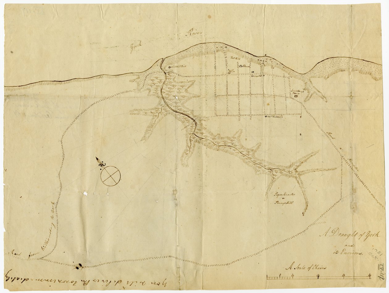
Map of Yorktown, Virginia, October 1781 by British School

Map of Yorktown, Virginia, October 1781

(Map of Yorktown, Virginia, October 1781 )


British School

€ 131
Enthält 13.5% MwSt.
   Configure art print
1781  ·  lithograph  ·  Picture ID: 475864

Cultural Circles  ·  Cartography

Map of Yorktown, Virginia, October 1781 by British School. Available as an art print on canvas, photo paper, watercolor board, uncoated paper or Japanese paper.
united states of america · mapping · cartography · maps · c18th · the war for independence · american revolution · Battle of Yorktown · drawing · sketch · Gilder Lehrman Collection, New York, USA / Bridgeman Images
AR/3D   View in 3D / AR zu Favoriten hinzufügen   Add to favorites    Select wall color    View painting in a room
0 Reviews

Configure art print

Picture Frame

Medium & Stretcher

Glass & Passepartout

Miscellaneous & Extras

 Save / compare configuration
Preview Icon

Summary

Gemälde
Veredelung
Keilrahmen
Museumslizenz

€ 131
(inkl. 20% MwSt)
   Add to cart

Bildschärfe: PERFEKT

Should you desire adjustments to brightness and color, or a custom crop of the motif, we are happy to make these changes at no additional cost to you. Please do not hesitate to contact us.

Similar artworks selected for you

A Topographical Sketch of New York Map of the mouth of the Chicago River, Illinois with the plan of the proposed piers for improving the harbour Battle of Camden, Augt. 16 Christ Church Parish, South Carolina - (Charleston District) Section of the Northern Course of the Canal from the Tide in the Elk River at Frenchtown to the Forked [Oak] in Mr. Rudulph Plan of the Disposition of British Troops, with Fortifications North of Fort Knipehausen to Fort Independence A Rough Draft of Dublin Bay Draft for the Park Layout at the Future Royal Residence in Christiania The map is hand-drawn (ca 1780) and shows Telemark Battle of Green Spring, Map of the Land on the Left Bank of the James River Opposite Jamestown in Virginia Where the Battle of July 6 Plan of Paulus Chart of Cork Harbour, Ireland Vicinity of Harpers Ferry A topographical map of the Elizabeth Furnace iron property, Augusta Co., Va., containing about 6250 acres, Aug. 1867 Plan of the Battle of Sinope George Washington Sketch of the Fortress of Ghuznee. Taken by Storm on the 23rd July 1839 Map of the Ohio River from Fort Pitt Plan of the Battle of Culloden A survey of the Kings lordship or manor of East Greenwich Confederate Civil War map of the Army of Mississippi camp at Corinth, Mississippi, May 1862 Map of Willesden, London (litho) A Plan of the Harbour Near Singapore by Captain D.L. Ross, FRS Marine Surveyor General Captain Snow Map of Zeelandia and Surroundings, Formosa Plan of town and fortress of Gariah Map of Christiania and Akershus Plan of the Battle of Sinope
Show more similar artworks

Other art prints by British School

Siberian blue robin, Larvivora cyane Portrait of a Gentleman A Plan of the City of New York by Ratzer Ireland - West Coast, Glengariff Harbour. Surveyed by Qualifying Class, Navigation School Sept - Oct 1912. Mrs. Edmund Nelson Althea Cartwright Half-Length Portrait of James Duff of Banff Adam and Eve in the Garden with a Pair of Sheep and a Pair of Doves Edward Fiennes de Clinton Industrial Revolution: Internal View of the Farm Machinery Pavilion at the Crystal Palace, Built by Joseph Paxton for the 1851 World Exposition in London Portrait of King Henry IV of England, Holding the Royal Sceptre Design for an Aesthetic interior, from Map of Yorktown, Virginia, October 1781 Ferguson flintlock breech-loading rifle, circa 1780 The advance of the 93rd Sutherland Highlanders at the Battle of the Alma 1854 - in
Discover more works by British School

Other motives from the category Cartography

Map of Sixteenth Century Europe, from the Map of the Nile from the Kitab-I Bahriye Map of London Map of the United States in 1803, from Our Whole Country: The Past and Present of the United States, Historical and Descriptive, by John Warner Barber and Henry Hare, 1861 Map of Africa showing Treaty Boundaries, 1891 Map of South America, 1777 Map of the Bay of Mont Saint-Michel Map of the Battle of Rivoli, published by William Blackwood and Sons, Edinburgh and London Typus Orbis Terrarum, map of the world, from Ortelius Sketch Map of India Illustrating the History from the Earliest Period to the Battle of Plassy Map of Guildhall, London, and Surrounding Area About 1750 Map of Flanders at the Time of the Thirty Years War (1618-48), from Map of Florida Map of Alexander the Great Renaissance map of Europe, Jacopo Russo (after) 1528
View More from "Cartography"

Excerpt from our top sellers

Young Hare The Dreamer The Geneva Window, eight panels depicting scenes from early Irish literature Lake Thun with Niesen The Red Tree The Fall of the Damned F. Goya, Dog Suigin Grove and Masaki, on the Sumida River, from Malcesine on Lake Garda Appian Way The Wanderer above the Sea of Fog World Map Universalis Cosmographia, 1507 The Olive Trees Yellow Red Blue Watercolor No. 326
Show More Artworks


What our customers think about us


Frequently Asked Questions about Meisterdrucke


Personalizing your art print at Meisterdrucke is a simple and intuitive process that allows you to design an artwork exactly to your specifications: Choose a frame, determine the image size, decide on a printing medium, and add suitable glazing or a stretcher frame. We also offer customization options such as mats, fillets, and spacers. Our customer service is available to help you design your perfect artwork.

At Meisterdrucke, you have the fascinating option to visualize the artwork you configured directly in your own space. For a tailored preview, simply upload a photo of your room and let the artwork appear on it. If you visit us via a mobile device, be it a phone or tablet, our augmented reality feature brings the image to life and seamlessly projects it into your space. An experience that uniquely combines art and technology.

Choosing the medium is often a matter of personal taste. To give you a clearer idea, we have provided some images for each medium. For a holistic experience, we also offer you a sample set of all paper variants so you can make a decision not just visually but also haptically. You can take advantage of the sample set free of charge – only the shipping costs will apply. You can order the sample set directly.

Do not worry. At Meisterdrucke, we do not proceed mechanically. We manually review each order. If there are any inconsistencies or peculiarities in the configuration, we will immediately contact you. Of course, our courteous and patient support is always at your side to assist you with the configuration. Together with you, we adjust your image by phone or email so that the final result exactly meets your expectations.


Do you have any questions?

Are you interested in an art print from our manufactory but still unsure? Do you need advice on choosing the medium or help with the order?

Our experts are happy to assist you.

+43 4257 29415
support@meisterdrucke.com
Mo-Do: 7:00 - 16:00 | Fr: 7:00 - 13:00

Do you have any questions?

Are you interested in an art print from our manufactory but still unsure? Do you need advice on choosing the medium or help with the order?

Our experts are happy to assist you.

+43 4257 29415
support@meisterdrucke.com
Mo-Do: 7:00 - 16:00 | Fr: 7:00 - 13:00


Meisterdrucke

   Kärntner Strasse 46
        9586 Finkenstein am Faaker See
        Austria
        +43 4257 29415
        support@meisterdrucke.com
Other languages

                   
Erfahrungen & Bewertungen zu Meisterdrucke
Post.at DHL Express Quehenberger Cargoboard
Kaiser Franz Joseph

Meisterdrucke
Kärntner Strasse 46
9586 Finkenstein am Faaker See · Austria
+43 4257 29415 · office@meisterdrucke.com
Post.at DHL Express Quehenberger Cargoboard


Meisterdrucke 2745 Bewertungen auf ProvenExpert.com

(c) 2025 meisterdrucke.ie