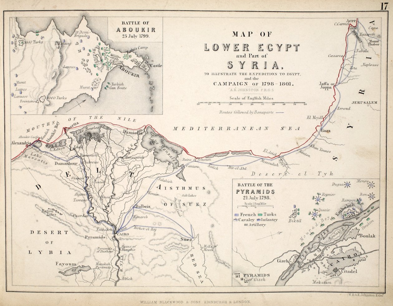
Map of Lower Egypt and part of Syria, published by William Blackwood and Sons by Alexander Keith Johnston

Map of Lower Egypt and part of Syria, published by William Blackwood and Sons

(Map of Lower Egypt and part of Syria, published by William Blackwood and Sons, Edinburgh und London, 1848 (hand-coloured engraving))


Alexander Keith Johnston

€ 129.74
Enthält 13.5% MwSt.
   Configure art print
1848  ·  hand-coloured engraving  ·  Picture ID: 292428

Nonclassified artists  ·  Cartography

Map of Lower Egypt and part of Syria, published by William Blackwood and Sons by Alexander Keith Johnston. Available as an art print on canvas, photo paper, watercolor board, uncoated paper or Japanese paper.
Private Collection / Bridgeman Images
AR/3D   View in 3D / AR zu Favoriten hinzufügen   Add to favorites    Select wall color    View painting in a room
0 Reviews

Configure art print

Picture Frame

Medium & Stretcher

Glass & Passepartout

Miscellaneous & Extras

 Save / compare configuration
Preview Icon

Summary

Gemälde
Veredelung
Keilrahmen
Museumslizenz

€ 129.74
(inkl. 20% MwSt)
   Add to cart

Bildschärfe: PERFEKT

Should you desire adjustments to brightness and color, or a custom crop of the motif, we are happy to make these changes at no additional cost to you. Please do not hesitate to contact us.

Similar artworks selected for you

Map of the Coast and Environs of Alexandria; Lower Egypt Unknown Image Overland Route to India Lands of the Jewish Captivities Map of Turkey showing telegraph cables and stations Map of India, 1822 Map of the Environs of Sevastopol Expedition of Cyrus the Young (5th century BC) and retreat of the ten miles - Plate extracted from “Universal Atlas of ancient and modern geography for residential schools” by Vuillemin - ca. 1845 Telegraph Map of Upper Egypt 1882 A Map of Cadiz A Map of the Kingdom of Kabul Map of Asia Minor, Expedition of Cyrus the Younger, and Retreat of the Ten Thousand Map of the Battle of Alexandria, published by William Blackwood and Sons, Edinburgh and London Map of the Cutch region of India and its border with neighbouring Baluchistan, by Carl Zimmerman, 1851 Map of the Battle of Jena, published by William Blackwood and Sons, Edinburgh and London, 1848 Historical Atlas of Mesopotamia. Babylonia, Syria and Assyria. End of 18th century Map of Ancient Egypt, drawn and engraved by Sydney Hall, c.1826 Map of Mesopotamia Chart of the Gulf of Finland and Baltic Sea Map of Egypt, 1902 The Southern Portion of Rajpootana, 1820 Map of Assyria, Chaldea and Adjacent Countries, 1890 Geographic map of Algeria and details of the provinces of Algiers, Oran and Constantine, realized by Amboise Tardieu Plan of Choul and Surat River Egypt with the Sinai Peninsula and the Journeys of the Israelites Modern Egypt and Sinai Turkey in Asia, Asia Minor, and Transcaucasia Map of Arequipa, 1865 Western Franz Josef Land, 1896-1899
Show more similar artworks

Other art prints by Alexander Keith Johnston

Map of the Battle of Trafalgar, published by William Blackwood and Sons, Edinburgh and London Map of Paris at the Outbreak of the French Revolution, published by William Blackwood and Sons Map of the Battle of Jena, published by William Blackwood and Sons, Edinburgh and London, 1848 Map of the Battle of Trafalgar, published by William Blackwood and Sons, Edinburgh and London, 1848 Map of the Battle of the Nile, published by William Blackwood and Sons, Edinburgh and London, 1848 Map of the Battle of Copenhagen, published by William Blackwood and Sons, Edinburgh and London, 1848 Plan of the Battle of Cape St. Vincent, 14th February 1797, c.1830s Map of the Battle of Hanau, published by William Blackwood and Sons, Edinburgh and London, 1848 Map of the Battle of Hohenlinden, Published by William Blackwood and Sons, Edinburgh and London A map of Spain and Portugal, c.1869 Map of the Siege of the Castle of Burgos, Published by William Blackwood and Sons, Edinburgh and London Map of the Battle of Cape St. Vincent, published by William Blackwood and Sons, Edinburgh and London, 1848 Map of the Battle of Malo-Jaroslawitz, published by William Blackwood and Sons, Edinburgh and London, 1848 Map of the Battle of Borodino, Published by William Blackwood and Sons, Edinburgh and London, 1848 Map of the Battle of Wagram, published by William Blackwood and Sons, Edinburgh and London, 1848
Discover more works by Alexander Keith Johnston

Other motives from the category Cartography

The City of Jerusalem and the surrounding area, detail from the Madaba mosaic map, Byzantine, 6th century The City of Jerusalem and the Surrounding Area, Detail from the Madaba Mosaic Map Map of France, Spain and North-West Africa, from the Part of South Australia, from a Series of World Maps published by John Tallis und Co, New York and London Map of Naples, c.1600 World Map Map of Ireland showing the Provinces of Ulster, Munster, Connaught and Leinster, by Johann B. Homann, c.1730 Map of Frankfurt and the Surrounding Area, from Map of Asia, Tartaria, Japan, the Philippines and the East Indies, engraved by G. van Gouwen, c.1690 Zodiac Calendar, from an Atlas of the World in 33 Maps, Venice, 1st September 1553 Cyclorama fold out map detailing the History of the Great Rebellion, c.1870 Map of the Passage of the Beresina, published by William Blackwood and Sons, Edinburgh and London, 1848 Map of the Great Lakes Map of the Travels of Alexander the Great (356-323 BC) from Map of the Battle of Camperdown, published by William Blackwood and Sons, Edinburgh and London, 1848
View More from "Cartography"

Excerpt from our top sellers

View of Dresden by Moonlight Pandora Tiger The Convalescent. 1888 Red Balloon Fish Blood The Water-Lily Pond Sadko Saviour (From the Deisus Chin) Isle of the Dead Portrait of a Young Woman, Drawing Group of Egrets, 1925-36 Head of a Skeleton with a Burning Cigarette Strolling along the Seashore, 1909 Sailboats on the Wannsee
Show More Artworks


What our customers think about us


Frequently Asked Questions about Meisterdrucke


Personalizing your art print at Meisterdrucke is a simple and intuitive process that allows you to design an artwork exactly to your specifications: Choose a frame, determine the image size, decide on a printing medium, and add suitable glazing or a stretcher frame. We also offer customization options such as mats, fillets, and spacers. Our customer service is available to help you design your perfect artwork.

At Meisterdrucke, you have the fascinating option to visualize the artwork you configured directly in your own space. For a tailored preview, simply upload a photo of your room and let the artwork appear on it. If you visit us via a mobile device, be it a phone or tablet, our augmented reality feature brings the image to life and seamlessly projects it into your space. An experience that uniquely combines art and technology.

Choosing the medium is often a matter of personal taste. To give you a clearer idea, we have provided some images for each medium. For a holistic experience, we also offer you a sample set of all paper variants so you can make a decision not just visually but also haptically. You can take advantage of the sample set free of charge – only the shipping costs will apply. You can order the sample set directly.

Do not worry. At Meisterdrucke, we do not proceed mechanically. We manually review each order. If there are any inconsistencies or peculiarities in the configuration, we will immediately contact you. Of course, our courteous and patient support is always at your side to assist you with the configuration. Together with you, we adjust your image by phone or email so that the final result exactly meets your expectations.


Do you have any questions?

Are you interested in an art print from our manufactory but still unsure? Do you need advice on choosing the medium or help with the order?

Our experts are happy to assist you.

+43 4257 29415
support@meisterdrucke.com
Mo-Do: 7:00 - 16:00 | Fr: 7:00 - 13:00

Do you have any questions?

Are you interested in an art print from our manufactory but still unsure? Do you need advice on choosing the medium or help with the order?

Our experts are happy to assist you.

+43 4257 29415
support@meisterdrucke.com
Mo-Do: 7:00 - 16:00 | Fr: 7:00 - 13:00


Meisterdrucke

   Kärntner Strasse 46
        9586 Finkenstein am Faaker See
        Austria
        +43 4257 29415
        support@meisterdrucke.com
Other languages

                   
Erfahrungen & Bewertungen zu Meisterdrucke
Post.at DHL Express Quehenberger Cargoboard
Kaiser Franz Joseph

Meisterdrucke
Kärntner Strasse 46
9586 Finkenstein am Faaker See · Austria
+43 4257 29415 · office@meisterdrucke.com
Post.at DHL Express Quehenberger Cargoboard


Meisterdrucke 2716 Bewertungen auf ProvenExpert.com

(c) 2025 meisterdrucke.ie